![[VTT] JS LCP](/_next/static/media/contour-lines-light-small.cafd5e5d.avif)
![[VTT] JS LCP](https://media.bikemap.net/routes/1678378/staticmaps/in_43b47191-99a9-4492-9f14-1087a5cad37e_694x400_bikemap-2021-3D-static.png)
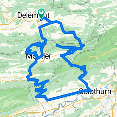
[VTT] JS LCP
Trasa rowerowa rozpoczynająca się w Courroux, Jura, Szwajcaria.
Przegląd
O tej trasie
Trasa etapowa:
Delémont
Le Domont
La Golatte
La Haute Borne
Plain de la Chève
Crête
Ferme du Brunchenal
Le Béridier (grzbiet)
Le Vorbourg
Delémont
Courroux - Courcelon
Vicques
Retemberg
Pierreberg
Delémont
Są opcje, między rolującą a techniczną, w tych obszarach:
Le Domont - La Golatte
Crête de la Haute Borne - druga część
Crête du Béridier -druga część
Vorbourg - Delémont
Crête du Roc de Courroux - pierwsza część
Crête du Roc de Courroux - druga część
Stworzone przez Noé Jobin i Bruno Vitali
- -:--
- Czas
- 45,5 km
- Dystans
- 1194 m
- Przewyższenia
- 1193 m
- Spadek
- ---
- Śr. Prędkość
- ---
- Maks. wysokość
Kontynuuj z Bikemap
Użyj, edytuj lub pobierz tę trasę rowerową
Chcesz przejechać trasę [VTT] JS LCP lub dostosować ją do swojej wycieczki? Oto, co możesz zrobić z tą trasą na Bikemap:
Darmowe funkcje
- Zapisz tę trasę jako ulubioną lub w kolekcji
- Skopiuj i zaplanuj swoją wersję tej trasy
- Synchronizuj swoją trasę z Garminem lub Wahoo
Funkcje Premium
3 dni bezpłatnej wersji próbnej lub jednorazowa opłata. Dowiedz się więcej o Bikemap Premium.
- Nawiguj po tej trasie na iOS i Androidzie
- Eksportuj plik GPX / KML tej trasy
- Stwórz swój własny wydruk (wypróbuj za darmo)
- Pobierz tę trasę do nawigacji offline
Odkryj więcej funkcji Premium.
Uzyskaj Bikemap PremiumOd naszej społeczności
Courroux: Inne popularne trasy rozpoczynające się tutaj
 Delemont Neuchatel
- Dystans
- 331,2 km
- Przewyższenia
- 2973 m
- Spadek
- 2893 m
- Lokalizacja
- Courroux, Jura, Szwajcaria
 Delemont-Vermes-Moutier-Bassecourt-Bellelay-Delemont
- Dystans
- 85,5 km
- Przewyższenia
- 934 m
- Spadek
- 932 m
- Lokalizacja
- Courroux, Jura, Szwajcaria
 ValTerbi-Scheulte-Balstahl-Moutier
- Dystans
- 75,6 km
- Przewyższenia
- 913 m
- Spadek
- 914 m
- Lokalizacja
- Courroux, Jura, Szwajcaria
![[VTT] JS LCP](https://media.bikemap.net/routes/1678378/staticmaps/in_43b47191-99a9-4492-9f14-1087a5cad37e_400x400_bikemap-2021-3D-static.png) [VTT] JS LCP
[VTT] JS LCP- Dystans
- 45,5 km
- Przewyższenia
- 1194 m
- Spadek
- 1193 m
- Lokalizacja
- Courroux, Jura, Szwajcaria
 Les Montagnes de Moutier
- Dystans
- 125,7 km
- Przewyższenia
- 3108 m
- Spadek
- 3108 m
- Lokalizacja
- Courroux, Jura, Szwajcaria
 Delémont - Bienne
- Dystans
- 61,3 km
- Przewyższenia
- 1151 m
- Spadek
- 1135 m
- Lokalizacja
- Courroux, Jura, Szwajcaria
 Boucle Haut-Plateau Valée de Delémont et Val terbi
- Dystans
- 94,6 km
- Przewyższenia
- 1298 m
- Spadek
- 1297 m
- Lokalizacja
- Courroux, Jura, Szwajcaria
 Parque Natural de Thal
- Dystans
- 104,3 km
- Przewyższenia
- 2021 m
- Spadek
- 2022 m
- Lokalizacja
- Courroux, Jura, Szwajcaria
Otwórz ją w aplikacji