

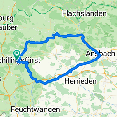
Romantisches Franken
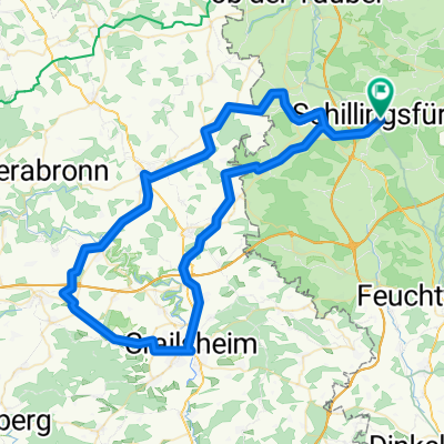
Schillingsfürst, Kloster Sulz, Aurach, Ansbach, Lehrberg, Colmberg, Schillingsfürstrholz, Leutershausen, Schillingsfürst
Trasa rowerowa rozpoczynająca się w Schillingsfürst, Bawaria, Niemcy.
Przegląd
O tej trasie
- 3 h 49 min
- Czas
- 65,5 km
- Dystans
- 568 m
- Przewyższenia
- 565 m
- Spadek
- 17,2 km/h
- Śr. Prędkość
- 543 m
- Maks. wysokość
Część
Romantisches Franken
5 etapów
Jakość trasy
Typy dróg i nawierzchnie na trasie
Typy dróg
Spokojna droga
28,2 km
(43 %)
Droga leśna
13,1 km
(20 %)
Powierzchnie
Utwardzona
43,2 km
(66 %)
Nieutwardzona
0,7 km
(1 %)
Asfalt
39,3 km
(60 %)
Nawierzchnia (nieokreślona)
2,6 km
(4 %)
Kontynuuj z Bikemap
Użyj, edytuj lub pobierz tę trasę rowerową
Chcesz przejechać trasę Schillingsfürst, Kloster Sulz, Aurach, Ansbach, Lehrberg, Colmberg, Schillingsfürstrholz, Leutershausen, Schillingsfürst lub dostosować ją do swojej wycieczki? Oto, co możesz zrobić z tą trasą na Bikemap:
Darmowe funkcje
- Zapisz tę trasę jako ulubioną lub w kolekcji
- Skopiuj i zaplanuj swoją wersję tej trasy
- Synchronizuj swoją trasę z Garminem lub Wahoo
Funkcje Premium
3 dni bezpłatnej wersji próbnej lub jednorazowa opłata. Dowiedz się więcej o Bikemap Premium.
- Nawiguj po tej trasie na iOS i Androidzie
- Eksportuj plik GPX / KML tej trasy
- Stwórz swój własny wydruk (wypróbuj za darmo)
- Pobierz tę trasę do nawigacji offline
Odkryj więcej funkcji Premium.
Uzyskaj Bikemap PremiumOd naszej społeczności
Schillingsfürst: Inne popularne trasy rozpoczynające się tutaj
 Mittlere Trainingsstrecke
- Dystans
- 33,3 km
- Przewyższenia
- 318 m
- Spadek
- 312 m
- Lokalizacja
- Schillingsfürst, Bawaria, Niemcy
 B2-11/B12c: Schillingsfürst - Fremdingen, 66,1km 550hm
- Dystans
- 66,1 km
- Przewyższenia
- 671 m
- Spadek
- 720 m
- Lokalizacja
- Schillingsfürst, Bawaria, Niemcy
 Route in Schillingsfürst Inzingen, Roth am See, Crailsheim, SChillingsfürst
- Dystans
- 82,2 km
- Przewyższenia
- 747 m
- Spadek
- 746 m
- Lokalizacja
- Schillingsfürst, Bawaria, Niemcy
 Schillingsfürst ---> Schaffhausen (CH)
- Dystans
- 503,6 km
- Przewyższenia
- 711 m
- Spadek
- 791 m
- Lokalizacja
- Schillingsfürst, Bawaria, Niemcy
 Schillingsfürst, Kloster Sulz, Aurach, Ansbach, Lehrberg, Colmberg, Schillingsfürstrholz, Leutershausen, Schillingsfürst
- Dystans
- 65,5 km
- Przewyższenia
- 568 m
- Spadek
- 565 m
- Lokalizacja
- Schillingsfürst, Bawaria, Niemcy
 Route Schillingsfürst, Neuweiler Diebach Rothenburg, Insingen, Oberoestheim, Sch
- Dystans
- 46,3 km
- Przewyższenia
- 577 m
- Spadek
- 575 m
- Lokalizacja
- Schillingsfürst, Bawaria, Niemcy
 Der Wörnitzradweg
- Dystans
- 106,3 km
- Przewyższenia
- 364 m
- Spadek
- 458 m
- Lokalizacja
- Schillingsfürst, Bawaria, Niemcy
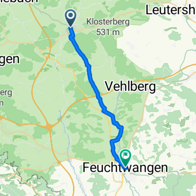 From Schillingsfürst to Feuchtwangen
- Dystans
- 16,9 km
- Przewyższenia
- 118 m
- Spadek
- 174 m
- Lokalizacja
- Schillingsfürst, Bawaria, Niemcy
Otwórz ją w aplikacji