
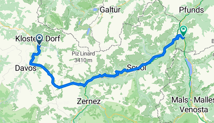
Klosters to Nauders
Trasa rowerowa rozpoczynająca się w Klosters Serneus, Gryzonia, Szwajcaria.
Przegląd
O tej trasie
- 5 h 14 min
- Czas
- 85,8 km
- Dystans
- 3100 m
- Przewyższenia
- 2928 m
- Spadek
- 16,4 km/h
- Śr. Prędkość
- 2395 m
- Maks. wysokość

Zdjęcia trasy

Jakość trasy
Typy dróg i nawierzchnie na trasie
Typy dróg
Droga
14,6 km
(17 %)
Spokojna droga
9,4 km
(11 %)
Powierzchnie
Utwardzona
60,1 km
(70 %)
Nieutwardzona
2,6 km
(3 %)
Asfalt
57,5 km
(67 %)
Nawierzchnia (nieokreślona)
2,6 km
(3 %)
Najważniejsze punkty trasy
Punkty zainteresowania na trasie
Interesujące miejsce po 17,4 km
Photopoint

Interesujące miejsce po 21,6 km
Flüelapass 12.9km 823m climb 6.4% av 10% max 2383m elevation
Interesujące miejsce po 35,6 km
Fortezza Rohan
Interesujące miejsce po 40,3 km
Ruinas da Gonda On the old Via Engiadina, between Lavin and Guarda, lie the remains of the Gonda settlement. In addition to the partially rebuilt chapel, the view of the remaining walls of a very large house is particularly impressive. The inhabitants apparently abandoned this site in 16??, and the houses and terraces fell into disrepair over the centuries.
Interesujące miejsce po 43 km
Jordankeramik ceramic art gallery 2-5
Interesujące miejsce po 43,3 km
Guard'Art art gallery
Interesujące miejsce po 48,1 km
Chastè Steinsberg
Interesujące miejsce po 49,2 km
Ruine Chanoua (Ruina Chanoua)
Interesujące miejsce po 56,3 km
Schloss Tarasp Built in the 11th century, this hilltop castle features a restored interior with antique furniture.

Interesujące miejsce po 62,2 km
Rablönch-Quelle mineral spring with arsenic level a little above acceptable (26 vs 10 ppb). Accounts for orange colour in runoff area.
Interesujące miejsce po 68 km
Burg Tschanüff
Kontynuuj z Bikemap
Użyj, edytuj lub pobierz tę trasę rowerową
Chcesz przejechać trasę Klosters to Nauders lub dostosować ją do swojej wycieczki? Oto, co możesz zrobić z tą trasą na Bikemap:
Darmowe funkcje
- Zapisz tę trasę jako ulubioną lub w kolekcji
- Skopiuj i zaplanuj swoją wersję tej trasy
- Podziel trasę na etapy, aby utworzyć kilkudniową wycieczkę
- Synchronizuj swoją trasę z Garminem lub Wahoo
Funkcje Premium
3 dni bezpłatnej wersji próbnej lub jednorazowa opłata. Dowiedz się więcej o Bikemap Premium.
- Nawiguj po tej trasie na iOS i Androidzie
- Eksportuj plik GPX / KML tej trasy
- Stwórz swój własny wydruk (wypróbuj za darmo)
- Pobierz tę trasę do nawigacji offline
Odkryj więcej funkcji Premium.
Uzyskaj Bikemap PremiumOd naszej społeczności
Klosters Serneus: Inne popularne trasy rozpoczynające się tutaj
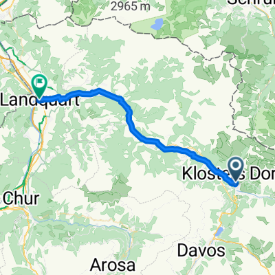
 21 Prättigauer Route Radweg von Klosters nach Sargans
- Dystans
- 47,8 km
- Przewyższenia
- 0 m
- Spadek
- 0 m
- Lokalizacja
- Klosters Serneus, Gryzonia, Szwajcaria
 20.7.25 Prättigau Talroute 21
- Dystans
- 33,4 km
- Przewyższenia
- 577 m
- Spadek
- 1264 m
- Lokalizacja
- Klosters Serneus, Gryzonia, Szwajcaria
 Langsame Fahrt in Klosters
- Dystans
- 22,5 km
- Przewyższenia
- 775 m
- Spadek
- 780 m
- Lokalizacja
- Klosters Serneus, Gryzonia, Szwajcaria
 Flüela vanuit Klosters - Serneus 26-7-2012
- Dystans
- 49,6 km
- Przewyższenia
- 1461 m
- Spadek
- 1027 m
- Lokalizacja
- Klosters Serneus, Gryzonia, Szwajcaria
 21 Prättigauer Route Radweg von Klosters nach Sargans
- Dystans
- 47,8 km
- Przewyższenia
- 345 m
- Spadek
- 1054 m
- Lokalizacja
- Klosters Serneus, Gryzonia, Szwajcaria
 tret-lager.ch 2014, 5. Etappe Kloster - Rämismühle
- Dystans
- 140 km
- Przewyższenia
- 690 m
- Spadek
- 1338 m
- Lokalizacja
- Klosters Serneus, Gryzonia, Szwajcaria
 Panoramaweg (Gotschnagrat - Davos Platz)
- Dystans
- 16 km
- Przewyższenia
- 283 m
- Spadek
- 1008 m
- Lokalizacja
- Klosters Serneus, Gryzonia, Szwajcaria
 Einfache Fahrt in Klosters
- Dystans
- 13,1 km
- Przewyższenia
- 853 m
- Spadek
- 849 m
- Lokalizacja
- Klosters Serneus, Gryzonia, Szwajcaria
Otwórz ją w aplikacji