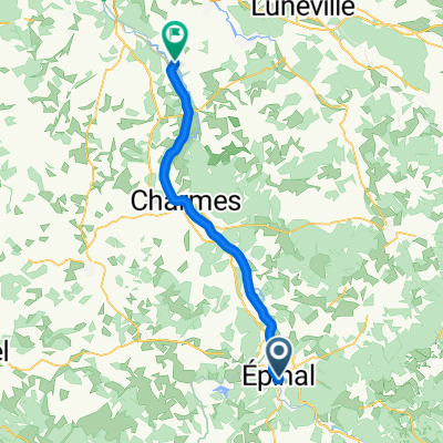
2009 Euro Tour -- Ride Day 30 — 29 July 2009 — 88000 Epinal to 88400 Xonrupt-Longemer
Trasa rowerowa rozpoczynająca się w Épinal, Alsace-Champagne-Ardenne-Lorraine, France.
Przegląd
O tej trasie
<div class="MsoNormal" style="color: #000000; font-family: Helvetica; font-size: medium;"><span style="font-family: Arial;"> <div class="MsoNormal"> <div class="MsoNormal"><span style="font-family: Arial;">Beautiful road, but terrible for bicycles as all was relatively heavy traffic with no shoulders.<span> </span>The only exception was D417 in Gérardmer and Xonrupt-Longemer where there was a good bike lane to deal with all the traffic.</span></div> <div class="MsoNormal"><span style="font-family: Arial;"> </span></div> <div class="MsoNormal"><span style="font-family: Arial;">Most of this short zigzag ride was easy gradual climbing of maybe 300 or 400 meters to about 700 meters at our hotel.</span></div> <div class="MsoNormal"><span style="font-family: Arial;"> </span></div> <div class="MsoNormal"><span style="font-family: Arial;">We’d noticed in both the last few days’ rides and today’s that this section of the northeast seems relatively more prosperous than most of the other parts of France that we’ve ridden through this trip.<span> </span>Especially yesterday we saw a lot of new construction and a few in-ground pools.<span> </span>Today, riding along D417, there were many homebuilding construction companies that had put up model homes for people to buy for their own lots.</span></div> <div class="MsoNormal"><span style="font-family: Arial;"> </span></div> <div class="MsoNormal"><span style="font-family: Arial;">This ride was entirely within the Vosges Department in the Lorraine Region.</span></div> </div> <div class="MsoNormal"> <div class="MsoNormal"> <div class="MsoNormal"> <div class="MsoNormal"></div> </div> </div> <div class="MsoNormal"><br /></div> </div> </span></div> <div class="MsoNormal" style="color: #000000; font-family: Helvetica; font-size: medium;">Background:<span style="font-family: Arial;"> <div class="MsoNormal" style="font-size: 16px;"><span style="font-family: Arial;"> </span></div> </span></div>
My wife and I have been doing self-supported tours in Western Europe (a majority in France) since 1993. This series of rides covers our 2009 4.5 month route through parts of France, Germany, Austria, Switzerland, and then back to France. Our beginning and ending point is near Chadurie (south of Angouleme) where our friends have a farm with Gites and Chambres d'Hotes.
We rode our Dawes touring bicycles purchased in 1993 heavily loaded with 700Cx32 tires. All of our riding was on paved roads, mostly with very little traffic. Pretty much the only unpaved sections were some bicycle paths in Germany and Austria. Sadly, that wasn't so great as Helen fell a number of times on the unpaved paths. Fortunately, though, no serious injury.
If any questions, feel free to email me at jeffkadet@netdiving.com
Jeff
- -:--
- Czas
- 48,8 km
- Dystans
- 519 m
- Przewyższenia
- 169 m
- Spadek
- ---
- Śr. Prędkość
- ---
- Maks. wysokość
Jakość trasy
Typy dróg i nawierzchnie na trasie
Typy dróg
Ruchliwa droga
38,6 km
(79 %)
Spokojna droga
5,9 km
(12 %)
Powierzchnie
Utwardzona
32,8 km
(67 %)
Asfalt
32,8 km
(67 %)
Niezdefiniowany
16 km
(33 %)
Kontynuuj z Bikemap
Użyj, edytuj lub pobierz tę trasę rowerową
Chcesz przejechać trasę 2009 Euro Tour -- Ride Day 30 — 29 July 2009 — 88000 Epinal to 88400 Xonrupt-Longemer lub dostosować ją do swojej wycieczki? Oto, co możesz zrobić z tą trasą na Bikemap:
Darmowe funkcje
- Zapisz tę trasę jako ulubioną lub w kolekcji
- Skopiuj i zaplanuj swoją wersję tej trasy
- Synchronizuj swoją trasę z Garminem lub Wahoo
Funkcje Premium
3 dni bezpłatnej wersji próbnej lub jednorazowa opłata. Dowiedz się więcej o Bikemap Premium.
- Nawiguj po tej trasie na iOS i Androidzie
- Eksportuj plik GPX / KML tej trasy
- Stwórz swój własny wydruk (wypróbuj za darmo)
- Pobierz tę trasę do nawigacji offline
Odkryj więcej funkcji Premium.
Uzyskaj Bikemap PremiumOd naszej społeczności
Épinal: Inne popularne trasy rozpoczynające się tutaj
- 04-M. Epinal - Mulhouse (180,8 Km)
- Dystans
- 180,8 km
- Przewyższenia
- 2483 m
- Spadek
- 2588 m
- Lokalizacja
- Épinal, Alsace-Champagne-Ardenne-Lorraine, France
- Épinal nach Saint-Maurice-sur-Moselle und Moselquelle
- Dystans
- 73,6 km
- Przewyższenia
- 782 m
- Spadek
- 554 m
- Lokalizacja
- Épinal, Alsace-Champagne-Ardenne-Lorraine, France
- 03 Epinal - Ray-sur-Saone
- Dystans
- 134,9 km
- Przewyższenia
- 148 m
- Spadek
- 288 m
- Lokalizacja
- Épinal, Alsace-Champagne-Ardenne-Lorraine, France
- CommercyTour2022_E3-3
- Dystans
- 126,4 km
- Przewyższenia
- 1301 m
- Spadek
- 1370 m
- Lokalizacja
- Épinal, Alsace-Champagne-Ardenne-Lorraine, France
- 2009 Euro Tour -- Ride Day 29 — 28 July 2009 — 88000 Epinal — Circle
- Dystans
- 80,5 km
- Przewyższenia
- 476 m
- Spadek
- 476 m
- Lokalizacja
- Épinal, Alsace-Champagne-Ardenne-Lorraine, France
- 5-X. Epinal - Basel (148,8 Km)
- Dystans
- 148,8 km
- Przewyższenia
- 983 m
- Spadek
- 1046 m
- Lokalizacja
- Épinal, Alsace-Champagne-Ardenne-Lorraine, France
- RnR Vosges Camp
- Dystans
- 204,5 km
- Przewyższenia
- 3098 m
- Spadek
- 3125 m
- Lokalizacja
- Épinal, Alsace-Champagne-Ardenne-Lorraine, France
- 2012 French Tour -- Ride Day 18 -- 26 August 2012 -- Épinal to St-Dié-des-Vosges
- Dystans
- 68,7 km
- Przewyższenia
- 400 m
- Spadek
- 445 m
- Lokalizacja
- Épinal, Alsace-Champagne-Ardenne-Lorraine, France
Otwórz ją w aplikacji