Shining Sea Bike Path, Falmouth MA CLONED FROM ROUTE 725885
Trasa rowerowa rozpoczynająca się w North Falmouth, Massachusetts, United States of America.
Przegląd
O tej trasie
One end of the bike path is in North Falmouth and the other is in Woods Hole. The path follows the old railroad grade so is fairly flat with gradual rises. It is for bicycles, running, roller blades, and walking.
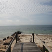
It passes by salt marshes and beaches while traveling through some woods. The views along the path are to the west so the sunset over the salt marshes can be amazing.
There are a number of ice cream shops along the way as well as a few restaurants. Parking lots are at both ends and a few along the way. On weekends during the summer thousands of people use the path during the day, but in early evening the numbers have thinned out. Fall is a great time to see the foliage and relatively few people on the path.
- -:--
- Czas
- 17,1 km
- Dystans
- 98 m
- Przewyższenia
- 114 m
- Spadek
- ---
- Śr. Prędkość
- ---
- Maks. wysokość
Kontynuuj z Bikemap
Użyj, edytuj lub pobierz tę trasę rowerową
Chcesz przejechać trasę Shining Sea Bike Path, Falmouth MA CLONED FROM ROUTE 725885 lub dostosować ją do swojej wycieczki? Oto, co możesz zrobić z tą trasą na Bikemap:
Darmowe funkcje
- Zapisz tę trasę jako ulubioną lub w kolekcji
- Skopiuj i zaplanuj swoją wersję tej trasy
- Synchronizuj swoją trasę z Garminem lub Wahoo
Funkcje Premium
3 dni bezpłatnej wersji próbnej lub jednorazowa opłata. Dowiedz się więcej o Bikemap Premium.
- Nawiguj po tej trasie na iOS i Androidzie
- Eksportuj plik GPX / KML tej trasy
- Stwórz swój własny wydruk (wypróbuj za darmo)
- Pobierz tę trasę do nawigacji offline
Odkryj więcej funkcji Premium.
Uzyskaj Bikemap PremiumOd naszej społeczności
North Falmouth: Inne popularne trasy rozpoczynające się tutaj
 edward gorey loop_11/8
- Dystans
- 107,3 km
- Przewyższenia
- 117 m
- Spadek
- 135 m
- Lokalizacja
- North Falmouth, Massachusetts, United States of America
 Depot Rd, North Falmouth to 13 County Rd, North Falmouth
- Dystans
- 29,8 km
- Przewyższenia
- 116 m
- Spadek
- 110 m
- Lokalizacja
- North Falmouth, Massachusetts, United States of America
 Recovered Route
- Dystans
- 12,1 km
- Przewyższenia
- 35 m
- Spadek
- 39 m
- Lokalizacja
- North Falmouth, Massachusetts, United States of America
 Depot Rd, North Falmouth to 35 County Rd, North Falmouth
- Dystans
- 34,8 km
- Przewyższenia
- 132 m
- Spadek
- 132 m
- Lokalizacja
- North Falmouth, Massachusetts, United States of America
 Goeletta Drive 150, Falmouth to Goeletta Drive 154, Falmouth
- Dystans
- 41,3 km
- Przewyższenia
- 99 m
- Spadek
- 105 m
- Lokalizacja
- North Falmouth, Massachusetts, United States of America
 cape cod canal et bord de mer
- Dystans
- 86,3 km
- Przewyższenia
- 177 m
- Spadek
- 178 m
- Lokalizacja
- North Falmouth, Massachusetts, United States of America
 Shining Sea Bike Path, Falmouth MA CLONED FROM ROUTE 725885
- Dystans
- 17,1 km
- Przewyższenia
- 98 m
- Spadek
- 114 m
- Lokalizacja
- North Falmouth, Massachusetts, United States of America
 35 County Rd, North Falmouth to 35 County Rd, North Falmouth
- Dystans
- 34,7 km
- Przewyższenia
- 119 m
- Spadek
- 120 m
- Lokalizacja
- North Falmouth, Massachusetts, United States of America
Otwórz ją w aplikacji

