Tesserete - Gola di Lago - Monte Bar - Piandanazzo - San Lucio - Tesserete
Trasa rowerowa rozpoczynająca się w Tesserete, Ticino, Szwajcaria.
Przegląd
O tej trasie
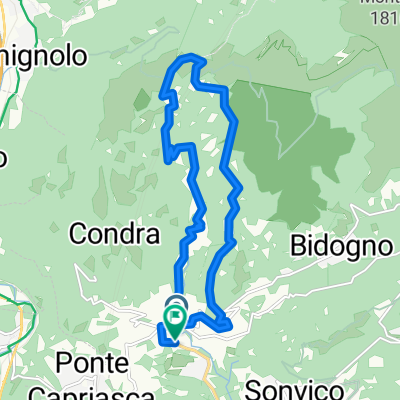
Start do 'Gola di Lago' jest przyjemny i pozwala na rozgrzanie nóg.Następnie trzeba podjechać na stromy asfalt do 'Davrosio'. Stamtąd rower musi być częściowo wypychany do 'Motto della Croce'. Dla bardzo silnych kolarzy z Full to prawdziwe wyzwanie.Z 'Motto della Croce' jedzie się po szerokiej drodze szutrowej po Monte Bar. Z 'Monte Bar' do Piadanazzo spada się nieprzerwanie, najpierw szeroką drogą szutrową, a potem przechodzi się na 'Single Trail'.Z Piadanazzo do San Lucio staje się ciężko. Bardzo ładne 'Single Traile'. Jednak rower musi być często noszony i popychany. Z drugiej strony dla silnych nóg to prawdziwe wyzwanie z doskonałymi widokami.W San Lucio wróciliśmy doliną aż do Tesserete.Dobrym alternatywnym szlakiem jest trasa SPM. Z 'Somazzo' można dojechać do 'Monte Bare'.
- -:--
- Czas
- 39,2 km
- Dystans
- 1280 m
- Przewyższenia
- 1276 m
- Spadek
- ---
- Śr. Prędkość
- ---
- Maks. wysokość
Najważniejsze punkty trasy
Punkty zainteresowania na trasie

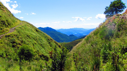
Zdjęcie po 7,9 km
Sicht auf "Motto della Croce" von da geht es den Wanderweg hinauf.

Zdjęcie po 9,4 km
Aussicht von "Motto della Croce"
Interesujące miejsce po 9,6 km
Alternative Steigweg von "Bidogno"
Interesujące miejsce po 12,6 km
Capanna Monte Bar (Verpflegung)
Interesujące miejsce po 14,3 km
Brunnen
Interesujące miejsce po 16,6 km
Alternativ an diesem Punkt Tahlwärts nach "Barchi di Colla" Abzweigen. So erspart man sich das Teilweise Tragen des Bike bis zu "San Lucio"

Zdjęcie po 17,3 km
Interesujące miejsce po 17,3 km
"Barchi di Colla" -> Alternative Tahlwärts fahrtauf der anderen Tahlseite
Interesujące miejsce po 17,5 km
Alternativ Abzweigen auch hier nach "Barchi di Colla" möglich.

Zdjęcie po 18 km
Aussicht und "Weg" links in dem Foto

Zdjęcie po 19,4 km
Aussicht auf den gefahrenen Weg

Zdjęcie po 22,1 km
Aussicht von "San Lucio"
Interesujące miejsce po 22,1 km
Capanna San Lucio (Verpflegung)
Interesujące miejsce po 22,4 km
Bei der Abfahrt immer den Schilder "Certara" Folgen
Kontynuuj z Bikemap
Użyj, edytuj lub pobierz tę trasę rowerową
Chcesz przejechać trasę Tesserete - Gola di Lago - Monte Bar - Piandanazzo - San Lucio - Tesserete lub dostosować ją do swojej wycieczki? Oto, co możesz zrobić z tą trasą na Bikemap:
Darmowe funkcje
- Zapisz tę trasę jako ulubioną lub w kolekcji
- Skopiuj i zaplanuj swoją wersję tej trasy
- Synchronizuj swoją trasę z Garminem lub Wahoo
Funkcje Premium
3 dni bezpłatnej wersji próbnej lub jednorazowa opłata. Dowiedz się więcej o Bikemap Premium.
- Nawiguj po tej trasie na iOS i Androidzie
- Eksportuj plik GPX / KML tej trasy
- Stwórz swój własny wydruk (wypróbuj za darmo)
- Pobierz tę trasę do nawigacji offline
Odkryj więcej funkcji Premium.
Uzyskaj Bikemap PremiumOd naszej społeczności
Tesserete: Inne popularne trasy rozpoczynające się tutaj
 Montebar-4756
- Dystans
- 39,9 km
- Przewyższenia
- 1401 m
- Spadek
- 1389 m
- Lokalizacja
- Tesserete, Ticino, Szwajcaria
 Tesserete-GolaDiLago-Trail-Expedition
- Dystans
- 13,9 km
- Przewyższenia
- 544 m
- Spadek
- 544 m
- Lokalizacja
- Tesserete, Ticino, Szwajcaria
 Monte Bar
- Dystans
- 48,5 km
- Przewyższenia
- 1814 m
- Spadek
- 1814 m
- Lokalizacja
- Tesserete, Ticino, Szwajcaria
 Monte Bar
- Dystans
- 17 km
- Przewyższenia
- 819 m
- Spadek
- 819 m
- Lokalizacja
- Tesserete, Ticino, Szwajcaria
 Scenic Trail 2024 - Scenic Trail 2024 - K54 - Scenic Trail 2024 - Scenic Trail 2024 - K54 sur TraceDeTrail.fr
- Dystans
- 54,7 km
- Przewyższenia
- 4778 m
- Spadek
- 4755 m
- Lokalizacja
- Tesserete, Ticino, Szwajcaria
 ponte-gresso con variazioni
- Dystans
- 97,9 km
- Przewyższenia
- 2272 m
- Spadek
- 1735 m
- Lokalizacja
- Tesserete, Ticino, Szwajcaria
 Tesserete - Gola di Lago - Monte Bar - Piandanazzo - San Lucio - Tesserete
- Dystans
- 39,2 km
- Przewyższenia
- 1280 m
- Spadek
- 1276 m
- Lokalizacja
- Tesserete, Ticino, Szwajcaria
 Tesserete-GolaDiLago-Tesserete
- Dystans
- 14,7 km
- Przewyższenia
- 540 m
- Spadek
- 537 m
- Lokalizacja
- Tesserete, Ticino, Szwajcaria
Otwórz ją w aplikacji

