33. Heidenauer RTF 20.09.2014 - 120 km
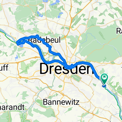
Trasa rowerowa rozpoczynająca się w Heidenau, Saksonia, Niemcy.
Przegląd
O tej trasie
20.09.2014 Start: 09-10.30 Pestalozzi-Gymnasium Heidenau KP Stolpen w Stolpen-Zscheppa (P z marketu Häntzschel&Hauffe), KP Ulbersdorf przy boisku sportowym; KP Cunnersdorf przy kąpielisku, następnie około 6 km przez las państwowy do Rosenthal, KP Bahra (Ochotnicza Straż Pożarna) 7 podjazdów: Pirna-Copitz Mockethaler Grund, do KP2 doliną Sebnitz, podjazd z Krippengrund, w lesie od rozwidlenia Fuchsteich do Rosenthal, z doliny Bielatal z Rosenthal do Raum, z doliny Gottleubatal do Berggießhübel; z Borna na zewnątrz 7 zjazdów: dolina Polenztal (Bockmühle), w Ulbersdorf do doliny Sebnitz, zjazd do Bad Schandau, wjazd do Rosenthal, z Bahra do dolin Bahra i Gottleubatal, wjazd do Gersdorf, wjazd do Pirna-Zuschendorf 9 dolin: dolina Wesenitz, dolina Polenztal, dolina Sebnitz, dolina Łaby, Krippengrund, dolina Cunnersdorfer, dolina Bielatal, dolina Gottleubatal, dolina Bahratal, dolina Seidewitztal Odpowiednia dla sportowych dorosłych, rower szosowy wskazany
- -:--
- Czas
- 114,6 km
- Dystans
- 900 m
- Przewyższenia
- 901 m
- Spadek
- ---
- Śr. Prędkość
- ---
- Maks. wysokość
Jakość trasy
Typy dróg i nawierzchnie na trasie
Typy dróg
Droga
53,9 km
(47 %)
Spokojna droga
12,6 km
(11 %)
Powierzchnie
Utwardzona
102 km
(89 %)
Asfalt
96,3 km
(84 %)
Nawierzchnia (nieokreślona)
4,6 km
(4 %)
Najważniejsze punkty trasy
Punkty zainteresowania na trasie
Zdjęcie po 0,1 km
Tourteilung: 160/120km links - 80/60/30km rechts
Interesujące miejsce po 0,5 km
Achtung, Vorfahrt beachten! Rechts ab nach Pirna
Interesujące miejsce po 4,9 km
Achtung! Ampelkreuzung über die B172 - gerade drüber auf den Rad-/Fußweg fahren!
Interesujące miejsce po 6,3 km
Vorfahrt beachten! Links ab
Interesujące miejsce po 9,4 km
leichter Anstieg im Mockethal
Interesujące miejsce po 14,6 km
links ab auf die Kastanienallee nach Lohmen
Interesujące miejsce po 17,1 km
Achtung! Vorfahrt, bes. von links beachten! Rechts ab, an Kreuzung danach links
Interesujące miejsce po 18,7 km
Links ab, Vorfahrt des Gegenverkehrs beachten!
Interesujące miejsce po 21,6 km
über die Kreuzung gerade, dann gleich rechts
Interesujące miejsce po 27,6 km
Tourteilung 160km-120km, Rechts ab, Beginn asphaltierter Radweg bis KP1 Stolpen
Interesujące miejsce po 28,8 km
Gerade über S 164 hinweg
Interesujące miejsce po 30,8 km
Links ab zum KP Stolpen, Vorfahrt beachten!
Nocleg po 31,2 km
KP1 - Stolpen (Parkplatz Baumarkt Hauffe&Häntzschel), Tourzusammenführung mit 160km-Strecke
Interesujące miejsce po 31,3 km
Links ab nach Langenwolmsdorf
Interesujące miejsce po 32,9 km
Beginn asphaltierter Radweg Richtung Polenztal
Interesujące miejsce po 35,1 km
Achtung! schattige Abfahrt ins Polenztal - neuer Asphalt
Interesujące miejsce po 36,5 km
Polenztal - Bockmühle, Anstieg aus Polenztal
Zdjęcie po 38,5 km
Tourteilung: 160 km links - 120 km gerade
Interesujące miejsce po 40,9 km
Achtung! Abfahrt zum Sebnitztal - die "Sense". Unten gleich links auf Holzbrücke! Bremsen!
Interesujące miejsce po 48 km
KP2 - Sportplatz Ulbersdorf
Interesujące miejsce po 48,5 km
Achtung! Abfahrt im Ort ins Sebnitztal
Interesujące miejsce po 50 km
Anstieg aus Sebnitztal
Interesujące miejsce po 58,2 km
Achtung! Abfahrt ins Elbtal nach Bad Schandau. Unten Stop! Tempo drosseln.
Interesujące miejsce po 60,8 km
Achtung! Gerade aus auf Elbbrücke fahren
Interesujące miejsce po 61,5 km
Rechts ab von Elbbrücke Ri. Krippen
Interesujące miejsce po 72,3 km
Abfahrt nach Cunnersdorf, am Ende scharf links zum Bad
Nocleg po 73,5 km
KP3 - Parkplatz Freibad Cunnersdorf
Interesujące miejsce po 73,7 km
Beginn asphaltierter Radweg durch den Sachsenforst nach Rosenthal
Interesujące miejsce po 79,6 km
Achtung! steile Abfahrt nach Rosenthal + Vorfahrt beachten! Tempo drosseln!
Interesujące miejsce po 83,1 km
Links ab, unscheinbar! Anstieg aus Bielatal nach Raum
Interesujące miejsce po 84,5 km
Tourteilung 160 km linka ab - 120 km gerade, Neuer Straßenbelag!
Nocleg po 86,8 km
KP5 - Hof von Freiwilligen Feuerwehr, Tourzusammenführung mit 80/60 km
Interesujące miejsce po 86,9 km
Achtung! gefährliche Pflasterberg-Abfahrt!, links ab
Interesujące miejsce po 87,3 km
Achtung! Vorfahrt beachten! Rechts ab ins Bahratal
Interesujące miejsce po 88,1 km
Achtung! Lange, schattige Abfahrt im Bahratal! Straßeneinengungen!
Interesujące miejsce po 90,1 km
Links ab nach Berggießhübel, Vorfahrt beachten!
Interesujące miejsce po 93,3 km
Tourteilung: 120/60km rechts - 80km gerade
Interesujące miejsce po 95,2 km
Achtung! steile Abfahrt, Tempo drosseln!
Interesujące miejsce po 96,9 km
Tourzusammenführung 160, 120, 80, 60 km - 30 km
Interesujące miejsce po 100,2 km
Tourzusammenführung 160, 80 km - 120, 60 km, rechts ab
Interesujące miejsce po 104,3 km
Abfahrt nach Pirna-Zuschendorf
Interesujące miejsce po 105,5 km
Links ab ins Seidewitztal, Vorfahrt beachten!
Interesujące miejsce po 106,8 km
Letzter kleiner Hügel, scharf rechts
Interesujące miejsce po 109,8 km
Achtung Rechts ab auf Fahr- u. Radweg über A17
Interesujące miejsce po 111,3 km
Achtung! Vorfahrt beachten! Links ab nach Großsedlitz
Interesujące miejsce po 112,1 km
Achtung! Abfahrt nach Heidenau. Unten Stop! Tempo drosseln!
Interesujące miejsce po 112,6 km
Achtung! Enge Straße, Rechts-Links
Interesujące miejsce po 114 km
Achtung! Stop! Gerade drüber
Interesujące miejsce po 114,6 km
Start und Ziel - Pestalozzi-Gymnasium Heidenau
Kontynuuj z Bikemap
Użyj, edytuj lub pobierz tę trasę rowerową
Chcesz przejechać trasę 33. Heidenauer RTF 20.09.2014 - 120 km lub dostosować ją do swojej wycieczki? Oto, co możesz zrobić z tą trasą na Bikemap:
Darmowe funkcje
- Zapisz tę trasę jako ulubioną lub w kolekcji
- Skopiuj i zaplanuj swoją wersję tej trasy
- Podziel trasę na etapy, aby utworzyć kilkudniową wycieczkę
- Synchronizuj swoją trasę z Garminem lub Wahoo
Funkcje Premium
3 dni bezpłatnej wersji próbnej lub jednorazowa opłata. Dowiedz się więcej o Bikemap Premium.
- Nawiguj po tej trasie na iOS i Androidzie
- Eksportuj plik GPX / KML tej trasy
- Stwórz swój własny wydruk (wypróbuj za darmo)
- Pobierz tę trasę do nawigacji offline
Odkryj więcej funkcji Premium.
Uzyskaj Bikemap PremiumOd naszej społeczności
Heidenau: Inne popularne trasy rozpoczynające się tutaj
 30. Heidenauer RTF 17.09.2011 - 80km NEU
- Dystans
- 71,1 km
- Przewyższenia
- 886 m
- Spadek
- 886 m
- Lokalizacja
- Heidenau, Saksonia, Niemcy
 Pirnaer Straße nach Pirnaer Straße
- Dystans
- 54 km
- Przewyższenia
- 226 m
- Spadek
- 274 m
- Lokalizacja
- Heidenau, Saksonia, Niemcy
 Schönwetterrunde
- Dystans
- 115,9 km
- Przewyższenia
- 448 m
- Spadek
- 443 m
- Lokalizacja
- Heidenau, Saksonia, Niemcy
 Von Dresden bis Radebeul
- Dystans
- 47,7 km
- Przewyższenia
- 149 m
- Spadek
- 149 m
- Lokalizacja
- Heidenau, Saksonia, Niemcy
 Müglitztaltour
- Dystans
- 77,5 km
- Przewyższenia
- 1507 m
- Spadek
- 1406 m
- Lokalizacja
- Heidenau, Saksonia, Niemcy
 29. Heidenauer RTF - 150 km NEU CLONED FROM ROUTE 684918
- Dystans
- 147,3 km
- Przewyższenia
- 1422 m
- Spadek
- 1422 m
- Lokalizacja
- Heidenau, Saksonia, Niemcy
 008_Mitteldeutschlandtour2010_Tag08_Dresden-Kirschau
- Dystans
- 70,2 km
- Przewyższenia
- 574 m
- Spadek
- 431 m
- Lokalizacja
- Heidenau, Saksonia, Niemcy
 Borsbergrunde (adaptiert von Route 249989)
- Dystans
- 24,9 km
- Przewyższenia
- 302 m
- Spadek
- 304 m
- Lokalizacja
- Heidenau, Saksonia, Niemcy
Otwórz ją w aplikacji

