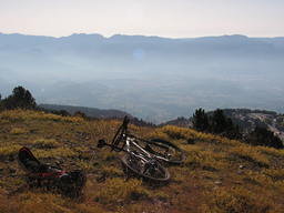
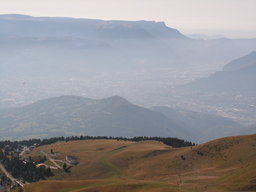
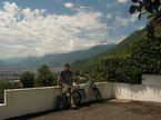
Wanna be at the white house on the top ;)
Trasa rowerowa rozpoczynająca się w Saint-Martin-d'Hères, Owernia-Rodan-Alpy, Francja.
Przegląd
O tej trasie
Widziałem biały dom narciarski na szczycie góry, blisko miasta. Mieszkam na Węgrzech, gdzie najwyższy punkt to około 1000 m, więc wspinaczka była wyzwaniem. Zrobiłem to na rowerze Banshee Chaparral z 2005 + Junior-T z 2003 - około 20,5 kg. Proponuję lżejszy rower do podjazdu... ;) Ale widok jest wart trudu! WEŹ DUŻO WODY! Nie znalazłem źródła między Uriage a Chamrousse!
- -:--
- Czas
- 27,2 km
- Dystans
- 2013 m
- Przewyższenia
- 22 m
- Spadek
- ---
- Śr. Prędkość
- ---
- Maks. wysokość
Najważniejsze punkty trasy
Punkty zainteresowania na trasie

Interesujące miejsce po 9,6 km

Interesujące miejsce po 10,8 km

Interesujące miejsce po 10,8 km

Interesujące miejsce po 11,4 km

Interesujące miejsce po 13,1 km

Interesujące miejsce po 14,4 km
Good place to eat :)

Interesujące miejsce po 16,7 km

Interesujące miejsce po 16,9 km

Interesujące miejsce po 16,9 km

Interesujące miejsce po 17 km

Interesujące miejsce po 17,7 km

Interesujące miejsce po 17,7 km

Interesujące miejsce po 17,7 km

Interesujące miejsce po 19,2 km
Was a good feeling to know that it goes up 370 m on 2,6 Km

Interesujące miejsce po 19,2 km
A guy didn't drift it with an MX-5.... BAAAAAD :D

Interesujące miejsce po 20,2 km

Interesujące miejsce po 20,2 km

Interesujące miejsce po 20,7 km

Interesujące miejsce po 20,7 km

Interesujące miejsce po 21,2 km

Interesujące miejsce po 21,2 km

Interesujące miejsce po 21,6 km

Interesujące miejsce po 23,7 km
First source since Uriage :)

Interesujące miejsce po 24,3 km
There's no much no.... NOT

Interesujące miejsce po 25,4 km

Interesujące miejsce po 25,8 km

Interesujące miejsce po 26,4 km

Interesujące miejsce po 26,5 km

Interesujące miejsce po 26,6 km

Interesujące miejsce po 26,8 km

Interesujące miejsce po 27,1 km
The lift closes, sheeps come :D

Interesujące miejsce po 27,1 km

Interesujące miejsce po 27,1 km
Kontynuuj z Bikemap
Użyj, edytuj lub pobierz tę trasę rowerową
Chcesz przejechać trasę Wanna be at the white house on the top ;) lub dostosować ją do swojej wycieczki? Oto, co możesz zrobić z tą trasą na Bikemap:
Darmowe funkcje
- Zapisz tę trasę jako ulubioną lub w kolekcji
- Skopiuj i zaplanuj swoją wersję tej trasy
- Synchronizuj swoją trasę z Garminem lub Wahoo
Funkcje Premium
3 dni bezpłatnej wersji próbnej lub jednorazowa opłata. Dowiedz się więcej o Bikemap Premium.
- Nawiguj po tej trasie na iOS i Androidzie
- Eksportuj plik GPX / KML tej trasy
- Stwórz swój własny wydruk (wypróbuj za darmo)
- Pobierz tę trasę do nawigacji offline
Odkryj więcej funkcji Premium.
Uzyskaj Bikemap PremiumOd naszej społeczności
Saint-Martin-d'Hères: Inne popularne trasy rozpoczynające się tutaj
 Grenoble Kyriad - Alpe d'Huez
- Dystans
- 58,9 km
- Przewyższenia
- 1812 m
- Spadek
- 259 m
- Lokalizacja
- Saint-Martin-d'Hères, Owernia-Rodan-Alpy, Francja
 De 106 Avenue Marcel Cachin, Saint-Martin-d'Hères à Avenue Marcel Cachin, Saint-Martin-d'Hères
- Dystans
- 23,8 km
- Przewyższenia
- 293 m
- Spadek
- 292 m
- Lokalizacja
- Saint-Martin-d'Hères, Owernia-Rodan-Alpy, Francja
 Clémencière + Palaquit
- Dystans
- 36,8 km
- Przewyższenia
- 1045 m
- Spadek
- 1045 m
- Lokalizacja
- Saint-Martin-d'Hères, Owernia-Rodan-Alpy, Francja
 Grand tour Chartreuse depuis Grenoble
- Dystans
- 71,8 km
- Przewyższenia
- 1318 m
- Spadek
- 1318 m
- Lokalizacja
- Saint-Martin-d'Hères, Owernia-Rodan-Alpy, Francja
 Wanna be at the white house on the top ;)
- Dystans
- 27,2 km
- Przewyższenia
- 2013 m
- Spadek
- 22 m
- Lokalizacja
- Saint-Martin-d'Hères, Owernia-Rodan-Alpy, Francja
 Tour Belledonne par Villard-Bonnot
- Dystans
- 52,1 km
- Przewyższenia
- 880 m
- Spadek
- 878 m
- Lokalizacja
- Saint-Martin-d'Hères, Owernia-Rodan-Alpy, Francja
 Montée Chamrousse depuis Grenoble
- Dystans
- 67,1 km
- Przewyższenia
- 1571 m
- Spadek
- 1571 m
- Lokalizacja
- Saint-Martin-d'Hères, Owernia-Rodan-Alpy, Francja
 Tavernolles - Arkéma
- Dystans
- 31,1 km
- Przewyższenia
- 377 m
- Spadek
- 377 m
- Lokalizacja
- Saint-Martin-d'Hères, Owernia-Rodan-Alpy, Francja
Otwórz ją w aplikacji


