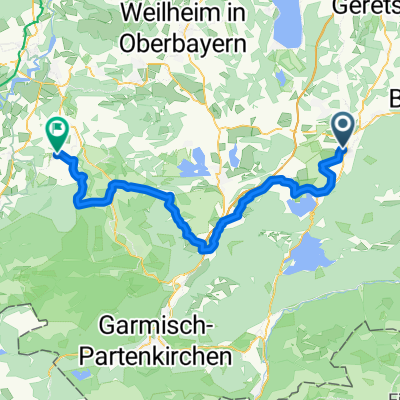
Ried/Benedektiner Wand - Mittenwald
- 37,4 km
- 868 m
- 589 m
- Benediktbeuern, Bawaria, Niemcy
Trasa rowerowa rozpoczynająca się w Benediktbeuern, Bawaria, Niemcy.
Przegląd
Embark on an exhilarating cycling adventure along this scenic route, perfect for those seeking a blend of challenge and beauty. Starting at the trailhead, you'll pedal through lush landscapes, enjoying the gentle undulations of the path. The route offers a balanced mix of uphill climbs and downhill descents, making it ideal for cyclists of various levels.
As you progress, you'll ascend to a maximum elevation of 694 meters, rewarding you with breathtaking views of the surrounding terrain. The ascent of 114 meters and descent of 64 meters ensure a dynamic ride, keeping your journey exciting and engaging.
Covering a total distance of 7.3 kilometers, this route is suitable for a leisurely ride or a more spirited challenge. Whether you're a seasoned cyclist or just getting into biking, this path promises an enjoyable experience with stunning scenery at every turn.
Wygenerowane przez AI
utworzono 2 miesiące temu temu
Jakość trasy
Spokojna droga
4,7 km
61 %
Ścieżka
1,8 km
23 %
Utwardzona
7,6 km
(98 %)
Asfalt
7,6 km
98 %
Niezdefiniowany
0,2 km
2 %
Kontynuuj z Bikemap
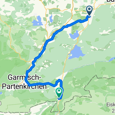
Chcesz przejechać trasę Tölzer Straße, Benediktbeuern nach Ostfeldring, Bad Heilbrunn lub dostosować ją do swojej wycieczki? Oto, co możesz zrobić z tą trasą na Bikemap:
3 dni bezpłatnej wersji próbnej lub jednorazowa opłata. Dowiedz się więcej o Bikemap Premium.
Odkryj więcej funkcji Premium.
Uzyskaj Bikemap PremiumOd naszej społeczności
Otwórz ją w aplikacji