- 13,9 km
- 197 m
- 159 m
- Retournac, Owernia-Rodan-Alpy, Francja
LV04 Retournac to Aurec.kml_LV04 Retournac to Aurec
Trasa rowerowa rozpoczynająca się w Retournac, Owernia-Rodan-Alpy, Francja.
Przegląd
O tej trasie
Begin your cycling adventure in the bustling city center, where vibrant streets and friendly locals set the tone. The route winds through lush parks, offering ample opportunities to pause and soak in the scenery. As you progress, the terrain varies, with gentle slopes and smooth flat stretches providing a comfortable ride. Around halfway, you'll encounter a charming village, perfect for a brief detour with its quaint shops and cafes. The journey concludes with a scenic coastal path, where the sea breeze adds a refreshing twist to the ride. Enjoy the diverse landscapes and the seamless blend of urban and natural beauty throughout your cycling excursion.
Wygenerowane przez AI
- 1:45 h
- Czas
- 30 km
- Dystans
- 0 m
- Przewyższenia
- 0 m
- Spadek
- 17,1 km/h
- Śr. Prędkość
- ---
- Maks. wysokość
utworzono 29 dni temu temu
Jakość trasy
Typy dróg i nawierzchnie na trasie
Typy dróg
Spokojna droga
4,8 km
16 %
Droga
0,6 km
2 %
Powierzchnie
Utwardzona
13,5 km
(45 %)
Asfalt
13,5 km
45 %
Niezdefiniowany
16,5 km
55 %
Kontynuuj z Bikemap
Użyj, edytuj lub pobierz tę trasę rowerową
Chcesz przejechać trasę LV04 Retournac to Aurec.kml_LV04 Retournac to Aurec lub dostosować ją do swojej wycieczki? Oto, co możesz zrobić z tą trasą na Bikemap:
Darmowe funkcje
- Zapisz tę trasę jako ulubioną lub w kolekcji
- Skopiuj i zaplanuj swoją wersję tej trasy
- Synchronizuj swoją trasę z Garminem lub Wahoo
Funkcje Premium
3 dni bezpłatnej wersji próbnej lub jednorazowa opłata. Dowiedz się więcej o Bikemap Premium.
- Nawiguj po tej trasie na iOS i Androidzie
- Eksportuj plik GPX / KML tej trasy
- Stwórz swój własny wydruk (wypróbuj za darmo)
- Pobierz tę trasę do nawigacji offline
Odkryj więcej funkcji Premium.
Uzyskaj Bikemap PremiumOd naszej społeczności
Retournac: Inne popularne trasy rozpoczynające się tutaj
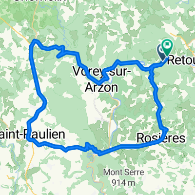
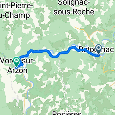
- 21. Retournac - Vorey
- Chamalieres 3
- 60,5 km
- 910 m
- 905 m
- Retournac, Owernia-Rodan-Alpy, Francja
- Retournac - Satillieu
- 71,1 km
- 1203 m
- 1196 m
- Retournac, Owernia-Rodan-Alpy, Francja
- Chamalieres 2
- 38,6 km
- 705 m
- 698 m
- Retournac, Owernia-Rodan-Alpy, Francja
- 4. Tag Retournac - Le Puy-en-Velay
- 43 km
- 753 m
- 770 m
- Retournac, Owernia-Rodan-Alpy, Francja
- 2 Route du Vert, Retournac à Fontanes, Naussac-Fontanes
- 87,5 km
- 1946 m
- 1429 m
- Retournac, Owernia-Rodan-Alpy, Francja
- LV04 Retournac to Aurec.kml - LV04 Retournac to Aurec.kml_LV04 Retournac to Aurec
- 30 km
- 449 m
- 569 m
- Retournac, Owernia-Rodan-Alpy, Francja
- FlatRide
- 14,2 km
- 228 m
- 196 m
- Retournac, Owernia-Rodan-Alpy, Francja
Otwórz ją w aplikacji


