

Wulai-Neidong forest trail
Trasa rowerowa rozpoczynająca się w Banqiao District, Taipei, Taiwan.
Przegląd
O tej trasie
<span style="color: #333333; font-family: 'lucida grande', tahoma, verdana, arial, sans-serif; font-size: 11px; line-height: 14px; white-space: pre-wrap;">Because the official entrance to the內洞林路 road has a police station (and is closed off) we had to turn and climb through a river bed for about 150m - probably the hardest part. There were also 2 big landslides which we needed to pass by climbing through the forest, and the last landslide was just before we got to the upper Neidong waterfall - that one is impossible to go around.</span><br style="color: #333333; font-family: 'lucida grande', tahoma, verdana, arial, sans-serif; font-size: 11px; line-height: 14px; white-space: pre-wrap;" /><span style="color: #333333; font-family: 'lucida grande', tahoma, verdana, arial, sans-serif; font-size: 11px; line-height: 14px; white-space: pre-wrap;">Then it's the stairs/trail down to the public waterfall area; that part is semi-ridable and sort of fun, if there aren't too many people coming up. Most of the trail is a nice gravel road with some stones mixed in.</span>
- -:--
- Czas
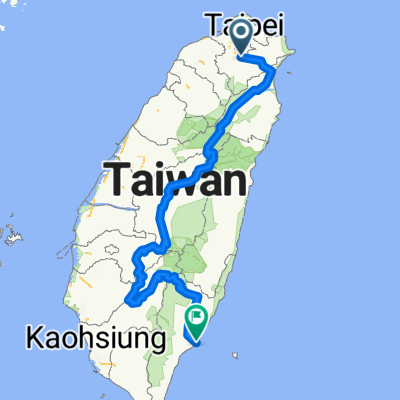
- 28,7 km
- Dystans
- 1031 m
- Przewyższenia
- 1031 m
- Spadek
- ---
- Śr. Prędkość
- ---
- Maks. wysokość

Kontynuuj z Bikemap
Użyj, edytuj lub pobierz tę trasę rowerową
Chcesz przejechać trasę Wulai-Neidong forest trail lub dostosować ją do swojej wycieczki? Oto, co możesz zrobić z tą trasą na Bikemap:
Darmowe funkcje
- Zapisz tę trasę jako ulubioną lub w kolekcji
- Skopiuj i zaplanuj swoją wersję tej trasy
- Synchronizuj swoją trasę z Garminem lub Wahoo
Funkcje Premium
3 dni bezpłatnej wersji próbnej lub jednorazowa opłata. Dowiedz się więcej o Bikemap Premium.
- Nawiguj po tej trasie na iOS i Androidzie
- Eksportuj plik GPX / KML tej trasy
- Stwórz swój własny wydruk (wypróbuj za darmo)
- Pobierz tę trasę do nawigacji offline
Odkryj więcej funkcji Premium.
Uzyskaj Bikemap PremiumOd naszej społeczności
Banqiao District: Inne popularne trasy rozpoczynające się tutaj
 中央山脈一條鞭
- Dystans
- 690,1 km
- Przewyższenia
- 8446 m
- Spadek
- 8466 m
- Lokalizacja
- Banqiao District, Taipei, Taiwan
 一日北高
一日北高- Dystans
- 362,1 km
- Przewyższenia
- 310 m
- Spadek
- 313 m
- Lokalizacja
- Banqiao District, Taipei, Taiwan
 菁桐遊
菁桐遊- Dystans
- 29,7 km
- Przewyższenia
- 505 m
- Spadek
- 270 m
- Lokalizacja
- Banqiao District, Taipei, Taiwan
 永和-深坑-石碇106乙-北47-北宜-新店
- Dystans
- 48,2 km
- Przewyższenia
- 541 m
- Spadek
- 541 m
- Lokalizacja
- Banqiao District, Taipei, Taiwan
 01/05/2019一日北高
- Dystans
- 361,5 km
- Przewyższenia
- 107 m
- Spadek
- 108 m
- Lokalizacja
- Banqiao District, Taipei, Taiwan
 新店_(台9)坪林_106乙(石碇)_環圈
- Dystans
- 59,8 km
- Przewyższenia
- 2096 m
- Spadek
- 2095 m
- Lokalizacja
- Banqiao District, Taipei, Taiwan
![[五星]分段環島-首部曲-永和到清水](https://media.bikemap.net/routes/98905/staticmaps/in_cba9c0d3-caf2-4f27-b1e4-472c0ba70923_400x400_bikemap-2021-3D-static.png) [五星]分段環島-首部曲-永和到清水
[五星]分段環島-首部曲-永和到清水- Dystans
- 172,5 km
- Przewyższenia
- 332 m
- Spadek
- 340 m
- Lokalizacja
- Banqiao District, Taipei, Taiwan
 北宜海倫咖啡
- Dystans
- 43,7 km
- Przewyższenia
- 1185 m
- Spadek
- 1194 m
- Lokalizacja
- Banqiao District, Taipei, Taiwan
Otwórz ją w aplikacji