- 13 km
- 41 m
- 165 m
- Santa Fe, Nowy Meksyk, USA
Rail Trail
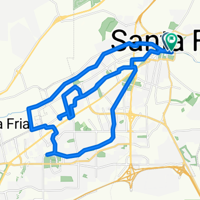
Trasa rowerowa rozpoczynająca się w Santa Fe, Nowy Meksyk, USA.
Przegląd
O tej trasie
The route follows the still operational Santa Fe Southern Line from Santa Fe Depot to Lamy Depot. The trail has three portions: the potion within the Santa Fe City Limits is paved and well populated by bikes, joggers and pedestrians. Leaving the southern city limit at Rabbit Road, the bike trail is dirt, but has been recently re-graded and hard packed for about 2 miles. At that point it joins onto a gravel trail heading west to the commmunity college where you can return to the city if you like a shorter route. Venturing further south, though, the trail is rough. Care in riding is required here as the trail goes through some deep sand traps that can toss you over the handlebars (personal experience with this). It's not dangerous if you take it slow and keep you eye on what's ahead. No road bikes can pass through this section, but its fine with a dirt or other fat-tire bike. Return by the same route, or on the roads from Lamy, via US 285.
- -:--
- Czas
- 28,4 km
- Dystans
- 173 m
- Przewyższenia
- 302 m
- Spadek
- ---
- Śr. Prędkość
- ---
- Maks. wysokość
utworzono 12 lat temu temu
Kontynuuj z Bikemap
Użyj, edytuj lub pobierz tę trasę rowerową
Chcesz przejechać trasę Rail Trail lub dostosować ją do swojej wycieczki? Oto, co możesz zrobić z tą trasą na Bikemap:
Darmowe funkcje
- Zapisz tę trasę jako ulubioną lub w kolekcji
- Skopiuj i zaplanuj swoją wersję tej trasy
- Synchronizuj swoją trasę z Garminem lub Wahoo
Funkcje Premium
3 dni bezpłatnej wersji próbnej lub jednorazowa opłata. Dowiedz się więcej o Bikemap Premium.
- Nawiguj po tej trasie na iOS i Androidzie
- Eksportuj plik GPX / KML tej trasy
- Stwórz swój własny wydruk (wypróbuj za darmo)
- Pobierz tę trasę do nawigacji offline
Odkryj więcej funkcji Premium.
Uzyskaj Bikemap PremiumOd naszej społeczności
Santa Fe: Inne popularne trasy rozpoczynające się tutaj
- High-speed route in Santa Fe
- Santa Fe to Chimayo, NM
- 57,7 km
- 504 m
- 745 m
- Santa Fe, Nowy Meksyk, USA
- 740 Cerrillos Rd, Santa Fe to 740 Cerrillos Rd, Santa Fe
- 32,2 km
- 246 m
- 245 m
- Santa Fe, Nowy Meksyk, USA
- E Alameda St, Santa Fe to Cathedral Pl, Santa Fe
- 35 km
- 246 m
- 247 m
- Santa Fe, Nowy Meksyk, USA
- Paseo De Peralta 1050, Santa Fe to Beckner Road 5400, Santa Fe
- 14,4 km
- 34 m
- 203 m
- Santa Fe, Nowy Meksyk, USA
- day 19 to Romomville
- 104,5 km
- 589 m
- 758 m
- Santa Fe, Nowy Meksyk, USA
- 20161013 Santa Fe NM Local bicycle ride #acaE6C2_2016
- 16,8 km
- 84 m
- 82 m
- Santa Fe, Nowy Meksyk, USA
- Slow ride in Santa Fe
- 9,8 km
- 92 m
- 145 m
- Santa Fe, Nowy Meksyk, USA
Otwórz ją w aplikacji


