De Rue de Ransou 72, Bagnes à Rue de Ransou 72, Bagnes
- 132 km
- 2810 m
- 2812 m
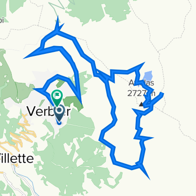
- Verbier, Valais, Szwajcaria
Trasa rowerowa rozpoczynająca się w Verbier, Valais, Szwajcaria.
Przegląd
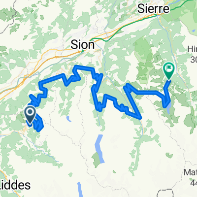
Trasa Grand Raid między Verbier a Grimentz w Valais. Ten wyścig MTB odbywa się co roku w sierpniu. Zwycięzcy docierają do Grimentz w mniej niż 6h15 – a ja po 2 dobrze wypełnionych dniach...
Długość: 128 km
Dodatnie przewyższenie: 5025 m (według organizatorów wyścigu)
Maksymalna wysokość: 2792 m (Basset de Lona)
Więcej informacji na grand-raid.ch i europebybike.info.
utworzono 12 lat temu temu
Najważniejsze punkty trasy
Verbier-Station, 1490 m
Le Camp de Base (Bed & Breakfast), Bâtiment de la télécabine, Tél. 027 775 33 63
Les Ruinettes, 2190 m
Croix de Coeur, 2173 m
La Tzoumaz, 1515 m
Nendaz-Station, 1380 m
Veysonnaz, 1340 m
Les Collons, 1800 m
Hérémence, 1237 m
Pension de Prolin 027 281 28 29
Mandelon, 2068 m
Chemeuille, 2140 m
Evolène, 1370 m
Volovron, 1760 m
Eison, 1650 m
L'A Vieille, 2370 m
Pas de Lona, 2787 m
Basset de Lona, 2792 m
Kontynuuj z Bikemap
Chcesz przejechać trasę Grand Raid Verbier-Grimentz lub dostosować ją do swojej wycieczki? Oto, co możesz zrobić z tą trasą na Bikemap:
3 dni bezpłatnej wersji próbnej lub jednorazowa opłata. Dowiedz się więcej o Bikemap Premium.
Odkryj więcej funkcji Premium.
Uzyskaj Bikemap PremiumOd naszej społeczności
Otwórz ją w aplikacji