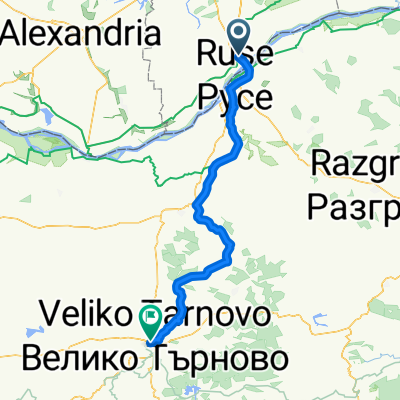
- 137 km
- 995 m
- 814 m
- Remuș, Okręg Giurgiu, Rumunia
Giurgiu - Ruse - Shtarklevo - Rusenski Lom canyon - Ivanovo - Krasen - Lom canyon - Ruse - Giurgiu
Trasa rowerowa rozpoczynająca się w Remuș, Okręg Giurgiu, Rumunia.
Przegląd
O tej trasie
Kompozycja z asfaltową drogą dla szybkiego dostępu do strefy MTB. Wejście do kanionu Rusenski Lom jest wskazane z głównej drogi po Shtraklevo. Szlak kanionu jest dość niejasny w niektórych miejscach i może być błotnisty, jeśli poprzednie dni padał deszcz. Nie ma źródeł wody przed pierwszym przekroczeniem rzeki przy kościołach wykutych w kamieniu w Ivanovo. Aby nie zgubić przejścia przez rzekę, obserwuj okna wykute w kamieniach po lewej stronie szlaku oraz kilka poręczy zawieszonych na szczycie klifu. Po przejściu przez rzekę jest pompa wodna. Uchwyt był złamany, ale udało nam się wydobyć trochę wody. Z tego miejsca do Krasen jest asfaltowa droga. Z Krasen do Ruse są tylko kaniony i małe drogi, bardzo lekkie wzniesienia, piękne krajobrazy. W pobliżu Basarbovo spróbuj znaleźć jaskinię, z której wydobywa się bardzo świeże powietrze. Nie ma znaku na szlaku, ale możesz poczuć zimne powietrze spływające z lasu podczas jazdy na rowerze. Miłej zabawy.
- -:--
- Czas
- 90,6 km
- Dystans
- 472 m
- Przewyższenia
- 472 m
- Spadek
- ---
- Śr. Prędkość
- ---
- Maks. wysokość
utworzono 12 lat temu temu
Kontynuuj z Bikemap
Użyj, edytuj lub pobierz tę trasę rowerową
Chcesz przejechać trasę Giurgiu - Ruse - Shtarklevo - Rusenski Lom canyon - Ivanovo - Krasen - Lom canyon - Ruse - Giurgiu lub dostosować ją do swojej wycieczki? Oto, co możesz zrobić z tą trasą na Bikemap:
Darmowe funkcje
- Zapisz tę trasę jako ulubioną lub w kolekcji
- Skopiuj i zaplanuj swoją wersję tej trasy
- Podziel trasę na etapy, aby utworzyć kilkudniową wycieczkę
- Synchronizuj swoją trasę z Garminem lub Wahoo
Funkcje Premium
3 dni bezpłatnej wersji próbnej lub jednorazowa opłata. Dowiedz się więcej o Bikemap Premium.
- Nawiguj po tej trasie na iOS i Androidzie
- Eksportuj plik GPX / KML tej trasy
- Stwórz swój własny wydruk (wypróbuj za darmo)
- Pobierz tę trasę do nawigacji offline
Odkryj więcej funkcji Premium.
Uzyskaj Bikemap PremiumOd naszej społeczności
Remuș: Inne popularne trasy rozpoczynające się tutaj
- Giurgiu - Veliko Tarnovo
- marten - nikolovo - ruse - giurgiu
- 47,4 km
- 208 m
- 210 m
- Remuș, Okręg Giurgiu, Rumunia
- Giurgiu-ValeaLomului
- 94,3 km
- 446 m
- 445 m
- Remuș, Okręg Giurgiu, Rumunia
- Giurgiu-Ruse-Basrbovo-Krasen-Ruse-Giurgiu
- 65,9 km
- 432 m
- 430 m
- Remuș, Okręg Giurgiu, Rumunia
- Bulgaria 2
- 103 km
- 631 m
- 627 m
- Remuș, Okręg Giurgiu, Rumunia
- Bulgaristan I
- 102,8 km
- 860 m
- 857 m
- Remuș, Okręg Giurgiu, Rumunia
- 5. diena Girgiu to Suhaia 90km
- 81,9 km
- 175 m
- 111 m
- Remuș, Okręg Giurgiu, Rumunia
- Giurgiu - Ruse - Shtarklevo - Rusenski Lom canyon - Ivanovo - Krasen - Lom canyon - Ruse - Giurgiu
- 90,6 km
- 472 m
- 472 m
- Remuș, Okręg Giurgiu, Rumunia
Otwórz ją w aplikacji


