

Plateau de Beille
Trasa rowerowa rozpoczynająca się w Mercus-Garrabet, Occitanie, Francja.
Przegląd
O tej trasie
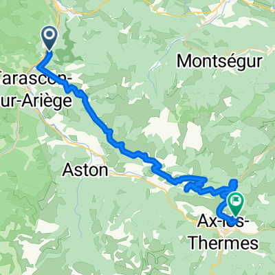
There and back to the famous Plateau de Beille from a small village close to Tarascon-s-Ariege. I would have preferred a round trip, but I didn't find any alternatives to the N20 national road which seemed to be the worst choice. On the other hand, this little mountain pass really worth a visit.
- -:--
- Czas
- 30,8 km
- Dystans
- 2202 m
- Przewyższenia
- 2202 m
- Spadek
- ---
- Śr. Prędkość
- ---
- Maks. wysokość

Jakość trasy
Typy dróg i nawierzchnie na trasie
Typy dróg
Droga
24,7 km
(80 %)
Spokojna droga
4,7 km
(15 %)
Powierzchnie
Utwardzona
20 km
(65 %)
Asfalt
20 km
(65 %)
Niezdefiniowany
10,8 km
(35 %)
Kontynuuj z Bikemap
Użyj, edytuj lub pobierz tę trasę rowerową
Chcesz przejechać trasę Plateau de Beille lub dostosować ją do swojej wycieczki? Oto, co możesz zrobić z tą trasą na Bikemap:
Darmowe funkcje
- Zapisz tę trasę jako ulubioną lub w kolekcji
- Skopiuj i zaplanuj swoją wersję tej trasy
- Synchronizuj swoją trasę z Garminem lub Wahoo
Funkcje Premium
3 dni bezpłatnej wersji próbnej lub jednorazowa opłata. Dowiedz się więcej o Bikemap Premium.
- Nawiguj po tej trasie na iOS i Androidzie
- Eksportuj plik GPX / KML tej trasy
- Stwórz swój własny wydruk (wypróbuj za darmo)
- Pobierz tę trasę do nawigacji offline
Odkryj więcej funkcji Premium.
Uzyskaj Bikemap PremiumOd naszej społeczności
Mercus-Garrabet: Inne popularne trasy rozpoczynające się tutaj
 Foix-Col de Peguere-Col de Port
- Dystans
- 74 km
- Przewyższenia
- 1410 m
- Spadek
- 1411 m
- Lokalizacja
- Mercus-Garrabet, Occitanie, Francja
 Col de Lers
- Dystans
- 16,1 km
- Przewyższenia
- 680 m
- Spadek
- 51 m
- Lokalizacja
- Mercus-Garrabet, Occitanie, Francja
 Francie 2012 14.den
- Dystans
- 46,6 km
- Przewyższenia
- 715 m
- Spadek
- 715 m
- Lokalizacja
- Mercus-Garrabet, Occitanie, Francja
 PYG-Pyrenees Whole route 2.0
- Dystans
- 2133,6 km
- Przewyższenia
- 1954 m
- Spadek
- 589 m
- Lokalizacja
- Mercus-Garrabet, Occitanie, Francja
 Mercus
- Dystans
- 45,1 km
- Przewyższenia
- 2734 m
- Spadek
- 2733 m
- Lokalizacja
- Mercus-Garrabet, Occitanie, Francja
 Vichy - Perpignan 1996 Etappe 15
- Dystans
- 46,5 km
- Przewyższenia
- 1219 m
- Spadek
- 566 m
- Lokalizacja
- Mercus-Garrabet, Occitanie, Francja
 Les corniches curta
- Dystans
- 40,2 km
- Przewyższenia
- 517 m
- Spadek
- 516 m
- Lokalizacja
- Mercus-Garrabet, Occitanie, Francja
 Corniche Arnave Cazenave
- Dystans
- 30,3 km
- Przewyższenia
- 468 m
- Spadek
- 479 m
- Lokalizacja
- Mercus-Garrabet, Occitanie, Francja
Otwórz ją w aplikacji