

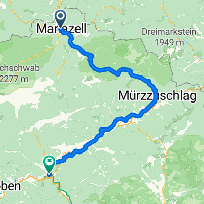
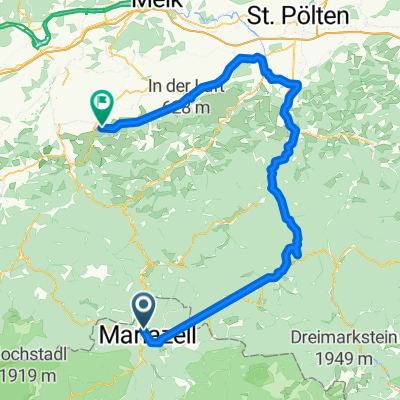
Tour de Barcelona 2014 dzień 7
Trasa rowerowa rozpoczynająca się w Mariazell, Styria, Austria.
Przegląd
O tej trasie
<span style="font-size: 13.5pt; line-height: 115%;">Halltal – </span><span style="font-size: 13.5pt; line-height: 115%; font-weight: normal;">MARIAZELL</span><span style="font-size: 13.5pt; line-height: 115%;"> </span><span style="font-size: 11pt; line-height: 115%; font-weight: normal;">(20</span><span style="font-size: 11pt; line-height: 115%;">)</span><span style="font-size: 13.5pt; line-height: 115%;"> – </span><span style="font-size: 13.5pt; line-height: 115%; font-weight: normal;">Rasing – Sigmundsberg</span><span style="font-size: 13.5pt; line-height: 115%;"> –</span><span style="font-size: 13.5pt; line-height: 115%; font-weight: normal;"> GuBwerk</span><span style="font-size: 13.5pt; line-height: 115%;"> </span><span style="font-size: 11pt; line-height: 115%; font-weight: normal;">(24</span><span style="font-size: 11pt; line-height: 115%;">)</span><span style="font-size: 13.5pt; line-height: 115%;"> </span><span style="font-size: 11pt; line-height: 115%;"> </span><span style="font-size: 13.5pt; line-height: 115%; font-weight: normal;">– Salzahammer – GleiBnerhof – Salzatal</span><span style="font-size: 13.5pt; line-height: 115%;"> – </span><span style="font-size: 13.5pt; line-height: 115%; font-weight: normal;">Greith</span><span style="font-size: 13.5pt; line-height: 115%;"> – </span><span style="font-size: 13.5pt; line-height: 115%; font-weight: normal;">Hals – Rotmoos – Weichselboden – Gschoder – Kornberg – Wildalpen</span><span style="font-size: 13.5pt; line-height: 115%;"> – </span><span style="font-size: 13.5pt; line-height: 115%; font-weight: normal;">Fischerau</span><span style="font-size: 13.5pt; line-height: 115%;"> </span><span style="font-size: 11pt; line-height: 115%;"> </span><span style="font-size: 13.5pt; line-height: 115%;">– </span><span style="font-size: 13.5pt; line-height: 115%; font-weight: normal;">Steinbruch </span><span style="font-size: 11pt; line-height: 115%;"> </span><span style="font-size: 13.5pt; line-height: 115%;">– </span><span style="font-size: 13.5pt; line-height: 115%; font-weight: normal;">Petrus</span><span style="font-size: 13.5pt; line-height: 115%;"> – </span><span style="font-size: 13.5pt; line-height: 115%; font-weight: normal;">Stickler – Pameralbruck </span><span style="font-size: 11pt; line-height: 115%; font-weight: normal;">(24-25)</span><span style="font-size: 13.5pt; line-height: 115%; font-weight: normal;"> – Obere Palfau – Palfau Links – Gams Bei Hieflau – Kirchenviertel – Radstathohle – Mooslandl – Lehnboden </span><span style="font-size: 11pt; line-height: 115%; font-weight: normal;">(115)</span><span style="font-size: 13.5pt; line-height: 115%; font-weight: normal;"> - Wandau</span><span style="font-size: 13.5pt; line-height: 115%;"> </span><span style="font-size: 13.5pt; line-height: 115%; font-weight: normal;">– Heiflau </span><span style="font-size: 11pt; line-height: 115%; font-weight: normal;">(146)</span><span style="font-size: 13.5pt; line-height: 115%; font-weight: normal;"> – Hochleiten – Tachenberg – Gstatterbodeenbauer – Gstatterboden – Lacken – Krumau – Kader – Admont – Atzmann – Unterdorf – Purgschachen </span><span style="font-size: 13.5pt; line-height: 115%;">– </span><span style="font-size: 13.5pt; line-height: 115%;">Zwirtnersee</span><span style="font-size: 13.5pt; line-height: 115%;"> (</span><span style="font-size: 13.5pt; line-height: 115%;">okolice jeziora</span><span style="font-size: 13.5pt; line-height: 115%;">)</span><span style="font-size: 11pt; line-height: 115%; font-weight: normal;"><o:p></o:p></span>
- -:--
- Czas
- 115 km
- Dystans
- 598 m
- Przewyższenia
- 750 m
- Spadek
- ---
- Śr. Prędkość
- ---
- Maks. wysokość

Jakość trasy
Typy dróg i nawierzchnie na trasie
Typy dróg
Droga rowerowa
2,3 km
(2 %)
Droga
1,2 km
(1 %)
Powierzchnie
Utwardzona
103,5 km
(90 %)
Asfalt
103,5 km
(90 %)
Niezdefiniowany
11,5 km
(10 %)
Najważniejsze punkty trasy
Punkty zainteresowania na trasie
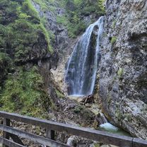
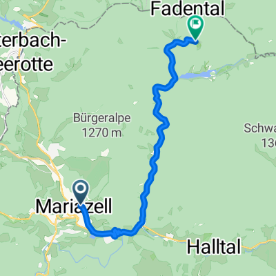
Interesujące miejsce po 114,9 km
nocleg 7
Kontynuuj z Bikemap
Użyj, edytuj lub pobierz tę trasę rowerową
Chcesz przejechać trasę Tour de Barcelona 2014 dzień 7 lub dostosować ją do swojej wycieczki? Oto, co możesz zrobić z tą trasą na Bikemap:
Darmowe funkcje
- Zapisz tę trasę jako ulubioną lub w kolekcji
- Skopiuj i zaplanuj swoją wersję tej trasy
- Podziel trasę na etapy, aby utworzyć kilkudniową wycieczkę
- Synchronizuj swoją trasę z Garminem lub Wahoo
Funkcje Premium
3 dni bezpłatnej wersji próbnej lub jednorazowa opłata. Dowiedz się więcej o Bikemap Premium.
- Nawiguj po tej trasie na iOS i Androidzie
- Eksportuj plik GPX / KML tej trasy
- Stwórz swój własny wydruk (wypróbuj za darmo)
- Pobierz tę trasę do nawigacji offline
Odkryj więcej funkcji Premium.
Uzyskaj Bikemap PremiumOd naszej społeczności
Mariazell: Inne popularne trasy rozpoczynające się tutaj
 Sigmundsberg do Sigmundsberg
- Dystans
- 30,8 km
- Przewyższenia
- 748 m
- Spadek
- 791 m
- Lokalizacja
- Mariazell, Styria, Austria
 MariazellnachWaidhofenYbbs
- Dystans
- 87 km
- Przewyższenia
- 2086 m
- Spadek
- 2578 m
- Lokalizacja
- Mariazell, Styria, Austria
 Mariazell - Bruck an der Mur
- Dystans
- 93,2 km
- Przewyższenia
- 1915 m
- Spadek
- 2276 m
- Lokalizacja
- Mariazell, Styria, Austria
 Hauptplatz nach Walstern
- Dystans
- 11 km
- Przewyższenia
- 345 m
- Spadek
- 362 m
- Lokalizacja
- Mariazell, Styria, Austria
 Tour de Barcelona 2014 dzień 7
- Dystans
- 115 km
- Przewyższenia
- 598 m
- Spadek
- 750 m
- Lokalizacja
- Mariazell, Styria, Austria
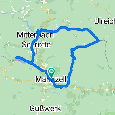 Mariazell - Erlaufsee - Hubertussee - Mariazell
- Dystans
- 33,4 km
- Przewyższenia
- 430 m
- Spadek
- 428 m
- Lokalizacja
- Mariazell, Styria, Austria
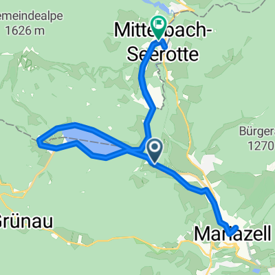 Von Maria Zell rund um den Erlaufsee nach Mitterbach Seegrotte
- Dystans
- 25 km
- Przewyższenia
- 337 m
- Spadek
- 384 m
- Lokalizacja
- Mariazell, Styria, Austria
 Traisetalrundweg von Marizell bis Obergrafendorf
- Dystans
- 106,2 km
- Przewyższenia
- 533 m
- Spadek
- 1130 m
- Lokalizacja
- Mariazell, Styria, Austria
Otwórz ją w aplikacji