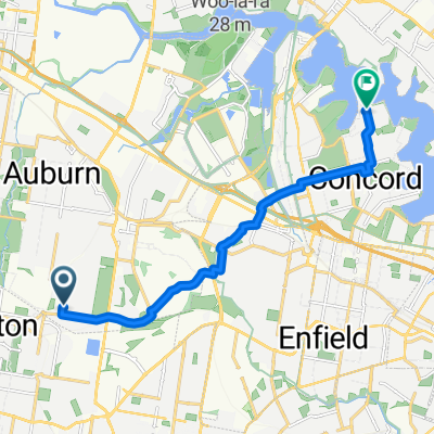
Dunc Gray Velodrome to Prospect Dam via Orphan School Creek
Trasa rowerowa rozpoczynająca się w Regents Park, Nowa Południowa Walia, Australia.
Przegląd
O tej trasie
Wykorzystuje całkowicie wspólne ścieżki rowerowe poza drogami. Zawiera objazd do Wetherill Park McDonalds McCafe na poranną kawę. Wzgórza w Lansdowne są strome (>10%), ale krótkie. Wzgórza z Abbotsbury do tamy Prospect są strome i dłuższe - trudne dla nieprzygotowanych rowerzystów. Poza tym głównie płaskie.
Uwaga, że Prospect Canal Cycleway jest zablokowany z powodu prac budowlanych tuż na wschód od tamy Prospect do października 2009 (i prawdopodobnie dłużej).
Długość szlaku 32,05 km Przechodząc przez: Bass Hill, Georges Hall, Lansdowne, Carramar, Canley Vale, Canley Heights, Wakeley, Prairiewood, Wetherill Park, Greenfield Park, Bossley Park, Edensor Park, Abbotsbury, Horsley Park, Pemulwuy.
- -:--
- Czas
- 31 km
- Dystans
- 156 m
- Przewyższenia
- 126 m
- Spadek
- ---
- Śr. Prędkość
- 88 m
- Maks. wysokość
Jakość trasy
Typy dróg i nawierzchnie na trasie
Typy dróg
Droga rowerowa
23,6 km
(76 %)
Spokojna droga
3,7 km
(12 %)
Powierzchnie
Utwardzona
30,7 km
(99 %)
Nieutwardzona
0,3 km
(1 %)
Beton
20,5 km
(66 %)
Nawierzchnia (nieokreślona)
5,3 km
(17 %)
Najważniejsze punkty trasy
Punkty zainteresowania na trasie
Interesujące miejsce po 24,1 km
Toilets, Water, BBQ and picnic facilities.
Interesujące miejsce po 26,2 km
Turn left uphill here on Southern Side of traffic light crossing, cross lights at Ferrers Rd and continue along northern side of The Horsley Drive to link up with M7 Cycleway at Horsley Park.
Interesujące miejsce po 31 km
Toilets, Picnic Area, Childrens Playground, BBQ facilities.
Interesujące miejsce po 31 km
This is where Boral has been allowed to demolish the Prospect Canal Cycleway in order to build a road.
Kontynuuj z Bikemap
Użyj, edytuj lub pobierz tę trasę rowerową
Chcesz przejechać trasę Dunc Gray Velodrome to Prospect Dam via Orphan School Creek lub dostosować ją do swojej wycieczki? Oto, co możesz zrobić z tą trasą na Bikemap:
Darmowe funkcje
- Zapisz tę trasę jako ulubioną lub w kolekcji
- Skopiuj i zaplanuj swoją wersję tej trasy
- Synchronizuj swoją trasę z Garminem lub Wahoo
Funkcje Premium
3 dni bezpłatnej wersji próbnej lub jednorazowa opłata. Dowiedz się więcej o Bikemap Premium.
- Nawiguj po tej trasie na iOS i Androidzie
- Eksportuj plik GPX / KML tej trasy
- Stwórz swój własny wydruk (wypróbuj za darmo)
- Pobierz tę trasę do nawigacji offline
Odkryj więcej funkcji Premium.
Uzyskaj Bikemap PremiumOd naszej społeczności
Regents Park: Inne popularne trasy rozpoczynające się tutaj
 66 Wyatt Avenue, Regents Park to 18 Woodlands Avenue, Breakfast Point
- Dystans
- 6050,5 km
- Przewyższenia
- 113 m
- Spadek
- 152 m
- Lokalizacja
- Regents Park, Nowa Południowa Walia, Australia
 Dunc Gray Velodrome to Prospect Dam
- Dystans
- 42,9 km
- Przewyższenia
- 163 m
- Spadek
- 170 m
- Lokalizacja
- Regents Park, Nowa Południowa Walia, Australia
 9 Patricia St, Chester Hill to 9 Patricia St, Chester Hill
- Dystans
- 4,1 km
- Przewyższenia
- 27 m
- Spadek
- 22 m
- Lokalizacja
- Regents Park, Nowa Południowa Walia, Australia
 Regents Park to KCCS Arncliffe via Cooks River Cycleway
- Dystans
- 18,4 km
- Przewyższenia
- 102 m
- Spadek
- 113 m
- Lokalizacja
- Regents Park, Nowa Południowa Walia, Australia
 Dunc Gray Velodrome to Rhodes via Liverpool Rail Trail
- Dystans
- 68,1 km
- Przewyższenia
- 130 m
- Spadek
- 130 m
- Lokalizacja
- Regents Park, Nowa Południowa Walia, Australia
 Jade Court 2, Georges Hall to Jade Court 2, Georges Hall
- Dystans
- 13,3 km
- Przewyższenia
- 0 m
- Spadek
- 4 m
- Lokalizacja
- Regents Park, Nowa Południowa Walia, Australia
 Dunc Gray Velodrome to Prospect Dam via Orphan School Creek
- Dystans
- 31 km
- Przewyższenia
- 156 m
- Spadek
- 126 m
- Lokalizacja
- Regents Park, Nowa Południowa Walia, Australia
 Dunc Gray Velodrome to Silverwater Bridge
- Dystans
- 22,1 km
- Przewyższenia
- 77 m
- Spadek
- 115 m
- Lokalizacja
- Regents Park, Nowa Południowa Walia, Australia
Otwórz ją w aplikacji

