

2012 French Tour -- Ride Day 37-- 25 September 2012 -- Seyssins (Grenoble) to Corps-la-Salette
Trasa rowerowa rozpoczynająca się w Seyssins, Owernia-Rodan-Alpy, Francja.
Przegląd
O tej trasie
Co za wspaniała jazda dzisiaj. Sceneria była fantastyczna, a większość trasy to niemal bezruchliwe drogi. Jedyne, czego nam brakowało, to słońca. Mieliśmy wiele groźnych chmur, z których poczuliśmy tylko kilka kropli pod koniec. Mieliśmy też za dużo wiatru w twarz, gdy teren nas nie osłaniał. Kilka razy podczas podjazdu wiatr był tak silny, że wątpiliśmy, czy moglibyśmy jechać szybciej, gdyby droga była płaska. Przy tak małej ilości słońca mam tylko nadzieję, że kilka zdjęć wyjdzie dobrze i odda chociaż trochę sprawiedliwości temu terenowi.
- -:--
- Czas
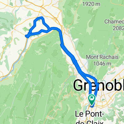
- 71,1 km
- Dystans
- 1352 m
- Przewyższenia
- 639 m
- Spadek
- ---
- Śr. Prędkość
- ---
- Maks. wysokość

Kontynuuj z Bikemap
Użyj, edytuj lub pobierz tę trasę rowerową
Chcesz przejechać trasę 2012 French Tour -- Ride Day 37-- 25 September 2012 -- Seyssins (Grenoble) to Corps-la-Salette lub dostosować ją do swojej wycieczki? Oto, co możesz zrobić z tą trasą na Bikemap:
Darmowe funkcje
- Zapisz tę trasę jako ulubioną lub w kolekcji
- Skopiuj i zaplanuj swoją wersję tej trasy
- Synchronizuj swoją trasę z Garminem lub Wahoo
Funkcje Premium
3 dni bezpłatnej wersji próbnej lub jednorazowa opłata. Dowiedz się więcej o Bikemap Premium.
- Nawiguj po tej trasie na iOS i Androidzie
- Eksportuj plik GPX / KML tej trasy
- Stwórz swój własny wydruk (wypróbuj za darmo)
- Pobierz tę trasę do nawigacji offline
Odkryj więcej funkcji Premium.
Uzyskaj Bikemap PremiumOd naszej społeczności
Seyssins: Inne popularne trasy rozpoczynające się tutaj
 De 14 Rue Henri Barbusse, Échirolles à 12 Allée François Villon, Échirolles
- Dystans
- 62,5 km
- Przewyższenia
- 866 m
- Spadek
- 871 m
- Lokalizacja
- Seyssins, Owernia-Rodan-Alpy, Francja
 2012 French Tour -- Ride Day 37-- 25 September 2012 -- Seyssins (Grenoble) to Corps-la-Salette
- Dystans
- 71,1 km
- Przewyższenia
- 1352 m
- Spadek
- 639 m
- Lokalizacja
- Seyssins, Owernia-Rodan-Alpy, Francja
 ETAPE 1 : SAINT NIZIER - VASSIEUX EN VERCORS
- Dystans
- 55,6 km
- Przewyższenia
- 736 m
- Spadek
- 842 m
- Lokalizacja
- Seyssins, Owernia-Rodan-Alpy, Francja
 Grenoble-Sestriere
- Dystans
- 167,1 km
- Przewyższenia
- 3732 m
- Spadek
- 2130 m
- Lokalizacja
- Seyssins, Owernia-Rodan-Alpy, Francja
 TP Iain Day 1
- Dystans
- 52,6 km
- Przewyższenia
- 1615 m
- Spadek
- 1840 m
- Lokalizacja
- Seyssins, Owernia-Rodan-Alpy, Francja
 2019 - 6a
- Dystans
- 79,8 km
- Przewyższenia
- 1773 m
- Spadek
- 1280 m
- Lokalizacja
- Seyssins, Owernia-Rodan-Alpy, Francja
 randovélo : grenoble - mimizan plage
- Dystans
- 819,4 km
- Przewyższenia
- 11 695 m
- Spadek
- 12 790 m
- Lokalizacja
- Seyssins, Owernia-Rodan-Alpy, Francja
 2009 J1 Seyssins - Villars de Lans
- Dystans
- 34 km
- Przewyższenia
- 1079 m
- Spadek
- 282 m
- Lokalizacja
- Seyssins, Owernia-Rodan-Alpy, Francja
Otwórz ją w aplikacji