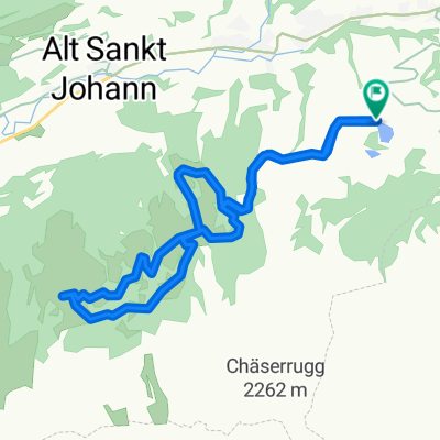
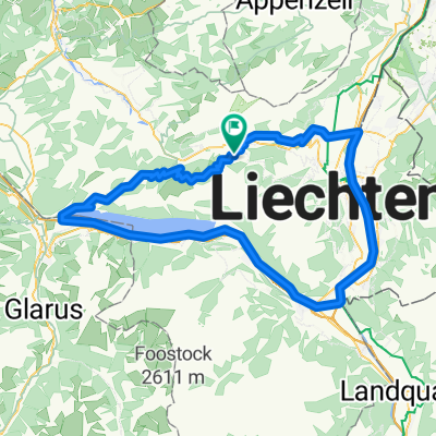
Rund ums Obertoggenburg
Trasa rowerowa rozpoczynająca się w Wildhaus, Kanton St. Gallen, Szwajcaria.
Przegląd
O tej trasie
Jasne, tylko na MTB, nowe klocki hamulcowe, dużo kondycji i dużo wody ... Pali jak ogień!
- -:--
- Czas
- 34,9 km
- Dystans
- 1355 m
- Przewyższenia
- 1355 m
- Spadek
- ---
- Śr. Prędkość
- ---
- Maks. wysokość
Najważniejsze punkty trasy
Punkty zainteresowania na trasie
Interesujące miejsce po 1,4 km
Steiler Anfang auf gut ausgebauter aber schmaler Bergstraße - Achtung Gegenverkehr!
Interesujące miejsce po 2,5 km
Kurze Verschnaufpause, bevor es wieder mächtig in die Waden geht.
Interesujące miejsce po 5,4 km
Herrlicher Fleck! Anhalten, Umdrehen und Aussicht genießen. Wer Mut hat wagt einen Sprung in den See.
Interesujące miejsce po 8,8 km
Kurzer knackiger Single-Trail.
Interesujące miejsce po 11,3 km
Ab hier lange und durchwegs asphaltierte Talfahrt bis Stein.
Interesujące miejsce po 15,1 km
Bis Starkenbach auf der Talstraße - viel verkehr ohne Ausweichmöglichkeit.
Interesujące miejsce po 18,3 km
Talstation der Älplerbahn - i. R. kein Radtransport.
Interesujące miejsce po 20,3 km
Hundgemeiner Anstieg auf holprigem Alpweg - dafür auf weiten Strecken im Schatten.
Interesujące miejsce po 21,8 km
Bergstation Seilbahn von Starkenbahn.
Interesujące miejsce po 22,6 km
Wildmannlisloch. 300 Meter lange, begehnbare Ganghöhle.
Interesujące miejsce po 27,6 km
Gasthaus Selamatt
Interesujące miejsce po 30,2 km
Iltios: Berggasthaus, Standseilbahn von Unterwasser, Bergbahn zum Chäserrugg
Interesujące miejsce po 31,8 km
"Badi" und Naturerlebnispfad Schwendiseen
Kontynuuj z Bikemap
Użyj, edytuj lub pobierz tę trasę rowerową
Chcesz przejechać trasę Rund ums Obertoggenburg lub dostosować ją do swojej wycieczki? Oto, co możesz zrobić z tą trasą na Bikemap:
Darmowe funkcje
- Zapisz tę trasę jako ulubioną lub w kolekcji
- Skopiuj i zaplanuj swoją wersję tej trasy
- Synchronizuj swoją trasę z Garminem lub Wahoo
Funkcje Premium
3 dni bezpłatnej wersji próbnej lub jednorazowa opłata. Dowiedz się więcej o Bikemap Premium.
- Nawiguj po tej trasie na iOS i Androidzie
- Eksportuj plik GPX / KML tej trasy
- Stwórz swój własny wydruk (wypróbuj za darmo)
- Pobierz tę trasę do nawigacji offline
Odkryj więcej funkcji Premium.
Uzyskaj Bikemap PremiumOd naszej społeczności
Wildhaus: Inne popularne trasy rozpoczynające się tutaj
 Schwendisee 3 Brixizimmer
- Dystans
- 14,3 km
- Przewyższenia
- 472 m
- Spadek
- 473 m
- Lokalizacja
- Wildhaus, Kanton St. Gallen, Szwajcaria
 Querpaß - Tag 2
- Dystans
- 86,6 km
- Przewyższenia
- 2383 m
- Spadek
- 2784 m
- Lokalizacja
- Wildhaus, Kanton St. Gallen, Szwajcaria
 Rund ums Obertoggenburg
- Dystans
- 34,9 km
- Przewyższenia
- 1355 m
- Spadek
- 1355 m
- Lokalizacja
- Wildhaus, Kanton St. Gallen, Szwajcaria
 Toggenburger Sagenweg
- Dystans
- 8,3 km
- Przewyższenia
- 195 m
- Spadek
- 191 m
- Lokalizacja
- Wildhaus, Kanton St. Gallen, Szwajcaria
 2016_tt_ch_e3
- Dystans
- 65,6 km
- Przewyższenia
- 332 m
- Spadek
- 679 m
- Lokalizacja
- Wildhaus, Kanton St. Gallen, Szwajcaria
 Wildhaus ums Obertoggenburg
- Dystans
- 35,7 km
- Przewyższenia
- 1261 m
- Spadek
- 1259 m
- Lokalizacja
- Wildhaus, Kanton St. Gallen, Szwajcaria
 Gasenzen - Wesen - Gasenzen
- Dystans
- 104 km
- Przewyższenia
- 1821 m
- Spadek
- 1821 m
- Lokalizacja
- Wildhaus, Kanton St. Gallen, Szwajcaria
 Dorf 10, Wildhaus nach Dorf 10, Wildhaus
- Dystans
- 24,8 km
- Przewyższenia
- 935 m
- Spadek
- 898 m
- Lokalizacja
- Wildhaus, Kanton St. Gallen, Szwajcaria
Otwórz ją w aplikacji

