

Camino 2015 07 Les Riceys nach Tonnerre
Trasa rowerowa rozpoczynająca się w Les Riceys, Grand Est, Francja.
Przegląd
O tej trasie
Les Riceys
6,5
6,5
Bagneux-la-Fosse
11,0
4,5
Bragelogne
17,5
6,5
Villiers-le-Blois
22,0
4,5
Étourvy
30,0
8,0
Mézisey
40,0
10,0
Épineuil
43,0
3,0
Tonnerre
Hotel La Ferme de la Fosse Dionne
11, rue de la Fosse Dionne
89700 TONNERRE
Tel : 03 86 54 82 62
Przetłumaczone, pokaż oryginał (niemiecki)- -:--
- Czas
- 42,9 km
- Dystans
- 516 m
- Przewyższenia
- 555 m
- Spadek
- ---
- Śr. Prędkość
- ---
- Maks. wysokość

Jakość trasy
Typy dróg i nawierzchnie na trasie
Typy dróg
Droga leśna
16,7 km
(39 %)
Droga
12,9 km
(30 %)
Powierzchnie
Utwardzona
3 km
(7 %)
Nieutwardzona
12,9 km
(30 %)
Nieutwardzony (nieokreślony)
10,3 km
(24 %)
Żwir
2,1 km
(5 %)
Kontynuuj z Bikemap
Użyj, edytuj lub pobierz tę trasę rowerową
Chcesz przejechać trasę Camino 2015 07 Les Riceys nach Tonnerre lub dostosować ją do swojej wycieczki? Oto, co możesz zrobić z tą trasą na Bikemap:
Darmowe funkcje
- Zapisz tę trasę jako ulubioną lub w kolekcji
- Skopiuj i zaplanuj swoją wersję tej trasy
- Synchronizuj swoją trasę z Garminem lub Wahoo
Funkcje Premium
3 dni bezpłatnej wersji próbnej lub jednorazowa opłata. Dowiedz się więcej o Bikemap Premium.
- Nawiguj po tej trasie na iOS i Androidzie
- Eksportuj plik GPX / KML tej trasy
- Stwórz swój własny wydruk (wypróbuj za darmo)
- Pobierz tę trasę do nawigacji offline
Odkryj więcej funkcji Premium.
Uzyskaj Bikemap PremiumOd naszej społeczności
Les Riceys: Inne popularne trasy rozpoczynające się tutaj
 Camino 2015 7b Les Riceys nach Tonnere
- Dystans
- 42,6 km
- Przewyższenia
- 311 m
- Spadek
- 356 m
- Lokalizacja
- Les Riceys, Grand Est, Francja
 230 Chemin Rural de la Grande Lande, Les Riceys à 1 Rue de la Maison Dieu de Ricey Bas, Les Riceys
- Dystans
- 6,1 km
- Przewyższenia
- 58 m
- Spadek
- 57 m
- Lokalizacja
- Les Riceys, Grand Est, Francja
 tourmalet 3 etape
- Dystans
- 183,9 km
- Przewyższenia
- 1069 m
- Spadek
- 1075 m
- Lokalizacja
- Les Riceys, Grand Est, Francja
 Griselles-Tonnerre-Griselles
- Dystans
- 91,6 km
- Przewyższenia
- 685 m
- Spadek
- 685 m
- Lokalizacja
- Les Riceys, Grand Est, Francja
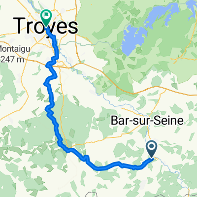 Les Riceys - Troyes
- Dystans
- 61,8 km
- Przewyższenia
- 527 m
- Spadek
- 623 m
- Lokalizacja
- Les Riceys, Grand Est, Francja
 TdF 2011 Et. 5 Les Riceys - Escolives-Sainte-Camille
- Dystans
- 82 km
- Przewyższenia
- 589 m
- Spadek
- 657 m
- Lokalizacja
- Les Riceys, Grand Est, Francja
 3 Rue des Perrières, Les Riceys à 1 Rue de la Maison Dieu de Ricey Bas, Les Riceys
- Dystans
- 7,4 km
- Przewyższenia
- 194 m
- Spadek
- 218 m
- Lokalizacja
- Les Riceys, Grand Est, Francja
 Recovered Route
- Dystans
- 8,1 km
- Przewyższenia
- 120 m
- Spadek
- 119 m
- Lokalizacja
- Les Riceys, Grand Est, Francja
Otwórz ją w aplikacji