Armidale to Point Lookout loop
Trasa rowerowa rozpoczynająca się w Armidale, Nowa Południowa Walia, Australia.
Przegląd
O tej trasie
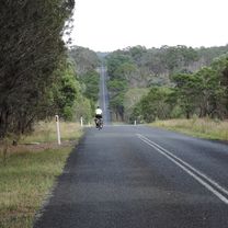
Trasa ta była przejechana jako trzydniowa pętla z Armidale. Pierwszy dzień prowadzi w górę pagórkowatą Rockvale Rd, następnie skręca na Chandler Rd. Asfalt kończy się po około 7 km. Jednakże przy obu okazjach, gdy ją pokonywaliśmy, droga szutrowa do Wollomobi była w dość dobrym stanie. Po krótkim odcinku asfaltowym Waterfall Way i pierwszych kilku kilometrach Kempsey Rd droga ponownie stała się szutrowa i nadal była bardzo pagórkowata. 87-kilometrowa jazda do miejsca biwakowego Wattle Flat była dość wymagająca ze względu na dużą ilość drogi szutrowej i pagórkowaty teren. Jednak miejsce biwakowe Wattle Flat to urocze miejsce, które warto odwiedzić. Drugiego dnia trasa wspina się z powrotem na wzgórze do Forest Way, a następnie kontynuuje wspinaczkę do piknikowego miejsca Little Styx. Ten krótki, 23-kilometrowy odcinek był trudny i zajęło nam prawie 3 godziny! Postanowiliśmy zostawić tam sprzęt i ostatnie podejście do Point Lookout zrobić bez obciążenia. Widoki tam są jednak warte każdego wysiłku. Po powrocie do Little Styx na lunch i odebraniu sprzętu, czekało nas jeszcze jedno strome podejście. Pozostały odcinek drogi szutrowej do autostrady był w dobrym stanie i szybciej się poruszaliśmy. Ta droga może jednak być mocno wyboista ze względu na duży ruch turystyczny. Pozostała część dnia była daleka od płaskiej, ale na asfaltowych drogach wzdłuż Waterfall Way do Ebor, a potem wzdłuż Guyra Rd do miejsca odpoczynku Native Dog Creek, jazda była bardzo łatwa. To kolejne urocze miejsce na biwak. Jednak w czasie naszej podróży podczas suszy w potoku nie było wody. Właściciel kampera widząc nas szukających, uprzejmie nam pomógł uzupełnić zapasy, ale większy Biscuit Creek około 200 m dalej miał wodę. Całkowity dystans drugiego dnia: ~60 km. Dzień 3: Kontynuowaliśmy wzdłuż Guyra Road (asfalt) do Rockvale Rd (około 10 km nieutwardzonych) i z powrotem do Armidale, około 80 km łącznie. Wciąż pagórkowato, ale netto w dół. Trasa była przyjemną przejażdżką, ale oceniana jako trudna ze względu na dużą ilość drogi szutrowej, bardzo pagórkowaty teren oraz całkowity brak sklepów, wymagający zabrania wystarczającej ilości jedzenia na 3 dni ciężkiej pracy. Uwaga: nie przejeżdżaliśmy tej trasy od czasu pożarów pod koniec 2019 roku.
- -:--
- Czas
- 226,3 km
- Dystans
- 4225 m
- Przewyższenia
- 4225 m
- Spadek
- ---
- Śr. Prędkość
- 1558 m
- Maks. wysokość
Zdjęcia trasy
Jakość trasy
Typy dróg i nawierzchnie na trasie
Typy dróg
Droga
133,5 km
(59 %)
Spokojna droga
9,1 km
(4 %)
Powierzchnie
Utwardzona
133,5 km
(59 %)
Nieutwardzona
90,5 km
(40 %)
Asfalt
133,5 km
(59 %)
Nieutwardzony (nieokreślony)
90,5 km
(40 %)
Niezdefiniowany
2,3 km
(1 %)
Kontynuuj z Bikemap
Użyj, edytuj lub pobierz tę trasę rowerową
Chcesz przejechać trasę Armidale to Point Lookout loop lub dostosować ją do swojej wycieczki? Oto, co możesz zrobić z tą trasą na Bikemap:
Darmowe funkcje
- Zapisz tę trasę jako ulubioną lub w kolekcji
- Skopiuj i zaplanuj swoją wersję tej trasy
- Podziel trasę na etapy, aby utworzyć kilkudniową wycieczkę
- Synchronizuj swoją trasę z Garminem lub Wahoo
Funkcje Premium
3 dni bezpłatnej wersji próbnej lub jednorazowa opłata. Dowiedz się więcej o Bikemap Premium.
- Nawiguj po tej trasie na iOS i Androidzie
- Eksportuj plik GPX / KML tej trasy
- Stwórz swój własny wydruk (wypróbuj za darmo)
- Pobierz tę trasę do nawigacji offline
Odkryj więcej funkcji Premium.
Uzyskaj Bikemap PremiumOd naszej społeczności
Armidale: Inne popularne trasy rozpoczynające się tutaj
 Armidale, Rockvale Rd Chandler Rd loop
- Dystans
- 86,1 km
- Przewyższenia
- 772 m
- Spadek
- 773 m
- Lokalizacja
- Armidale, Nowa Południowa Walia, Australia
 Armidale, Toms Gully, Puddledock loop
- Dystans
- 71,6 km
- Przewyższenia
- 607 m
- Spadek
- 607 m
- Lokalizacja
- Armidale, Nowa Południowa Walia, Australia
 New England Cycle Trail South
- Dystans
- 353,4 km
- Przewyższenia
- 999 m
- Spadek
- 1577 m
- Lokalizacja
- Armidale, Nowa Południowa Walia, Australia
 Apple tree drive loop for kids
- Dystans
- 7,8 km
- Przewyższenia
- 92 m
- Spadek
- 93 m
- Lokalizacja
- Armidale, Nowa Południowa Walia, Australia
 Avoiding the Waterfall Way from Armidale
- Dystans
- 92,5 km
- Przewyższenia
- 708 m
- Spadek
- 708 m
- Lokalizacja
- Armidale, Nowa Południowa Walia, Australia
 Armidale to Uralla via Hawthorne Dr
- Dystans
- 72,4 km
- Przewyższenia
- 463 m
- Spadek
- 464 m
- Lokalizacja
- Armidale, Nowa Południowa Walia, Australia
 Armidale Tourist Information Centre to Dangars Gorge return
- Dystans
- 47 km
- Przewyższenia
- 355 m
- Spadek
- 353 m
- Lokalizacja
- Armidale, Nowa Południowa Walia, Australia
 Armidale to Point Lookout loop
- Dystans
- 226,3 km
- Przewyższenia
- 4225 m
- Spadek
- 4225 m
- Lokalizacja
- Armidale, Nowa Południowa Walia, Australia
Otwórz ją w aplikacji


