

The Ladywell Way - Motherwell to Hillend Reservoir
Trasa rowerowa rozpoczynająca się w Motherwell, Szkocja, Zjednoczone Królestwo Wielkiej Brytanii.
Przegląd
O tej trasie
Oprócz ruchliwej miejskiej drogi na początku w kierunku Newhouse, ta droga prowadzi do wielkich dzikich terenów z wrzosowiskami i izolowanymi jeziorami.
Szczegółowy opis poniżej
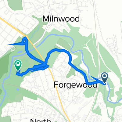
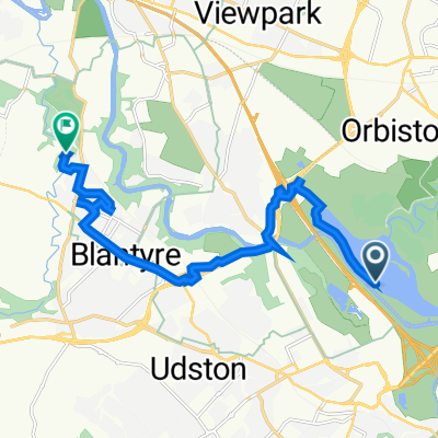
Ten niski odcinek dzikiej przyrody zaczyna się przy Katedrze Motherwell. Zaleca się krótki zjazd do kamienia Ladywell na drodze Ladywell oraz do pochodzenia nazwy Motherwell. Następnie przez obszary miejskie na ruchliwej drodze z chodnikiem. Po 3 km docierasz do słynnej groty Carfin. Następnie kontynuuj wzdłuż drogi z chodnikiem przez Newarthill jeszcze 4 km do Newhouse. (To jest alternatywny punkt startowy, jeśli chcesz uniknąć miejskiego odcinka z Motherwell). Kontynuuj wzdłuż chodnika i drogi przez półtora kilometra, a potem skręć w lewo w cichą ogrodzoną drogę na kilometr przechodząc pod autostradą, a następnie kontynuuj kilometr skręcając w lewo przy Blackridge Farm i w górę do lasu w Easter Dunsyston. Skręć w prawo w ścieżkę do wzięcia, a potem znowu w prawo w ścieżkę wzdłuż północnej strony zbiornika Roughrigg, kierując się do masztów radiowych na Black Hill, aż dołączysz do cichej drogi, Duntilland Road, w Mountcow.
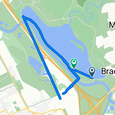
Kontynuuj na północny zachód wzdłuż drogi przez 1½ kilometra, a następnie odbierz ścieżkę oznakowaną jako Lilly Loch 1 mila. Przy Lilly Loch weź ścieżkę okrążającą wschodni koniec jeziora, która zaprowadzi cię do miejsca docelowego przy zbiorniku Hillend.
Hotel itp. w Newhouse, ale potem żadnych udogodnień aż do zbiornika Hillend i pobliskiej wioski Caldercruix.
To jest 1. sekcja wielkiego szlaku pielgrzymkowego, Ladywell Way, z Motherwell w Lanarkshire do mostu Forth Road, a następnie dalej do St Andrews.
Dla innych wspaniałych tras pielgrzymkowych odwiedź stronę internetową: http://www.thewayofstandrews.com/
- -:--
- Czas
- 17,3 km
- Dystans
- 268 m
- Przewyższenia
- 147 m
- Spadek
- ---
- Śr. Prędkość
- 267 m
- Maks. wysokość

Jakość trasy
Typy dróg i nawierzchnie na trasie
Typy dróg
Spokojna droga
4,7 km
(27 %)
Droga leśna
2,9 km
(17 %)
Powierzchnie
Utwardzona
1,9 km
(11 %)
Nieutwardzona
2,1 km
(12 %)
Ziemia
1,4 km
(8 %)
Nawierzchnia (nieokreślona)
1,2 km
(7 %)
Najważniejsze punkty trasy
Punkty zainteresowania na trasie
Interesujące miejsce po 3,3 km
Carfin Grotto 100 Newarthill Road, Motherwell, United Kingdom 01698 263308

Interesujące miejsce po 11,3 km
Former Quarry
Interesujące miejsce po 14 km
Joins quiet tarmac road

Interesujące miejsce po 16,4 km
Lilly Loch
Kontynuuj z Bikemap
Użyj, edytuj lub pobierz tę trasę rowerową
Chcesz przejechać trasę The Ladywell Way - Motherwell to Hillend Reservoir lub dostosować ją do swojej wycieczki? Oto, co możesz zrobić z tą trasą na Bikemap:
Darmowe funkcje
- Zapisz tę trasę jako ulubioną lub w kolekcji
- Skopiuj i zaplanuj swoją wersję tej trasy
- Synchronizuj swoją trasę z Garminem lub Wahoo
Funkcje Premium
3 dni bezpłatnej wersji próbnej lub jednorazowa opłata. Dowiedz się więcej o Bikemap Premium.
- Nawiguj po tej trasie na iOS i Androidzie
- Eksportuj plik GPX / KML tej trasy
- Stwórz swój własny wydruk (wypróbuj za darmo)
- Pobierz tę trasę do nawigacji offline
Odkryj więcej funkcji Premium.
Uzyskaj Bikemap PremiumOd naszej społeczności
Motherwell: Inne popularne trasy rozpoczynające się tutaj
 Watling Street
- Dystans
- 13,1 km
- Przewyższenia
- 104 m
- Spadek
- 104 m
- Lokalizacja
- Motherwell, Szkocja, Zjednoczone Królestwo Wielkiej Brytanii
 Recovered Route
- Dystans
- 11 km
- Przewyższenia
- 211 m
- Spadek
- 223 m
- Lokalizacja
- Motherwell, Szkocja, Zjednoczone Królestwo Wielkiej Brytanii
 North Lodge Avenue 5 to Clyde Valley Avenue 1
- Dystans
- 0,1 km
- Przewyższenia
- 0 m
- Spadek
- 0 m
- Lokalizacja
- Motherwell, Szkocja, Zjednoczone Królestwo Wielkiej Brytanii
 Dalriada Crescent 156 to Forbes Drive 9
- Dystans
- 4 km
- Przewyższenia
- 214 m
- Spadek
- 209 m
- Lokalizacja
- Motherwell, Szkocja, Zjednoczone Królestwo Wielkiej Brytanii
 Motherwell West Ward, North Lanarkshire to 72 Kirkwall Ave, Glasgow
- Dystans
- 10,9 km
- Przewyższenia
- 90 m
- Spadek
- 78 m
- Lokalizacja
- Motherwell, Szkocja, Zjednoczone Królestwo Wielkiej Brytanii
 Hamilton Road 366, Bellshill to Unnamed Road, Bellshill
- Dystans
- 10,2 km
- Przewyższenia
- 41 m
- Spadek
- 41 m
- Lokalizacja
- Motherwell, Szkocja, Zjednoczone Królestwo Wielkiej Brytanii
 North-Holytown-The Craig- Strathy-Home
- Dystans
- 21,2 km
- Przewyższenia
- 151 m
- Spadek
- 151 m
- Lokalizacja
- Motherwell, Szkocja, Zjednoczone Królestwo Wielkiej Brytanii
 Prospect Hill Road 6 to Merry Street 545
- Dystans
- 3,4 km
- Przewyższenia
- 36 m
- Spadek
- 32 m
- Lokalizacja
- Motherwell, Szkocja, Zjednoczone Królestwo Wielkiej Brytanii
Otwórz ją w aplikacji