

Scotland 1 - Arran to Tobermoray, Isle of Mull
Trasa rowerowa rozpoczynająca się w Isle of Arran, Szkocja, Zjednoczone Królestwo Wielkiej Brytanii.
Przegląd
O tej trasie
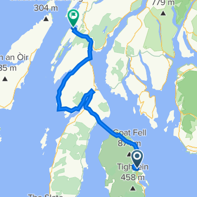
Train from Glasgow Central railway station to Ardrossan. Ferry to Brodick, Isle of Arran.
Destination is Lochranza in the north of the island. Cycle there directly or spendthe day cycling round the island (or half the island). Lochranza has accommodation and places to eat. Take the ferry to Cloanaig. Take the A83 main road to Lochgilphead (town with shops, places to eat, accommodation). Take the A816 to Oban (town with accommodation, shops and places to eat). Take the ferry to Caignure on the Isle of Mull. Destination is Tobemoray - you can cycle around the island to get there.- -:--
- Czas
- 267,5 km
- Dystans
- 1123 m
- Przewyższenia
- 1069 m
- Spadek
- ---
- Śr. Prędkość
- ---
- Maks. wysokość
Kontynuuj z Bikemap
Użyj, edytuj lub pobierz tę trasę rowerową
Chcesz przejechać trasę Scotland 1 - Arran to Tobermoray, Isle of Mull lub dostosować ją do swojej wycieczki? Oto, co możesz zrobić z tą trasą na Bikemap:
Darmowe funkcje
- Zapisz tę trasę jako ulubioną lub w kolekcji
- Skopiuj i zaplanuj swoją wersję tej trasy
- Podziel trasę na etapy, aby utworzyć kilkudniową wycieczkę
- Synchronizuj swoją trasę z Garminem lub Wahoo
Funkcje Premium
3 dni bezpłatnej wersji próbnej lub jednorazowa opłata. Dowiedz się więcej o Bikemap Premium.
- Nawiguj po tej trasie na iOS i Androidzie
- Eksportuj plik GPX / KML tej trasy
- Stwórz swój własny wydruk (wypróbuj za darmo)
- Pobierz tę trasę do nawigacji offline
Odkryj więcej funkcji Premium.
Uzyskaj Bikemap PremiumOd naszej społeczności
Isle of Arran: Inne popularne trasy rozpoczynające się tutaj
 LEJO'G 18 Brodick, Isle of Arran to Crinan
- Dystans
- 112,3 km
- Przewyższenia
- 1296 m
- Spadek
- 1299 m
- Lokalizacja
- Isle of Arran, Szkocja, Zjednoczone Królestwo Wielkiej Brytanii
 The String nach The String
- Dystans
- 65,3 km
- Przewyższenia
- 854 m
- Spadek
- 854 m
- Lokalizacja
- Isle of Arran, Szkocja, Zjednoczone Królestwo Wielkiej Brytanii
 South Arran
- Dystans
- 55,2 km
- Przewyższenia
- 644 m
- Spadek
- 644 m
- Lokalizacja
- Isle of Arran, Szkocja, Zjednoczone Królestwo Wielkiej Brytanii
 Brodick to Oban
- Dystans
- 127,6 km
- Przewyższenia
- 1489 m
- Spadek
- 1443 m
- Lokalizacja
- Isle of Arran, Szkocja, Zjednoczone Królestwo Wielkiej Brytanii
 Tour of the Shire - Arran 2014 (Concept)
- Dystans
- 90,4 km
- Przewyższenia
- 714 m
- Spadek
- 714 m
- Lokalizacja
- Isle of Arran, Szkocja, Zjednoczone Królestwo Wielkiej Brytanii
 Blackwaterfoot - Brodick Ferry Terminal
- Dystans
- 18,6 km
- Przewyższenia
- 274 m
- Spadek
- 274 m
- Lokalizacja
- Isle of Arran, Szkocja, Zjednoczone Królestwo Wielkiej Brytanii
 Scotland 1 - Arran to Tobermoray, Isle of Mull
- Dystans
- 267,5 km
- Przewyższenia
- 1123 m
- Spadek
- 1069 m
- Lokalizacja
- Isle of Arran, Szkocja, Zjednoczone Królestwo Wielkiej Brytanii
 12. Etappe: Brodick - Lochranza - Brodick
- Dystans
- 47,3 km
- Przewyższenia
- 519 m
- Spadek
- 526 m
- Lokalizacja
- Isle of Arran, Szkocja, Zjednoczone Królestwo Wielkiej Brytanii
Otwórz ją w aplikacji