

Roswell NM to Silver City NM
Trasa rowerowa rozpoczynająca się w Roswell, Nowy Meksyk, USA.
Przegląd
O tej trasie
Trasa rowerowa na drogach i poza nimi z Roswell do Silver City w bardziej północnej trasie. Podążając za rzeką Rio Grande tak blisko, jak to możliwe do zbiornika Elephant Butte.
Ta trasa jest wciąż w fazie planowania, a ja szukam opinii na temat warunków szlaków. Szczególnie dotyczących odcinka poza asfaltem od San Antonio NM do jeziora Elephant Butte. Wygląda na to, że delta na północ od jeziora Elephant Butte może być trudna do nawigacji z ładunkiem, który noszę. Używając otaczających szczytów górskich jako wskazówek wizualnych, powinienem być w stanie odbić się na zachód od Rio Grande. Celuj w szczyt Penasco, gdy łańcuch górski Fra Cristobel staje się większy. Podążaj ścieżkami, które wiją się na południe przez różne arroyos, zanim staną się kanionami.- -:--
- Czas
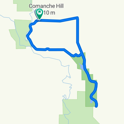
- 546 km
- Dystans
- 3049 m
- Przewyższenia
- 2334 m
- Spadek
- ---
- Śr. Prędkość
- ---
- Maks. wysokość
Najważniejsze punkty trasy
Punkty zainteresowania na trasie
Interesujące miejsce po 318 km
Bridge to the East Side of Elmendorf Ditch
Kontynuuj z Bikemap
Użyj, edytuj lub pobierz tę trasę rowerową
Chcesz przejechać trasę Roswell NM to Silver City NM lub dostosować ją do swojej wycieczki? Oto, co możesz zrobić z tą trasą na Bikemap:
Darmowe funkcje
- Zapisz tę trasę jako ulubioną lub w kolekcji
- Skopiuj i zaplanuj swoją wersję tej trasy
- Podziel trasę na etapy, aby utworzyć kilkudniową wycieczkę
- Synchronizuj swoją trasę z Garminem lub Wahoo
Funkcje Premium
3 dni bezpłatnej wersji próbnej lub jednorazowa opłata. Dowiedz się więcej o Bikemap Premium.
- Nawiguj po tej trasie na iOS i Androidzie
- Eksportuj plik GPX / KML tej trasy
- Stwórz swój własny wydruk (wypróbuj za darmo)
- Pobierz tę trasę do nawigacji offline
Odkryj więcej funkcji Premium.
Uzyskaj Bikemap PremiumOd naszej społeczności
Roswell: Inne popularne trasy rozpoczynające się tutaj
 The bottomless route
- Dystans
- 64 km
- Przewyższenia
- 420 m
- Spadek
- 422 m
- Lokalizacja
- Roswell, Nowy Meksyk, USA
 Roswell circuit
- Dystans
- 44 km
- Przewyższenia
- 82 m
- Spadek
- 80 m
- Lokalizacja
- Roswell, Nowy Meksyk, USA
 Route to 705 East Linda Vista Boulevard, Roswell, NM 88201
- Dystans
- 22,8 km
- Przewyższenia
- 60 m
- Spadek
- 59 m
- Lokalizacja
- Roswell, Nowy Meksyk, USA
 Roswell NM to Silver City NM Onroad
- Dystans
- 538 km
- Przewyższenia
- 2938 m
- Spadek
- 2211 m
- Lokalizacja
- Roswell, Nowy Meksyk, USA
 Highs and lows
- Dystans
- 19,1 km
- Przewyższenia
- 41 m
- Spadek
- 43 m
- Lokalizacja
- Roswell, Nowy Meksyk, USA
 Bottomless loop 2
- Dystans
- 30,9 km
- Przewyższenia
- 192 m
- Spadek
- 188 m
- Lokalizacja
- Roswell, Nowy Meksyk, USA
 Roswell western circuit
- Dystans
- 27,5 km
- Przewyższenia
- 39 m
- Spadek
- 40 m
- Lokalizacja
- Roswell, Nowy Meksyk, USA
 Roswell NM to Silver City NM
- Dystans
- 546 km
- Przewyższenia
- 3049 m
- Spadek
- 2334 m
- Lokalizacja
- Roswell, Nowy Meksyk, USA
Otwórz ją w aplikacji