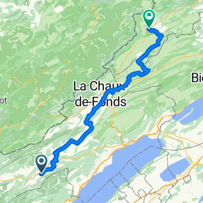
Gorge de L'Areuse - Beau Rivage (Neuchatel)
Trasa rowerowa rozpoczynająca się w Couvet, Neuchâtel, Szwajcaria.
Przegląd
O tej trasie
Stary klasyk niedzielnego popołudnia. Wąwóz wygląda inaczej w każdej porze roku. Uważaj w wąwozie na rowery z cienkimi oponami, szczególnie gdy jest mokro. Interesująca alternatywa: przejechać przez rezerwat ntue w Boudry zamiast Cortailod. Płasko i zjazdowo. Krótkie wzniesienie z Noiraigue, aby wejść do wąwozu. Warto przedłużyć trasę dalej w wąwozie do Fleurier lub jeszcze dalej do Sainte Croix i dodać Vallon de Noirvaux.
- -:--
- Czas
- 33 km
- Dystans
- 112 m
- Przewyższenia
- 420 m
- Spadek
- ---
- Śr. Prędkość
- ---
- Maks. wysokość
Jakość trasy
Typy dróg i nawierzchnie na trasie
Typy dróg
Spokojna droga
22,1 km
(67 %)
Droga leśna
3,3 km
(10 %)
Powierzchnie
Utwardzona
14,5 km
(44 %)
Nieutwardzona
1 km
(3 %)
Asfalt
11,2 km
(34 %)
Nawierzchnia (nieokreślona)
3,3 km
(10 %)
Kontynuuj z Bikemap
Użyj, edytuj lub pobierz tę trasę rowerową
Chcesz przejechać trasę Gorge de L'Areuse - Beau Rivage (Neuchatel) lub dostosować ją do swojej wycieczki? Oto, co możesz zrobić z tą trasą na Bikemap:
Darmowe funkcje
- Zapisz tę trasę jako ulubioną lub w kolekcji
- Skopiuj i zaplanuj swoją wersję tej trasy
- Synchronizuj swoją trasę z Garminem lub Wahoo
Funkcje Premium
3 dni bezpłatnej wersji próbnej lub jednorazowa opłata. Dowiedz się więcej o Bikemap Premium.
- Nawiguj po tej trasie na iOS i Androidzie
- Eksportuj plik GPX / KML tej trasy
- Stwórz swój własny wydruk (wypróbuj za darmo)
- Pobierz tę trasę do nawigacji offline
Odkryj więcej funkcji Premium.
Uzyskaj Bikemap PremiumOd naszej społeczności
Couvet: Inne popularne trasy rozpoczynające się tutaj
 Jura Tour: Couvet -> Saignlegier
- Dystans
- 70,4 km
- Przewyższenia
- 885 m
- Spadek
- 639 m
- Lokalizacja
- Couvet, Neuchâtel, Szwajcaria
 Nouvelle Censière circuit / Vallon de Noirvaux
- Dystans
- 44,2 km
- Przewyższenia
- 683 m
- Spadek
- 683 m
- Lokalizacja
- Couvet, Neuchâtel, Szwajcaria
 Couvet - Neuchâtel
- Dystans
- 30,9 km
- Przewyższenia
- 117 m
- Spadek
- 420 m
- Lokalizacja
- Couvet, Neuchâtel, Szwajcaria
 Couvet - Neuchatel (over the top)
- Dystans
- 44,8 km
- Przewyższenia
- 628 m
- Spadek
- 936 m
- Lokalizacja
- Couvet, Neuchâtel, Szwajcaria
 Etappe 3 La Brevine - St. Ursanne, via Moreau-Val du Dessoubre -Hippolythe- St. Ursanne
- Dystans
- 108,3 km
- Przewyższenia
- 519 m
- Spadek
- 1102 m
- Lokalizacja
- Couvet, Neuchâtel, Szwajcaria
 Val de Travers / Vallon de Noirvaux
- Dystans
- 38,4 km
- Przewyższenia
- 431 m
- Spadek
- 429 m
- Lokalizacja
- Couvet, Neuchâtel, Szwajcaria
 Gorge de L'Areuse - Beau Rivage (Neuchatel)
- Dystans
- 33 km
- Przewyższenia
- 112 m
- Spadek
- 420 m
- Lokalizacja
- Couvet, Neuchâtel, Szwajcaria
 Les Taillères, Montlebon, Nid du Fol, Rundfahrt
- Dystans
- 39,7 km
- Przewyższenia
- 681 m
- Spadek
- 679 m
- Lokalizacja
- Couvet, Neuchâtel, Szwajcaria
Otwórz ją w aplikacji


