

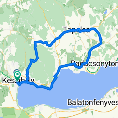
Lake Balaton Minor tour from Keszthely
Trasa rowerowa rozpoczynająca się w Keszthely, Komitat Zala, Węgry.
Przegląd
O tej trasie
Those attractions that can be visited freely without expert guidance are accessible on two wheels from Keszthely.
- -:--
- Czas
- 66,5 km
- Dystans
- 166 m
- Przewyższenia
- 165 m
- Spadek
- ---
- Śr. Prędkość
- ---
- Maks. wysokość
Jakość trasy
Typy dróg i nawierzchnie na trasie
Typy dróg
Droga rowerowa
23,4 km
(35 %)
Droga leśna
20,3 km
(31 %)
Powierzchnie
Utwardzona
38,9 km
(59 %)
Nieutwardzona
23,6 km
(35 %)
Asfalt
38,1 km
(57 %)
Żwir
23,3 km
(35 %)
Najważniejsze punkty trasy
Punkty zainteresowania na trasie
Interesujące miejsce po 2,6 km
Covered resting-places
Interesujące miejsce po 3,2 km
Covered resting-places
Interesujące miejsce po 4,9 km
Covered resting-places
Interesujące miejsce po 6 km
Covered resting-places
Interesujące miejsce po 7,3 km
Covered resting-places
Interesujące miejsce po 10,1 km
Covered resting-places
Interesujące miejsce po 19,5 km
Covered resting-places
Interesujące miejsce po 20,8 km
Covered resting-places
Interesujące miejsce po 27,1 km
Covered resting-places
Interesujące miejsce po 36,8 km
Covered resting-places
Interesujące miejsce po 42,6 km
Covered resting-places
Interesujące miejsce po 46,9 km
Covered resting-places
Interesujące miejsce po 58,1 km
Covered resting-places
Interesujące miejsce po 59,9 km
Covered resting-places
Interesujące miejsce po 61,1 km
Covered resting-places
Interesujące miejsce po 62,8 km
Covered resting-places
Interesujące miejsce po 63,6 km
Covered resting-places
Kontynuuj z Bikemap
Użyj, edytuj lub pobierz tę trasę rowerową
Chcesz przejechać trasę Lake Balaton Minor tour from Keszthely lub dostosować ją do swojej wycieczki? Oto, co możesz zrobić z tą trasą na Bikemap:
Darmowe funkcje
- Zapisz tę trasę jako ulubioną lub w kolekcji
- Skopiuj i zaplanuj swoją wersję tej trasy
- Synchronizuj swoją trasę z Garminem lub Wahoo
Funkcje Premium
3 dni bezpłatnej wersji próbnej lub jednorazowa opłata. Dowiedz się więcej o Bikemap Premium.
- Nawiguj po tej trasie na iOS i Androidzie
- Eksportuj plik GPX / KML tej trasy
- Stwórz swój własny wydruk (wypróbuj za darmo)
- Pobierz tę trasę do nawigacji offline
Odkryj więcej funkcji Premium.
Uzyskaj Bikemap PremiumOd naszej społeczności
Keszthely: Inne popularne trasy rozpoczynające się tutaj
 Lake Balaton
- Dystans
- 71 km
- Przewyższenia
- 358 m
- Spadek
- 341 m
- Lokalizacja
- Keszthely, Komitat Zala, Węgry
 Belga csoport ötödik nap
- Dystans
- 54,7 km
- Przewyższenia
- 145 m
- Spadek
- 146 m
- Lokalizacja
- Keszthely, Komitat Zala, Węgry
 KIS-BALATON kör
- Dystans
- 77,9 km
- Przewyższenia
- 370 m
- Spadek
- 368 m
- Lokalizacja
- Keszthely, Komitat Zala, Węgry
 keszthely
- Dystans
- 38,3 km
- Przewyższenia
- 122 m
- Spadek
- 134 m
- Lokalizacja
- Keszthely, Komitat Zala, Węgry
 Keszthely-Szigliget-Tapolca-Keszthely
- Dystans
- 72,2 km
- Przewyższenia
- 437 m
- Spadek
- 443 m
- Lokalizacja
- Keszthely, Komitat Zala, Węgry
 A piros+ panorámája
- Dystans
- 26,9 km
- Przewyższenia
- 385 m
- Spadek
- 392 m
- Lokalizacja
- Keszthely, Komitat Zala, Węgry
 Bakonyerdö túra
- Dystans
- 31,1 km
- Przewyższenia
- 292 m
- Spadek
- 290 m
- Lokalizacja
- Keszthely, Komitat Zala, Węgry
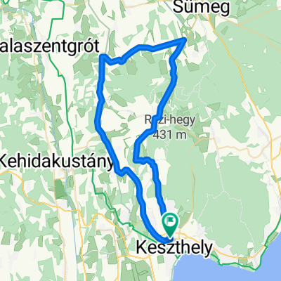 KH - Rezi - Sümegprága - Kisgörbö - Karmacs - KH
- Dystans
- 54,6 km
- Przewyższenia
- 365 m
- Spadek
- 365 m
- Lokalizacja
- Keszthely, Komitat Zala, Węgry
Otwórz ją w aplikacji