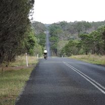
Armidale to Blue Hole
Trasa rowerowa rozpoczynająca się w Armidale, Nowa Południowa Walia, Australia.
Przegląd
O tej trasie
An easy ride on mostly flat tar roads, with a short hilly section at the end where the road drops down to the Gara River. Total distance 36 kms round trip.
Ride out of town on the Waterfall Way. Turn off onto Castledoyle Road. Head out to the junction with Blue Hole Road. The tar ends here with just a few short kilometres of dirt road to Blue Hole.
Great swimming spot in summer, spectacular raging river after heavy rain.
- -:--
- Czas
- 18,1 km
- Dystans
- 165 m
- Przewyższenia
- 183 m
- Spadek
- ---
- Śr. Prędkość
- 1043 m
- Maks. wysokość
Jakość trasy
Typy dróg i nawierzchnie na trasie
Typy dróg
Spokojna droga
16,7 km
(92 %)
Droga leśna
0,6 km
(4 %)
Powierzchnie
Utwardzona
16,4 km
(90 %)
Nieutwardzona
1,7 km
(10 %)
Asfalt
15,9 km
(88 %)
Nieutwardzony (nieokreślony)
1,1 km
(6 %)
Kontynuuj z Bikemap
Użyj, edytuj lub pobierz tę trasę rowerową
Chcesz przejechać trasę Armidale to Blue Hole lub dostosować ją do swojej wycieczki? Oto, co możesz zrobić z tą trasą na Bikemap:
Darmowe funkcje
- Zapisz tę trasę jako ulubioną lub w kolekcji
- Skopiuj i zaplanuj swoją wersję tej trasy
- Synchronizuj swoją trasę z Garminem lub Wahoo
Funkcje Premium
3 dni bezpłatnej wersji próbnej lub jednorazowa opłata. Dowiedz się więcej o Bikemap Premium.
- Nawiguj po tej trasie na iOS i Androidzie
- Eksportuj plik GPX / KML tej trasy
- Stwórz swój własny wydruk (wypróbuj za darmo)
- Pobierz tę trasę do nawigacji offline
Odkryj więcej funkcji Premium.
Uzyskaj Bikemap PremiumOd naszej społeczności
Armidale: Inne popularne trasy rozpoczynające się tutaj
 Avoiding the Waterfall Way from Armidale
- Dystans
- 92,5 km
- Przewyższenia
- 708 m
- Spadek
- 708 m
- Lokalizacja
- Armidale, Nowa Południowa Walia, Australia
 Armidale to Point Lookout loop
- Dystans
- 226,3 km
- Przewyższenia
- 4225 m
- Spadek
- 4225 m
- Lokalizacja
- Armidale, Nowa Południowa Walia, Australia
 Armidale, Toms Gully, Puddledock loop
- Dystans
- 71,6 km
- Przewyższenia
- 607 m
- Spadek
- 607 m
- Lokalizacja
- Armidale, Nowa Południowa Walia, Australia
 Kelly's plains circuit
- Dystans
- 19,5 km
- Przewyższenia
- 179 m
- Spadek
- 179 m
- Lokalizacja
- Armidale, Nowa Południowa Walia, Australia
 Apple tree drive loop for kids
- Dystans
- 7,8 km
- Przewyższenia
- 92 m
- Spadek
- 93 m
- Lokalizacja
- Armidale, Nowa Południowa Walia, Australia
 Flat White
- Dystans
- 19,5 km
- Przewyższenia
- 203 m
- Spadek
- 201 m
- Lokalizacja
- Armidale, Nowa Południowa Walia, Australia
 Armidale Tourist Information Centre to Dangars Gorge return
- Dystans
- 47 km
- Przewyższenia
- 355 m
- Spadek
- 353 m
- Lokalizacja
- Armidale, Nowa Południowa Walia, Australia
 Armidale, Rockvale Rd Chandler Rd loop
- Dystans
- 86,1 km
- Przewyższenia
- 772 m
- Spadek
- 773 m
- Lokalizacja
- Armidale, Nowa Południowa Walia, Australia
Otwórz ją w aplikacji

