

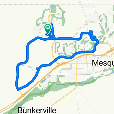
Sun City Bike Club Hard Ride 1 Out and Back Through Bunkerville to the I-15 Interchange
Trasa rowerowa rozpoczynająca się w Mesquite, Nevada, USA.
Przegląd
O tej trasie
This rides starts at the corner of Flat Top Mesa Drive and Falcon Ridge Parkway; continues on a downhill run South through the two roundabouts; then turns right off the second roundabout, crossing Leavett Lane to Hafen Lane; the ride continues by turning left (East) on Hafen Lane and riding to the intersection of NV 170 (Riverside Drive); riders now turn right onto Riverside Drive and continue on a lengthy ride of rollers through Bunkerville all the way to the I-15 interchange - there is a lengthy grade that begins passed the bridge that crosses the Virgin River all the way to the I-15 interchange; here the riders turn around and trace the same route along Riverside Drive back into Mesquite; at the corner of Riverside Drive and West Mesquite Boulevard, riders turn left (West) onto West Mesquite Boulevard and ride through the two roundabouts, bearing right on both of them onto Falcon Ridge Parkway; the ride ends with the climb along Falcon Ridge Parkway back to the starting point at the corner of Flat Top Mesa Drive and Falcon Ridge Parkway. Total Ride Distance: 30.13 Miles.
Notes: 1. If you open the route in Google Roadmap or Google Hybrid (pulled down from the "Relief Map" tab) you will get a more up-to-date view of the roads and paths. Some of the other maps are dated. 2. This mapping program tends to under-compute the total ride mileage by roughly 10%, based on mileage for this ride when it has been actually ridden. - -:--
- Czas
- 48,5 km
- Dystans
- 288 m
- Przewyższenia
- 287 m
- Spadek
- ---
- Śr. Prędkość
- ---
- Maks. wysokość
Jakość trasy
Typy dróg i nawierzchnie na trasie
Typy dróg
Droga rowerowa
6,8 km
(14 %)
Droga
2,4 km
(5 %)
Powierzchnie
Utwardzona
43,7 km
(90 %)
Asfalt
37,8 km
(78 %)
Beton
5,8 km
(12 %)
Niezdefiniowany
4,9 km
(10 %)
Kontynuuj z Bikemap
Użyj, edytuj lub pobierz tę trasę rowerową
Chcesz przejechać trasę Sun City Bike Club Hard Ride 1 Out and Back Through Bunkerville to the I-15 Interchange lub dostosować ją do swojej wycieczki? Oto, co możesz zrobić z tą trasą na Bikemap:
Darmowe funkcje
- Zapisz tę trasę jako ulubioną lub w kolekcji
- Skopiuj i zaplanuj swoją wersję tej trasy
- Synchronizuj swoją trasę z Garminem lub Wahoo
Funkcje Premium
3 dni bezpłatnej wersji próbnej lub jednorazowa opłata. Dowiedz się więcej o Bikemap Premium.
- Nawiguj po tej trasie na iOS i Androidzie
- Eksportuj plik GPX / KML tej trasy
- Stwórz swój własny wydruk (wypróbuj za darmo)
- Pobierz tę trasę do nawigacji offline
Odkryj więcej funkcji Premium.
Uzyskaj Bikemap PremiumOd naszej społeczności
Mesquite: Inne popularne trasy rozpoczynające się tutaj
 870 Deep Gorge Trail, Mesquite to 1350 Flat Top Mesa Dr, Mesquite
- Dystans
- 27,3 km
- Przewyższenia
- 281 m
- Spadek
- 243 m
- Lokalizacja
- Mesquite, Nevada, USA
 Mesquite, NV - Mount Charleston, NV
- Dystans
- 182,8 km
- Przewyższenia
- 2261 m
- Spadek
- 464 m
- Lokalizacja
- Mesquite, Nevada, USA
 Settlers Way, Mesquite to 870 Deep Gorge Trail, Mesquite
- Dystans
- 16,5 km
- Przewyższenia
- 222 m
- Spadek
- 226 m
- Lokalizacja
- Mesquite, Nevada, USA
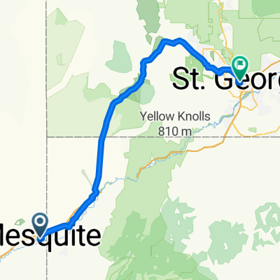 Route to St. George
- Dystans
- 79,3 km
- Przewyższenia
- 1232 m
- Spadek
- 893 m
- Lokalizacja
- Mesquite, Nevada, USA
 Settlers Way, Mesquite to 870 Deep Gorge Trail, Mesquite
- Dystans
- 23,8 km
- Przewyższenia
- 331 m
- Spadek
- 324 m
- Lokalizacja
- Mesquite, Nevada, USA
 Settlers Way, Mesquite to 1350 Flat Top Mesa Dr, Mesquite
- Dystans
- 15,1 km
- Przewyższenia
- 232 m
- Spadek
- 194 m
- Lokalizacja
- Mesquite, Nevada, USA
 1350 Flat Top Mesa Dr, Mesquite to 1173 Clouds Rest Pt, Mesquite
- Dystans
- 0,9 km
- Przewyższenia
- 21 m
- Spadek
- 32 m
- Lokalizacja
- Mesquite, Nevada, USA
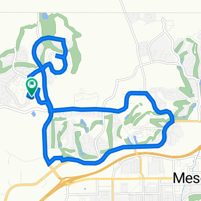
 Sun City Bike Club Easy Ride 2 Out and Back Around Mesquite (With Some Climbs)
- Dystans
- 20,1 km
- Przewyższenia
- 81 m
- Spadek
- 82 m
- Lokalizacja
- Mesquite, Nevada, USA
Otwórz ją w aplikacji