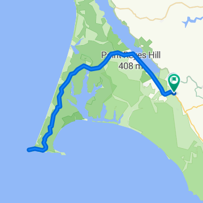
Leon Marshall Wall and Wilson Hill
Trasa rowerowa rozpoczynająca się w Inverness, California, United States of America.
Przegląd
O tej trasie
This is Leon Sun's ride
<span style="color: #000000; font-family: arial; font-size: 11px; line-height: 13px;">Will lead a ride on the 20th in <span id="lw_1252646841_0" class="yshortcuts" style="line-height: 1.2em; outline-style: none; outline-width: initial; outline-color: initial; cursor: pointer; background-image: initial; background-repeat: initial; background-attachment: initial; -webkit-background-clip: initial; -webkit-background-origin: initial; background-color: transparent; border-bottom-style: none; border-bottom-width: initial; border-bottom-color: initial; background-position: initial initial;">West Marin</span>. Toward the end of the ride, I want to stop at the G.R.O. Art Gallery in Pt Reyes Station where my friend Lucien Kubo has a solo show. Here are the details of the ride, if you don't mind posting it:<br style="line-height: 1.2em; outline-style: none; outline-width: initial; outline-color: initial;" /><br style="line-height: 1.2em; outline-style: none; outline-width: initial; outline-color: initial;" />Start: 9:00 a.m., <span id="lw_1252646841_1" class="yshortcuts" style="line-height: 1.2em; outline-style: none; outline-width: initial; outline-color: initial; border-bottom-style: dashed; border-bottom-width: 1px; border-bottom-color: #0066cc; cursor: pointer; background-image: initial; background-repeat: initial; background-attachment: initial; -webkit-background-clip: initial; -webkit-background-origin: initial; background-color: transparent; background-position: initial initial;">Bear Valley Visitor Center</span>, <span id="lw_1252646841_2" class="yshortcuts" style="line-height: 1.2em; outline-style: none; outline-width: initial; outline-color: initial; cursor: pointer; background-image: initial; background-repeat: initial; background-attachment: initial; -webkit-background-clip: initial; -webkit-background-origin: initial; background-color: transparent; border-bottom-style: none; border-bottom-width: initial; border-bottom-color: initial; background-position: initial initial;">Bear Valley Rd</span>, <span id="lw_1252646841_3" class="yshortcuts" style="line-height: 1.2em; outline-style: none; outline-width: initial; outline-color: initial; cursor: pointer; background-image: initial; background-repeat: initial; background-attachment: initial; -webkit-background-clip: initial; -webkit-background-origin: initial; background-color: transparent; border-bottom-style: none; border-bottom-width: initial; border-bottom-color: initial; background-position: initial initial;">Olema</span>. <br style="line-height: 1.2em; outline-style: none; outline-width: initial; outline-color: initial;" /><br style="line-height: 1.2em; outline-style: none; outline-width: initial; outline-color: initial;" />Route: Exiting Visitor Center, R onto Bear Valley Rd, L (North) onto Hwy 1, R onto Marshal-Petaluma Rd (Marshall Wall, about 1100' elev gain), L onto <span id="lw_1252646841_4" class="yshortcuts" style="line-height: 1.2em; outline-style: none; outline-width: initial; outline-color: initial;">Wilson Hill Rd</span>, L onto Chileno Valley Rd, L onto Tomales-Petaluma Rd, R onto Hwy 1 to <span id="lw_1252646841_5" class="yshortcuts" style="line-height: 1.2em; outline-style: none; outline-width: initial; outline-color: initial; cursor: pointer; background-image: initial; background-repeat: initial; background-attachment: initial; -webkit-background-clip: initial; -webkit-background-origin: initial; background-color: transparent; border-bottom-style: none; border-bottom-width: initial; border-bottom-color: initial; background-position: initial initial;">Tomales</span>, stop for lunch or snack, Return South on Hwy1 all the way to Bear Valley Rd, turn R, L into Visitor Center.<br style="line-height: 1.2em; outline-style: none; outline-width: initial; outline-color: initial;" /><br style="line-height: 1.2em; outline-style: none; outline-width: initial; outline-color: initial;" />Marshall Wall and Wilson Hill are the two major climbs, about 1500' el.gain combined. The rest are rollers. About 60 miles, total distance. Overlaps parts of Pilgrimage route. Stopping at gallery, of course, is optional.<br style="line-height: 1.2em; outline-style: none; outline-width: initial; outline-color: initial;" /></span>
- -:--
- Czas
- 98,3 km
- Dystans
- 1271 m
- Przewyższenia
- 1276 m
- Spadek
- ---
- Śr. Prędkość
- 220 m
- Maks. wysokość
Jakość trasy
Typy dróg i nawierzchnie na trasie
Typy dróg
Ruchliwa droga
77 km
(78 %)
Droga
21,2 km
(22 %)
Powierzchnie
Utwardzona
43,9 km
(45 %)
Asfalt
43,7 km
(44 %)
Nawierzchnia (nieokreślona)
0,2 km
(<1 %)
Najważniejsze punkty trasy
Punkty zainteresowania na trasie
Interesujące miejsce po 20,3 km
R Marshall-Petaluma Rod (Marshall Wall about 1100' elev gain)
Interesujące miejsce po 42,4 km
L Chileno Valley Rd
Interesujące miejsce po 53,4 km
R Chileno Valley Rd
Interesujące miejsce po 58,1 km
L Tomales Petaluma Rd.
Interesujące miejsce po 67,1 km
Interesujące miejsce po 67,8 km
LUNCH IN TOMALES
Interesujące miejsce po 68,4 km
L Shoreline HWY1
Kontynuuj z Bikemap
Użyj, edytuj lub pobierz tę trasę rowerową
Chcesz przejechać trasę Leon Marshall Wall and Wilson Hill lub dostosować ją do swojej wycieczki? Oto, co możesz zrobić z tą trasą na Bikemap:
Darmowe funkcje
- Zapisz tę trasę jako ulubioną lub w kolekcji
- Skopiuj i zaplanuj swoją wersję tej trasy
- Podziel trasę na etapy, aby utworzyć kilkudniową wycieczkę
- Synchronizuj swoją trasę z Garminem lub Wahoo
Funkcje Premium
3 dni bezpłatnej wersji próbnej lub jednorazowa opłata. Dowiedz się więcej o Bikemap Premium.
- Nawiguj po tej trasie na iOS i Androidzie
- Eksportuj plik GPX / KML tej trasy
- Stwórz swój własny wydruk (wypróbuj za darmo)
- Pobierz tę trasę do nawigacji offline
Odkryj więcej funkcji Premium.
Uzyskaj Bikemap PremiumOd naszej społeczności
Inverness: Inne popularne trasy rozpoczynające się tutaj
- Point Reyes Ride
- Dystans
- 26,8 km
- Przewyższenia
- 305 m
- Spadek
- 333 m
- Lokalizacja
- Inverness, California, United States of America
- Point Reyes N 1
- Dystans
- 23,3 km
- Przewyższenia
- 508 m
- Spadek
- 508 m
- Lokalizacja
- Inverness, California, United States of America
- Leon Marshall Wall and Wilson Hill
- Dystans
- 98,3 km
- Przewyższenia
- 1271 m
- Spadek
- 1276 m
- Lokalizacja
- Inverness, California, United States of America
- Pierce Point
- Dystans
- 26,5 km
- Przewyższenia
- 391 m
- Spadek
- 350 m
- Lokalizacja
- Inverness, California, United States of America
- Point reyes station to point out and back
- Dystans
- 63,7 km
- Przewyższenia
- 714 m
- Spadek
- 714 m
- Lokalizacja
- Inverness, California, United States of America
- PointReyes-RussionRiver-Run
- Dystans
- 147,8 km
- Przewyższenia
- 618 m
- Spadek
- 618 m
- Lokalizacja
- Inverness, California, United States of America
- Point Reyes N 2
- Dystans
- 25,1 km
- Przewyższenia
- 555 m
- Spadek
- 562 m
- Lokalizacja
- Inverness, California, United States of America
- Point Reyes Out & Back
- Dystans
- 96,8 km
- Przewyższenia
- 729 m
- Spadek
- 624 m
- Lokalizacja
- Inverness, California, United States of America
Otwórz ją w aplikacji