

Eastern HSDRRS Levee Ride
Trasa rowerowa rozpoczynająca się w Arabi, Luizjana, USA.
Przegląd
O tej trasie
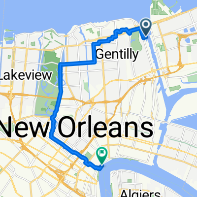
30-milowa przejażdżka wokół Bayou Sauvage na szczycie systemu wałów przeciwpowodziowych.
- -:--
- Czas
- 48,3 km
- Dystans
- 23 m
- Przewyższenia
- 20 m
- Spadek
- ---
- Śr. Prędkość
- ---
- Maks. wysokość
Najważniejsze punkty trasy
Punkty zainteresowania na trasie

Zdjęcie po 16,2 km
Pump Station No. 15 consists of a 653-foot long T-wall located at Pump Station No. 15. The T-wall was repaired after being damaged by Hurricane Katrina and raised to +22 feet NAVD 88. Three 72-inch discharge pipes from Pump Station No. 15 pass through the T-wall and outlet into a discharge basin on the T-wall’s flood (GIWW) side. The Collins petroleum pipeline also extends through the T-wall stem. The T-wall section has since been raised to +34 feet NAVD 88.
Kontynuuj z Bikemap
Użyj, edytuj lub pobierz tę trasę rowerową
Chcesz przejechać trasę Eastern HSDRRS Levee Ride lub dostosować ją do swojej wycieczki? Oto, co możesz zrobić z tą trasą na Bikemap:
Darmowe funkcje
- Zapisz tę trasę jako ulubioną lub w kolekcji
- Skopiuj i zaplanuj swoją wersję tej trasy
- Synchronizuj swoją trasę z Garminem lub Wahoo
Funkcje Premium
3 dni bezpłatnej wersji próbnej lub jednorazowa opłata. Dowiedz się więcej o Bikemap Premium.
- Nawiguj po tej trasie na iOS i Androidzie
- Eksportuj plik GPX / KML tej trasy
- Stwórz swój własny wydruk (wypróbuj za darmo)
- Pobierz tę trasę do nawigacji offline
Odkryj więcej funkcji Premium.
Uzyskaj Bikemap PremiumOd naszej społeczności
Arabi: Inne popularne trasy rozpoczynające się tutaj
 Eastern HSDRRS Levee Ride
- Dystans
- 48,3 km
- Przewyższenia
- 23 m
- Spadek
- 20 m
- Lokalizacja
- Arabi, Luizjana, USA
 Eastern HSDRRS
- Dystans
- 48,6 km
- Przewyższenia
- 31 m
- Spadek
- 30 m
- Lokalizacja
- Arabi, Luizjana, USA
 Chartres Street 4000, New Orleans to Port of New Orleans Place 1100
- Dystans
- 5,5 km
- Przewyższenia
- 31 m
- Spadek
- 24 m
- Lokalizacja
- Arabi, Luizjana, USA
 Pontchartrain Park, New Orleans to Decatur St, New Orleans
- Dystans
- 16,8 km
- Przewyższenia
- 40 m
- Spadek
- 39 m
- Lokalizacja
- Arabi, Luizjana, USA
 3601 Saint Claude Ave, New Orleans to 1125 Congress St, New Orleans
- Dystans
- 24,5 km
- Przewyższenia
- 37 m
- Spadek
- 41 m
- Lokalizacja
- Arabi, Luizjana, USA
 1425 Jourdan Ave, New Orleans to 1436 Reynes St, New Orleans
- Dystans
- 6,6 km
- Przewyższenia
- 12 m
- Spadek
- 8 m
- Lokalizacja
- Arabi, Luizjana, USA
 East Route to Dowmman
- Dystans
- 21,4 km
- Przewyższenia
- 43 m
- Spadek
- 44 m
- Lokalizacja
- Arabi, Luizjana, USA
 New Orleans Jazz National Park Service bike tour
- Dystans
- 14,5 km
- Przewyższenia
- 17 m
- Spadek
- 19 m
- Lokalizacja
- Arabi, Luizjana, USA
Otwórz ją w aplikacji