

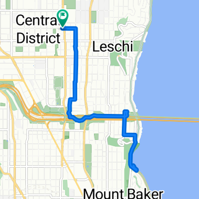
Circumnavigating Lake Union
Trasa rowerowa rozpoczynająca się w Seattle, Waszyngton, USA.
Przegląd
O tej trasie
Ta trasa omija jezioro Lake Union najmniejszym oporem. Kilka punktów na mapie nie pokrywa się dokładnie ze ścieżką, którą chciałem wybrać, ale jest bardzo blisko, zadziała i w tych kilku przypadkach znajdziesz bardziej bezpośrednie ścieżki. (Na przykład południowo-zachodni „róg” jeziora można objechać blisko brzegu.)
Na tej trasie jest bardzo niewielka zmiana wysokości. Most University to lekki podjazd, a po przejechaniu przez most Fremont mamy darmowy zjazd. „Szlak” naprawdę trzyma się jeziora i unika Eastlake, jeśli jest taka możliwość, aby wybrać łatwiejszy podjazd i dać rowerzyście kilka płaskich bloków do „odpoczynku” między podjazdami.
Ta przejażdżka zajmie mniej niż pół godziny, jeśli utrzymasz dobre tempo.
- -:--
- Czas
- 11 km
- Dystans
- 79 m
- Przewyższenia
- 77 m
- Spadek
- ---
- Śr. Prędkość
- 36 m
- Maks. wysokość
Jakość trasy
Typy dróg i nawierzchnie na trasie
Typy dróg
Spokojna droga
2,5 km
(23 %)
Droga
2,2 km
(20 %)
Powierzchnie
Utwardzona
8,8 km
(80 %)
Asfalt
5,2 km
(47 %)
Beton
3,6 km
(33 %)
Niezdefiniowany
2,2 km
(20 %)
Kontynuuj z Bikemap
Użyj, edytuj lub pobierz tę trasę rowerową
Chcesz przejechać trasę Circumnavigating Lake Union lub dostosować ją do swojej wycieczki? Oto, co możesz zrobić z tą trasą na Bikemap:
Darmowe funkcje
- Zapisz tę trasę jako ulubioną lub w kolekcji
- Skopiuj i zaplanuj swoją wersję tej trasy
- Synchronizuj swoją trasę z Garminem lub Wahoo
Funkcje Premium
3 dni bezpłatnej wersji próbnej lub jednorazowa opłata. Dowiedz się więcej o Bikemap Premium.
- Nawiguj po tej trasie na iOS i Androidzie
- Eksportuj plik GPX / KML tej trasy
- Stwórz swój własny wydruk (wypróbuj za darmo)
- Pobierz tę trasę do nawigacji offline
Odkryj więcej funkcji Premium.
Uzyskaj Bikemap PremiumOd naszej społeczności
Seattle: Inne popularne trasy rozpoczynające się tutaj
 East Mercer Street to 14th Ave S & S Washington St
- Dystans
- 15,3 km
- Przewyższenia
- 156 m
- Spadek
- 181 m
- Lokalizacja
- Seattle, Waszyngton, USA
 E Hamlin St, Seattle to W Mercer Way, Mercer Island
- Dystans
- 20,8 km
- Przewyższenia
- 298 m
- Spadek
- 256 m
- Lokalizacja
- Seattle, Waszyngton, USA
 Afternoon Commute
- Dystans
- 4,2 km
- Przewyższenia
- 79 m
- Spadek
- 112 m
- Lokalizacja
- Seattle, Waszyngton, USA
 2025-7-12 Seattle to Chehalis - STP Day 1
- Dystans
- 171,5 km
- Przewyższenia
- 1532 m
- Spadek
- 1564 m
- Lokalizacja
- Seattle, Waszyngton, USA
 5th Ave S, Seattle to 76th Ave SE, Mercer Island
- Dystans
- 8,3 km
- Przewyższenia
- 98 m
- Spadek
- 81 m
- Lokalizacja
- Seattle, Waszyngton, USA
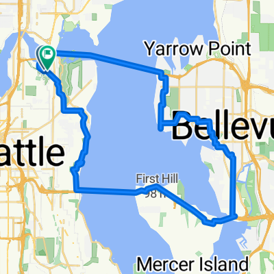
 To Bellevue and Back
- Dystans
- 15,8 km
- Przewyższenia
- 265 m
- Spadek
- 265 m
- Lokalizacja
- Seattle, Waszyngton, USA
 Route in Seattle
- Dystans
- 8,8 km
- Przewyższenia
- 147 m
- Spadek
- 147 m
- Lokalizacja
- Seattle, Waszyngton, USA
 Lake WA bridges loop
- Dystans
- 33,9 km
- Przewyższenia
- 554 m
- Spadek
- 554 m
- Lokalizacja
- Seattle, Waszyngton, USA
Otwórz ją w aplikacji