
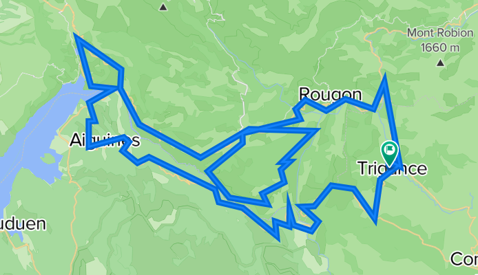
Gorges du Verdon and Route des Crêtes
Trasa rowerowa rozpoczynająca się w Castellane, Prowansja-Alpy-Lazurowe Wybrzeże, Francja.
Przegląd
O tej trasie
- -:--
- Czas
- 110,9 km
- Dystans
- 2188 m
- Przewyższenia
- 2188 m
- Spadek
- ---
- Śr. Prędkość
- ---
- Maks. wysokość

Najważniejsze punkty trasy
Punkty zainteresowania na trasie
Interesujące miejsce po 31,2 km
Col de Vaumale - 1201 metres
Interesujące miejsce po 34,2 km
Col d'Illoire - ç§è metres
Interesujące miejsce po 57 km
Col de l'Olivier 713m
Interesujące miejsce po 63,8 km
Col d'Ayen 1032m
Interesujące miejsce po 75,4 km
Pas de l'Abauc or Pas de la Bau - 1280 metres
Interesujące miejsce po 107 km
Collet d'Ampon 725m
Kontynuuj z Bikemap
Użyj, edytuj lub pobierz tę trasę rowerową
Chcesz przejechać trasę Gorges du Verdon and Route des Crêtes lub dostosować ją do swojej wycieczki? Oto, co możesz zrobić z tą trasą na Bikemap:
Darmowe funkcje
- Zapisz tę trasę jako ulubioną lub w kolekcji
- Skopiuj i zaplanuj swoją wersję tej trasy
- Podziel trasę na etapy, aby utworzyć kilkudniową wycieczkę
- Synchronizuj swoją trasę z Garminem lub Wahoo
Funkcje Premium
3 dni bezpłatnej wersji próbnej lub jednorazowa opłata. Dowiedz się więcej o Bikemap Premium.
- Nawiguj po tej trasie na iOS i Androidzie
- Eksportuj plik GPX / KML tej trasy
- Stwórz swój własny wydruk (wypróbuj za darmo)
- Pobierz tę trasę do nawigacji offline
Odkryj więcej funkcji Premium.
Uzyskaj Bikemap PremiumOd naszej społeczności
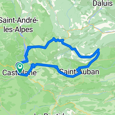
Castellane: Inne popularne trasy rozpoczynające się tutaj
 2016 Ride Day 78 - Castellane to Puget-Théniers
- Dystans
- 49,9 km
- Przewyższenia
- 441 m
- Spadek
- 749 m
- Lokalizacja
- Castellane, Prowansja-Alpy-Lazurowe Wybrzeże, Francja
 La Palud-sur-Verdon - Les Salles-sur-Verdon
- Dystans
- 19,7 km
- Przewyższenia
- 354 m
- Spadek
- 797 m
- Lokalizacja
- Castellane, Prowansja-Alpy-Lazurowe Wybrzeże, Francja
 Objezd kan.Verdon ze SEVERU_4.den
- Dystans
- 41,8 km
- Przewyższenia
- 1011 m
- Spadek
- 1277 m
- Lokalizacja
- Castellane, Prowansja-Alpy-Lazurowe Wybrzeże, Francja
 Allauch 9. Etappe
- Dystans
- 122,8 km
- Przewyższenia
- 1204 m
- Spadek
- 1660 m
- Lokalizacja
- Castellane, Prowansja-Alpy-Lazurowe Wybrzeże, Francja
 6. Tag Trigance - Bauduen
- Dystans
- 53,8 km
- Przewyższenia
- 957 m
- Spadek
- 1255 m
- Lokalizacja
- Castellane, Prowansja-Alpy-Lazurowe Wybrzeże, Francja
 42 km Le Bourget - Gorges du Verdon
- Dystans
- 42,1 km
- Przewyższenia
- 515 m
- Spadek
- 512 m
- Lokalizacja
- Castellane, Prowansja-Alpy-Lazurowe Wybrzeże, Francja
 RR Dingo Castel D1 81k
- Dystans
- 81,7 km
- Przewyższenia
- 2305 m
- Spadek
- 2299 m
- Lokalizacja
- Castellane, Prowansja-Alpy-Lazurowe Wybrzeże, Francja
 Verdonrunde groß
- Dystans
- 100,8 km
- Przewyższenia
- 1498 m
- Spadek
- 1498 m
- Lokalizacja
- Castellane, Prowansja-Alpy-Lazurowe Wybrzeże, Francja
Otwórz ją w aplikacji