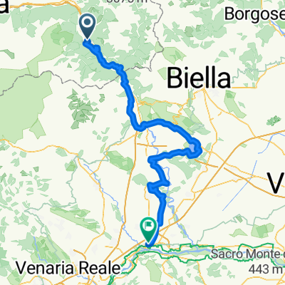
- 113,3 km
- 441 m
- 624 m
- Verrès, Regione Autonoma Valle d'Aosta, Włochy
Colle Vert Enduro (Verres Aosta)
Trasa rowerowa rozpoczynająca się w Verrès, Regione Autonoma Valle d'Aosta, Włochy.
Przegląd
O tej trasie
Odcinek po Champurney niepewny
Trasa: (Verrès –) Omens – Champore – Colle Vert – Fornelle – Barmelongue – Avieil – Champurney – Prouve Ville – Arnad – Verrès
Opis wycieczki:
Wycieczka zaczyna się w Omens, gdzie można dojechać samochodem. Następnie kierujesz się od razu pod górę na stromym podjeździe, początkowo kilka metrów po asfalcie, potem wiele ciasnych zakrętów po drodze szutrowej, 630 metrów przewyższenia w górę. Colle Vert osiąga się, gdy skręca się w prawo na szutrową drogę do Fornelle. Przy okazji podczas podjazdu zawsze można podziwiać ładny widok na Matterhorn. Zjazd zaczyna się potem łagodnie na szutrowej drodze do Fornelle. Zaraz po ostatnim zakręcie w prawo przed pierwszymi domami po lewej zaczyna się 2-Trail. Wąska ścieżka wije się przez stromy las, na przemian serpentyny z odcinkami i przejazdami dla skuterów, wszystko bardzo płynne, ale z konieczną koncentracją. Przechodzi się małą drogę, potem szlak jest trochę bardziej nierówny, aż do dolnej części osady Avieil. Tutaj skręcasz w lewo i jedziesz małą drogą w kierunku Champurney. Bezpośredni zjazd stąd do Arnadu jest trochę nudny. Bardziej ekscytująca jest 3-Trail, która odgałęzia się wkrótce w prawo i kręto oraz płynnie prowadzi w dół do domów Prouve Ville. Idzie równolegle do głównej drogi, a potem wraca do Verrès.
- -:--
- Czas
- 21,8 km
- Dystans
- 1024 m
- Przewyższenia
- 1025 m
- Spadek
- ---
- Śr. Prędkość
- ---
- Maks. wysokość
utworzono 9 lat temu temu
Kontynuuj z Bikemap
Użyj, edytuj lub pobierz tę trasę rowerową
Chcesz przejechać trasę Colle Vert Enduro (Verres Aosta) lub dostosować ją do swojej wycieczki? Oto, co możesz zrobić z tą trasą na Bikemap:
Darmowe funkcje
- Zapisz tę trasę jako ulubioną lub w kolekcji
- Skopiuj i zaplanuj swoją wersję tej trasy
- Synchronizuj swoją trasę z Garminem lub Wahoo
Funkcje Premium
3 dni bezpłatnej wersji próbnej lub jednorazowa opłata. Dowiedz się więcej o Bikemap Premium.
- Nawiguj po tej trasie na iOS i Androidzie
- Eksportuj plik GPX / KML tej trasy
- Stwórz swój własny wydruk (wypróbuj za darmo)
- Pobierz tę trasę do nawigacji offline
Odkryj więcej funkcji Premium.
Uzyskaj Bikemap PremiumOd naszej społeczności
Verrès: Inne popularne trasy rozpoczynające się tutaj
- Verres-Ivrea.Viverone-Chivasso
- 7b) Fénis + hotel
- 49 km
- 1242 m
- 1028 m
- Verrès, Regione Autonoma Valle d'Aosta, Włochy
- Tappa B03 - Da Verres a Roppolo
- 61,3 km
- 306 m
- 368 m
- Verrès, Regione Autonoma Valle d'Aosta, Włochy
- champoluc antagnod lignod verres
- 57,2 km
- 1371 m
- 1378 m
- Verrès, Regione Autonoma Valle d'Aosta, Włochy
- col Tze Core-col de Joux - ago.2010
- 52 km
- 1694 m
- 1694 m
- Verrès, Regione Autonoma Valle d'Aosta, Włochy
- Colle Vert Enduro (Verres Aosta)
- 21,8 km
- 1024 m
- 1025 m
- Verrès, Regione Autonoma Valle d'Aosta, Włochy
- Zuccore, san pantaleone e Joux
- 108,1 km
- 3543 m
- 3551 m
- Verrès, Regione Autonoma Valle d'Aosta, Włochy
- Vall d'Ayas e Vall di Gressoney
- 94,3 km
- 2267 m
- 2267 m
- Verrès, Regione Autonoma Valle d'Aosta, Włochy
Otwórz ją w aplikacji


