

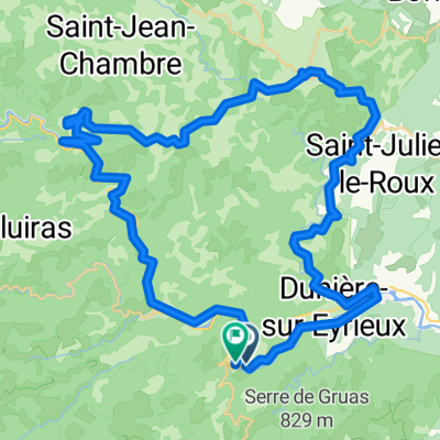
2016 Ride Day 107 - St-Sauveur-de-Montagut Circle to Le Cheylard
Trasa rowerowa rozpoczynająca się w Saint-Sauveur-de-Montagut, Owernia-Rodan-Alpy, Francja.
Przegląd
O tej trasie
Planując przejażdżkę na dłuższy dystans, jednak upał był zbyt silny i zrezygnowaliśmy z oryginalnego planu na stromym podjeździe D204 z Le Cheylard.
Ścieżka rowerowa na dawnej linii kolejowej była doskonała... pod warunkiem, że ma się stosunkowo szerokie opony. Nasze opony 700Cx35 sprawdziły się świetnie. Nie byłoby to dobre dla wąskich opon rowerów wyścigowych.
Piękne krajobrazy. Gorąco polecamy.
Zwróć uwagę, że profil i liczby dotyczące przewyższenia nie mają sensu. Zarówno szlak kolejowy pod górę, jak i droga D120 w dół były raczej stałe i łagodne. Przewyższenie nie powinno przekraczać 350 lub 400 metrów.
- -:--
- Czas
- 51,1 km
- Dystans
- 680 m
- Przewyższenia
- 680 m
- Spadek
- ---
- Śr. Prędkość
- ---
- Maks. wysokość

Zdjęcia trasy


Jakość trasy
Typy dróg i nawierzchnie na trasie
Typy dróg
Spokojna droga
8,7 km
(17 %)
Droga rowerowa
7,7 km
(15 %)
Powierzchnie
Utwardzona
15,8 km
(31 %)
Nieutwardzona
10,2 km
(20 %)
Asfalt
15,8 km
(31 %)
Żwir
7,1 km
(14 %)
Kontynuuj z Bikemap
Użyj, edytuj lub pobierz tę trasę rowerową
Chcesz przejechać trasę 2016 Ride Day 107 - St-Sauveur-de-Montagut Circle to Le Cheylard lub dostosować ją do swojej wycieczki? Oto, co możesz zrobić z tą trasą na Bikemap:
Darmowe funkcje
- Zapisz tę trasę jako ulubioną lub w kolekcji
- Skopiuj i zaplanuj swoją wersję tej trasy
- Synchronizuj swoją trasę z Garminem lub Wahoo
Funkcje Premium
3 dni bezpłatnej wersji próbnej lub jednorazowa opłata. Dowiedz się więcej o Bikemap Premium.
- Nawiguj po tej trasie na iOS i Androidzie
- Eksportuj plik GPX / KML tej trasy
- Stwórz swój własny wydruk (wypróbuj za darmo)
- Pobierz tę trasę do nawigacji offline
Odkryj więcej funkcji Premium.
Uzyskaj Bikemap PremiumOd naszej społeczności
Saint-Sauveur-de-Montagut: Inne popularne trasy rozpoczynające się tutaj
 2016 Ride Day 108 - St-Sauveur-de-Montagut to Largentière
- Dystans
- 69,2 km
- Przewyższenia
- 1053 m
- Spadek
- 1075 m
- Lokalizacja
- Saint-Sauveur-de-Montagut, Owernia-Rodan-Alpy, Francja
 Saint-Sau->Saou Smooth Ride
- Dystans
- 69,1 km
- Przewyższenia
- 1502 m
- Spadek
- 1400 m
- Lokalizacja
- Saint-Sauveur-de-Montagut, Owernia-Rodan-Alpy, Francja
 Saint-Pierreville Runde
- Dystans
- 37,4 km
- Przewyższenia
- 917 m
- Spadek
- 919 m
- Lokalizacja
- Saint-Sauveur-de-Montagut, Owernia-Rodan-Alpy, Francja
 Saint-Sau - Saou - Max VeloRoute
- Dystans
- 70,6 km
- Przewyższenia
- 1495 m
- Spadek
- 1391 m
- Lokalizacja
- Saint-Sauveur-de-Montagut, Owernia-Rodan-Alpy, Francja
 les Ollières- les Vastres
- Dystans
- 62,4 km
- Przewyższenia
- 2360 m
- Spadek
- 1310 m
- Lokalizacja
- Saint-Sauveur-de-Montagut, Owernia-Rodan-Alpy, Francja
 Dolce Via Les Ollières - La Voulte
- Dystans
- 19,7 km
- Przewyższenia
- 139 m
- Spadek
- 227 m
- Lokalizacja
- Saint-Sauveur-de-Montagut, Owernia-Rodan-Alpy, Francja
 07 Route bei SF du Eyrieux
- Dystans
- 51,8 km
- Przewyższenia
- 2527 m
- Spadek
- 2533 m
- Lokalizacja
- Saint-Sauveur-de-Montagut, Owernia-Rodan-Alpy, Francja
 2016 Ride Day 107 - St-Sauveur-de-Montagut Circle to Le Cheylard
- Dystans
- 51,1 km
- Przewyższenia
- 680 m
- Spadek
- 680 m
- Lokalizacja
- Saint-Sauveur-de-Montagut, Owernia-Rodan-Alpy, Francja
Otwórz ją w aplikacji