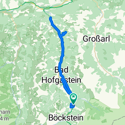
Biciklitúra 2016. 3. nap. (Bad Gastein - Mallnitz-Spittal. d. Drau)
Trasa rowerowa rozpoczynająca się w Bad Gastein, Salzburg, Austria.
Przegląd
O tej trasie
Podsumowanie
Ten etap zaczyna się w Dolinie Gastein lub w Mallnitz (w zależności od tego, kiedy wolisz skorzystać z usługi motorail Tauernschleuse). Po Tauernschleuse znajdujemy się w Karyntii, jednym z najważniejszych regionów turystycznych Austrii, położonym po południowej stronie Alp. Na tym etapie Alpe-Adria Bike Tour zazwyczaj prowadzi nas przez dolinę Mölltal Dolny, usytuowaną wśród gór sięgających około 3 000 metrów w grupie Reisseck na północy i grupie Kreuzeck na południe od doliny. Wybitne atrakcje turystyczne i satysfakcjonujące miejsca postojowe to centrum miasta Obervellach, Zamek Falkenstein, Wodospad Bernitz, kolejki linowe Reisseck i Kreuzeck, Wąwóz Barbarossy, miejsce odpoczynku nad brzegiem Möllstausee w Mühldorf oraz Muzeum Rzymskie Teurinia tuż poza Spittal. W samym powiecie Spittal znajdujemy piękny Renesansowy Zamek Porcia, Muzeum Kultury Ludowej i zawsze popularny park miejski.
- -:--
- Czas
- 58,9 km
- Dystans
- 1572 m
- Przewyższenia
- 2103 m
- Spadek
- ---
- Śr. Prędkość
- ---
- Maks. wysokość
Kontynuuj z Bikemap
Użyj, edytuj lub pobierz tę trasę rowerową
Chcesz przejechać trasę Biciklitúra 2016. 3. nap. (Bad Gastein - Mallnitz-Spittal. d. Drau) lub dostosować ją do swojej wycieczki? Oto, co możesz zrobić z tą trasą na Bikemap:
Darmowe funkcje
- Zapisz tę trasę jako ulubioną lub w kolekcji
- Skopiuj i zaplanuj swoją wersję tej trasy
- Synchronizuj swoją trasę z Garminem lub Wahoo
Funkcje Premium
3 dni bezpłatnej wersji próbnej lub jednorazowa opłata. Dowiedz się więcej o Bikemap Premium.
- Nawiguj po tej trasie na iOS i Androidzie
- Eksportuj plik GPX / KML tej trasy
- Stwórz swój własny wydruk (wypróbuj za darmo)
- Pobierz tę trasę do nawigacji offline
Odkryj więcej funkcji Premium.
Uzyskaj Bikemap PremiumOd naszej społeczności
Bad Gastein: Inne popularne trasy rozpoczynające się tutaj
 Ei Rastötzen
- Dystans
- 16,5 km
- Przewyższenia
- 658 m
- Spadek
- 668 m
- Lokalizacja
- Bad Gastein, Salzburg, Austria
 Bad Gastein - Runde
- Dystans
- 54,8 km
- Przewyższenia
- 774 m
- Spadek
- 773 m
- Lokalizacja
- Bad Gastein, Salzburg, Austria
 Bad Gastein - Villach
- Dystans
- 102,3 km
- Przewyższenia
- 873 m
- Spadek
- 1443 m
- Lokalizacja
- Bad Gastein, Salzburg, Austria
 Karl-Heinrich-Waggerl-Straße 12, Bad Gastein to Kaiser-Franz-Josef-Straße 41, Bad Gastein
- Dystans
- 23 km
- Przewyższenia
- 1149 m
- Spadek
- 1148 m
- Lokalizacja
- Bad Gastein, Salzburg, Austria
 AAR-5.1 Bad Gastein nach Böckstein
- Dystans
- 4,1 km
- Przewyższenia
- 94 m
- Spadek
- 9 m
- Lokalizacja
- Bad Gastein, Salzburg, Austria
 Stubnerkogel
- Dystans
- 17,8 km
- Przewyższenia
- 1288 m
- Spadek
- 138 m
- Lokalizacja
- Bad Gastein, Salzburg, Austria
 Badgastein - Dorfgastein
- Dystans
- 51,7 km
- Przewyższenia
- 518 m
- Spadek
- 518 m
- Lokalizacja
- Bad Gastein, Salzburg, Austria
 03 Bad Gastein - Spittal an. d. Drau
- Dystans
- 63 km
- Przewyższenia
- 922 m
- Spadek
- 1334 m
- Lokalizacja
- Bad Gastein, Salzburg, Austria
Otwórz ją w aplikacji

