somme to calais
Trasa rowerowa rozpoczynająca się w Albert, Hauts-de-France, Francja.
Przegląd
O tej trasie
- -:--
- Czas
- 273,8 km
- Dystans
- 604 m
- Przewyższenia
- 694 m
- Spadek
- ---
- Śr. Prędkość
- ---
- Maks. wysokość
Najważniejsze punkty trasy
Punkty zainteresowania na trasie
Interesujące miejsce po 36,7 km
Ruins Abbey Mont-Saint-Éloi
Interesujące miejsce po 56,7 km
Bunker Tinques
Interesujące miejsce po 75,1 km
Launch Facility V-1 Siracourt (Wasserwerk 1 St.-Pol)
Interesujące miejsce po 85,4 km
Underground V2 storagetunnels
Interesujące miejsce po 89,8 km
German Radiocentre Prédefin
Interesujące miejsce po 97,4 km
Remains Launch Base V1
Interesujące miejsce po 106,6 km
Bunker Auchy-au-Bois
Interesujące miejsce po 120,8 km
V2 Leitstrahlstellung Roquetoire
Interesujące miejsce po 127,4 km
V1 Feuerstellung 622 - FA Depot
Interesujące miejsce po 127,4 km
V1 Feuerstellung 622 - FA Vormontage
Interesujące miejsce po 127,4 km
V1 Feuerstellung 622 - Waterbasin
Interesujące miejsce po 127,4 km
V1 Feuerstellung 622 - FA Dampferzeuger-Garage
Interesujące miejsce po 145,6 km
V1 Feuerstellung 623 - FA Depot 2
Interesujące miejsce po 145,8 km
V1 Lauch facility
Interesujące miejsce po 145,9 km
V1 Feuerstellung 623 - Concrete Roads
Interesujące miejsce po 145,9 km
V1 Feuerstellung 623 - Zunderlager
Interesujące miejsce po 145,9 km
V1 Feuerstellung 623 - Richthaus
Interesujące miejsce po 146 km
V1 Feuerstellung 623 - FA Lager
Interesujące miejsce po 146 km
V1 Feuerstellung 623 - FA Depot 1
Interesujące miejsce po 146 km
V1 Feuerstellung 623 - FA Abschußbunker
Interesujące miejsce po 146 km
V1 Feuerstellung 623 - FA Vormontage
Interesujące miejsce po 146 km
V1 Feuerstellung 623 - Abshußrampe
Interesujące miejsce po 146 km
V1 Feuerstellung 623 - Waterbasin
Interesujące miejsce po 146 km
V1 Feuerstellung 623 - FA Depot 3
Interesujące miejsce po 272,7 km
The Migrant Camp
Kontynuuj z Bikemap
Użyj, edytuj lub pobierz tę trasę rowerową
Chcesz przejechać trasę somme to calais lub dostosować ją do swojej wycieczki? Oto, co możesz zrobić z tą trasą na Bikemap:
Darmowe funkcje
- Zapisz tę trasę jako ulubioną lub w kolekcji
- Skopiuj i zaplanuj swoją wersję tej trasy
- Podziel trasę na etapy, aby utworzyć kilkudniową wycieczkę
- Synchronizuj swoją trasę z Garminem lub Wahoo
Funkcje Premium
3 dni bezpłatnej wersji próbnej lub jednorazowa opłata. Dowiedz się więcej o Bikemap Premium.
- Nawiguj po tej trasie na iOS i Androidzie
- Eksportuj plik GPX / KML tej trasy
- Stwórz swój własny wydruk (wypróbuj za darmo)
- Pobierz tę trasę do nawigacji offline
Odkryj więcej funkcji Premium.
Uzyskaj Bikemap PremiumOd naszej społeczności
Albert: Inne popularne trasy rozpoczynające się tutaj
- Albert via Corbie to Amiens
- Dystans
- 42,7 km
- Przewyższenia
- 132 m
- Spadek
- 166 m
- Lokalizacja
- Albert, Hauts-de-France, Francja
- somme to calais
- Dystans
- 273,8 km
- Przewyższenia
- 604 m
- Spadek
- 694 m
- Lokalizacja
- Albert, Hauts-de-France, Francja
- Somme NW from Albert
- Dystans
- 52,5 km
- Przewyższenia
- 291 m
- Spadek
- 291 m
- Lokalizacja
- Albert, Hauts-de-France, Francja
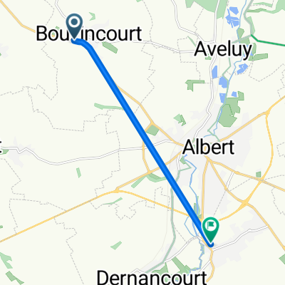
- De Rue Edouard Herriot 40, Albert à Rue Jules Verne 12, Albert
- Dystans
- 5,6 km
- Przewyższenia
- 13 m
- Spadek
- 31 m
- Lokalizacja
- Albert, Hauts-de-France, Francja
- Albert to St Quentin
- Dystans
- 54,7 km
- Przewyższenia
- 318 m
- Spadek
- 308 m
- Lokalizacja
- Albert, Hauts-de-France, Francja
- De Place du Général de Gaulle 18, Albert à Rue des Massacres 19D, Méaulte
- Dystans
- 3,7 km
- Przewyższenia
- 7 m
- Spadek
- 69 m
- Lokalizacja
- Albert, Hauts-de-France, Francja
- Rue Gambetta 4, Albert to LONGUEVAL - Place Bulte, Longueval
- Dystans
- 15,4 km
- Przewyższenia
- 164 m
- Spadek
- 81 m
- Lokalizacja
- Albert, Hauts-de-France, Francja
- Albert to Laon
- Dystans
- 108,8 km
- Przewyższenia
- 203 m
- Spadek
- 175 m
- Lokalizacja
- Albert, Hauts-de-France, Francja
Otwórz ją w aplikacji