- 16,5 km
- 48 m
- 49 m
- Goirle, Brabancja Północna, Holandia
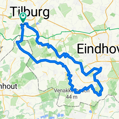
MTB Toertocht Goirle 2010
Trasa rowerowa rozpoczynająca się w Goirle, Brabancja Północna, Holandia.
Przegląd
O tej trasie
Ta trasa MTB ma 55 kilometrów długości i prowadzi przez tereny wiejskie Goirle oraz kawałek Hilvarenbeek. Trasa jest zróżnicowana. Przejechano 21 lutego po nocnej froście. W związku z tym nawierzchnia była twarda prawie wszędzie. Zamarznięte ślady sprawiają, że jazda jest ekscytująca. Start odbywa się w Wijcentrum De Deel na Frankische Driehoek.
- -:--
- Czas
- 55,2 km
- Dystans
- 70 m
- Przewyższenia
- 70 m
- Spadek
- ---
- Śr. Prędkość
- ---
- Maks. wysokość
utworzono 15 lat temu temu
Kontynuuj z Bikemap
Użyj, edytuj lub pobierz tę trasę rowerową
Chcesz przejechać trasę MTB Toertocht Goirle 2010 lub dostosować ją do swojej wycieczki? Oto, co możesz zrobić z tą trasą na Bikemap:
Darmowe funkcje
- Zapisz tę trasę jako ulubioną lub w kolekcji
- Skopiuj i zaplanuj swoją wersję tej trasy
- Synchronizuj swoją trasę z Garminem lub Wahoo
Funkcje Premium
3 dni bezpłatnej wersji próbnej lub jednorazowa opłata. Dowiedz się więcej o Bikemap Premium.
- Nawiguj po tej trasie na iOS i Androidzie
- Eksportuj plik GPX / KML tej trasy
- Stwórz swój własny wydruk (wypróbuj za darmo)
- Pobierz tę trasę do nawigacji offline
Odkryj więcej funkcji Premium.
Uzyskaj Bikemap PremiumOd naszej społeczności
Goirle: Inne popularne trasy rozpoczynające się tutaj
- Rondje G en Roovert en Halve maan
- MTB 36 - Goirle - Regte Hei - Rovertse Lei - Papschot - Broekeling - Esbeek - Roverste Hei - Gorp & Rovert - Goirle
- 36,4 km
- 71 m
- 67 m
- Goirle, Brabancja Północna, Holandia
- Turnhoutsebaan, Goirle naar Turnhoutsebaan, Goirle
- 52 km
- 59 m
- 59 m
- Goirle, Brabancja Północna, Holandia
- Intervaltraining
- 30,4 km
- 27 m
- 30 m
- Goirle, Brabancja Północna, Holandia
- ZO 133 - Goirle - Acht Zaligheden - Valkenswaard - Waalre - VV
- 133 km
- 180 m
- 180 m
- Goirle, Brabancja Północna, Holandia
- Ronde Goirle Reusel Poppel
- 53,6 km
- 57 m
- 59 m
- Goirle, Brabancja Północna, Holandia
- Rings - Smokkelaarsroute - 70km
- 67 km
- 46 m
- 46 m
- Goirle, Brabancja Północna, Holandia
- Goirle St Oedenrode Goirle
- 77 km
- 26 m
- 29 m
- Goirle, Brabancja Północna, Holandia
Otwórz ją w aplikacji


