Przegląd
O tej trasie
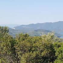
Wspinaczka asfaltowa, dalej droga leśna, kończąca się szybką i płynną zjazdem.
- Skręć w lewo wychodząc z hotelu i wspinaj się drogą w kierunku Argalasti.
- Na pierwszym skrzyżowaniu skręć w prawo do Metochi.
- Po przejechaniu Metochi zwróć uwagę na lustro na słupie i skręć w prawo w betonową drogę obok niego, która następnie ostro skręca w lewo.
- Podążaj tą ścieżką, następnie skręć w prawo na skrzyżowaniu typu T.
- Jedź tą trasą, mijając kilka ciasnych zakrętów w dół, a potem z powrotem pod górę.
- Zobaczysz żółty znak wskazujący bardzo strome wzniesienie, nie jedź tam w górę, lecz skręć w następny w lewo.
- Podążaj tą ścieżką, która jest dość zarośnięta, ale przebrnij przez to, bo nie trwa to długo.
- Dotarjesz do stromego podjazdu skręcającego w lewo, a około 20 metrów za lewym zakrętem jest ścieżka na prawo oznaczona żółtymi znakami.
- Trzymaj się tej ścieżki aż do Milina.
- Wracaj drogą do hotelu.
- -:--
- Czas
- 14,4 km
- Dystans
- 322 m
- Przewyższenia
- 324 m
- Spadek
- ---
- Śr. Prędkość
- ---
- Maks. wysokość
Część

Leda Routes
3 etapy
Jakość trasy
Typy dróg i nawierzchnie na trasie
Typy dróg
Droga leśna
5,1 km
(35 %)
Spokojna droga
0,7 km
(5 %)
Powierzchnie
Utwardzona
7,9 km
(55 %)
Nieutwardzona
0,4 km
(3 %)
Asfalt
7,9 km
(55 %)
Ziemia
0,4 km
(3 %)
Niezdefiniowany
6,1 km
(42 %)
Kontynuuj z Bikemap
Użyj, edytuj lub pobierz tę trasę rowerową
Chcesz przejechać trasę Postcard lub dostosować ją do swojej wycieczki? Oto, co możesz zrobić z tą trasą na Bikemap:
Darmowe funkcje
- Zapisz tę trasę jako ulubioną lub w kolekcji
- Skopiuj i zaplanuj swoją wersję tej trasy
- Synchronizuj swoją trasę z Garminem lub Wahoo
Funkcje Premium
3 dni bezpłatnej wersji próbnej lub jednorazowa opłata. Dowiedz się więcej o Bikemap Premium.
- Nawiguj po tej trasie na iOS i Androidzie
- Eksportuj plik GPX / KML tej trasy
- Stwórz swój własny wydruk (wypróbuj za darmo)
- Pobierz tę trasę do nawigacji offline
Odkryj więcej funkcji Premium.
Uzyskaj Bikemap PremiumOd naszej społeczności
Argalastí: Inne popularne trasy rozpoczynające się tutaj
 Techy
Techy- Dystans
- 13,6 km
- Przewyższenia
- 493 m
- Spadek
- 493 m
- Lokalizacja
- Argalastí, Thessaly, Grecja
 160819_Platanias_Trikeri_Platanias
- Dystans
- 91,3 km
- Przewyższenia
- 1185 m
- Spadek
- 1183 m
- Lokalizacja
- Argalastí, Thessaly, Grecja
 Paou Monastry Simplified
- Dystans
- 9,5 km
- Przewyższenia
- 279 m
- Spadek
- 288 m
- Lokalizacja
- Argalastí, Thessaly, Grecja
 160823_Platanias_Milies_Platanias
- Dystans
- 99,9 km
- Przewyższenia
- 1481 m
- Spadek
- 1483 m
- Lokalizacja
- Argalastí, Thessaly, Grecja
 160822_Platanias_Promiri_Liri_Platanias
- Dystans
- 38,3 km
- Przewyższenia
- 735 m
- Spadek
- 730 m
- Lokalizacja
- Argalastí, Thessaly, Grecja
 Road Circuit
- Dystans
- 20,1 km
- Przewyższenia
- 418 m
- Spadek
- 415 m
- Lokalizacja
- Argalastí, Thessaly, Grecja
 B route descent
- Dystans
- 2,3 km
- Przewyższenia
- 30 m
- Spadek
- 275 m
- Lokalizacja
- Argalastí, Thessaly, Grecja
 160827_Platanias_Katigiorgis_Platanias
- Dystans
- 31,9 km
- Przewyższenia
- 703 m
- Spadek
- 703 m
- Lokalizacja
- Argalastí, Thessaly, Grecja
Otwórz ją w aplikacji


