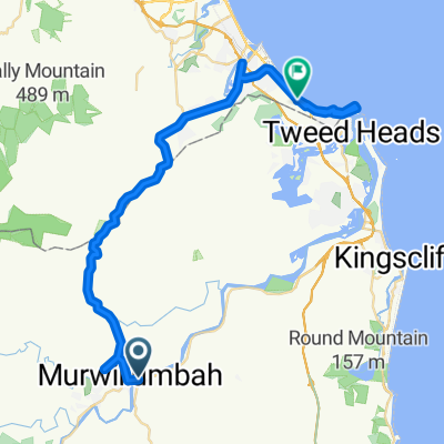
19 Murwillumbah YHA to Coolangatta YHA
- 50,6 km
- 443 m
- 450 m
- Murwillumbah, Nowa Południowa Walia, Australia
Trasa rowerowa rozpoczynająca się w Murwillumbah, Nowa Południowa Walia, Australia.
Przegląd
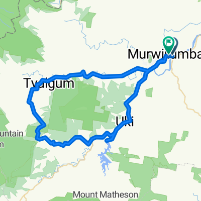
We start off at UKi and travel East and then North along the Kyogle Road following the Tweed River. At around 10k we trun left onto the Tyalgum Road which follows the Oxley River. We stop at Tyalgum for morning tea. We then head South on Brays Creek Road. At 33k veer left onto Byrrill Creek road. We steadily climb though bushland on an unsealed road. At the 38k mark we start to descend with glimpses of the Byrrill creek on the right and Mount Warning on our left. At 49.8k we turn left into the Kyogle Road which we follow to Uki. Lunch at Uki in the park or at the coffee shop or pub.
utworzono 8 lat temu temu
Kontynuuj z Bikemap
Chcesz przejechać trasę GCBW - Around Mount Warning lub dostosować ją do swojej wycieczki? Oto, co możesz zrobić z tą trasą na Bikemap:
3 dni bezpłatnej wersji próbnej lub jednorazowa opłata. Dowiedz się więcej o Bikemap Premium.
Odkryj więcej funkcji Premium.
Uzyskaj Bikemap PremiumOd naszej społeczności
Otwórz ją w aplikacji