

Rota Vicentina MTB Day1 - Easy
Trasa rowerowa rozpoczynająca się w Santiago do Cacém, Setúbal, Portugalia.
Przegląd
O tej trasie
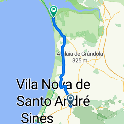
Starting from the north, Rota Vicentina begins at the beautiful church of Santiago do Cacém. The panoramic views over the city are inspiring and the view from the hillside with the Castle and the Church, a constant presence as far as the outskirts of the convent of Loreto.
Santiago do Cacém, a city with a strong connection to the pilgrimages to Santiago de Compostela. Since the Middle Ages pilgrims pass here coming from the Promontorium Sacrum, the mythical destination of this historic journey now recovered through Rota Vicentina.
After some kms throughout country fields and traditions Alentejo farmlands the route pass by Morgavel dam before it arrives to the Atlantic coast with marvelous views to desert beaches. The beaches of Malhão and Aivados are the biggest of the Sw coast, south of Porto Covo. As you arrive to Alturas do Norte, the landscape changes and the beaches give way to towering cliffs that from this point to Cape St. Vincent give this wild coast its personality.
The small town of Porto Covo it's just fantastic but the view over Ilha do Passegueiro demans for a stop to contemplate it's beauty. Proceding south to Vila Nova de Milfontes along the coast area it's easy and really pleasing.
- -:--
- Czas
- 55,9 km
- Dystans
- 346 m
- Przewyższenia
- 576 m
- Spadek
- ---
- Śr. Prędkość
- ---
- Maks. wysokość

Jakość trasy
Typy dróg i nawierzchnie na trasie
Typy dróg
Droga leśna
27,4 km
(49 %)
Spokojna droga
21,3 km
(38 %)
Powierzchnie
Utwardzona
5,6 km
(10 %)
Nieutwardzona
33,6 km
(60 %)
Ziemia
19,6 km
(35 %)
Nieutwardzony (nieokreślony)
7,8 km
(14 %)
Kontynuuj z Bikemap
Użyj, edytuj lub pobierz tę trasę rowerową
Chcesz przejechać trasę Rota Vicentina MTB Day1 - Easy lub dostosować ją do swojej wycieczki? Oto, co możesz zrobić z tą trasą na Bikemap:
Darmowe funkcje
- Zapisz tę trasę jako ulubioną lub w kolekcji
- Skopiuj i zaplanuj swoją wersję tej trasy
- Synchronizuj swoją trasę z Garminem lub Wahoo
Funkcje Premium
3 dni bezpłatnej wersji próbnej lub jednorazowa opłata. Dowiedz się więcej o Bikemap Premium.
- Nawiguj po tej trasie na iOS i Androidzie
- Eksportuj plik GPX / KML tej trasy
- Stwórz swój własny wydruk (wypróbuj za darmo)
- Pobierz tę trasę do nawigacji offline
Odkryj więcej funkcji Premium.
Uzyskaj Bikemap PremiumOd naszej społeczności
Santiago do Cacém: Inne popularne trasy rozpoczynające się tutaj
 December Second 2020
- Dystans
- 69,3 km
- Przewyższenia
- 580 m
- Spadek
- 580 m
- Lokalizacja
- Santiago do Cacém, Setúbal, Portugalia
 Rota Vicentina 01
- Dystans
- 17,7 km
- Przewyższenia
- 274 m
- Spadek
- 341 m
- Lokalizacja
- Santiago do Cacém, Setúbal, Portugalia
 Santiago do Cacém to Vale Seco
- Dystans
- 17,7 km
- Przewyższenia
- 274 m
- Spadek
- 337 m
- Lokalizacja
- Santiago do Cacém, Setúbal, Portugalia
 Santiago - ZILS Sines
- Dystans
- 11,8 km
- Przewyższenia
- 41 m
- Spadek
- 194 m
- Lokalizacja
- Santiago do Cacém, Setúbal, Portugalia
 8. Santiago do Cacém- Tomar
- Dystans
- 224,4 km
- Przewyższenia
- 623 m
- Spadek
- 772 m
- Lokalizacja
- Santiago do Cacém, Setúbal, Portugalia
 Deutschland - Portugal (Berlin - Faro) PT 19 Santiago do Cacém - Vila Nova de Milfontes
- Dystans
- 44 km
- Przewyższenia
- 250 m
- Spadek
- 475 m
- Lokalizacja
- Santiago do Cacém, Setúbal, Portugalia
 Santiago to Comporta
- Dystans
- 48,9 km
- Przewyższenia
- 234 m
- Spadek
- 408 m
- Lokalizacja
- Santiago do Cacém, Setúbal, Portugalia
 Santiago to Vila Nova
- Dystans
- 46,3 km
- Przewyższenia
- 294 m
- Spadek
- 491 m
- Lokalizacja
- Santiago do Cacém, Setúbal, Portugalia
Otwórz ją w aplikacji