Piste cyclable Soulanges
Trasa rowerowa
Przegląd
O tej trasie
- ENGLISH DESCRIPTION BELOW*
S’étendant sur 35 km, la piste cyclable Soulanges est reconnue pour la qualité de ses installations et la diversité des paysages qui l’entourent. Totalement asphaltée et longeant le canal de Soulanges, joyau patrimonial de la région, cette piste multifonctionnelle traverse les boisés et les champs de Pointe-des-Cascades jusqu’à Rivière-Beaudette, joignant la Belle province à l’Ontario.
A quelques kilomètres seulement de l’île de Montréal et accessible par deux navettes fluviales (Les Cèdres et Les Coteaux), cette piste vous promet de beaux moments cet été. La Piste cyclable Soulanges fait partie de la Route verte No 5, ce qui la rend accessible à partir de l’île de Montréal ainsi que de l’Ontario via la Waterfront Trail. Parfait pour sportifs et familles.
Pour les cyclistes aguerris, faites l’essai du circuit cyclable du canal de Soulanges qui emprunte 22 des 35 km de la piste cyclable Soulanges.
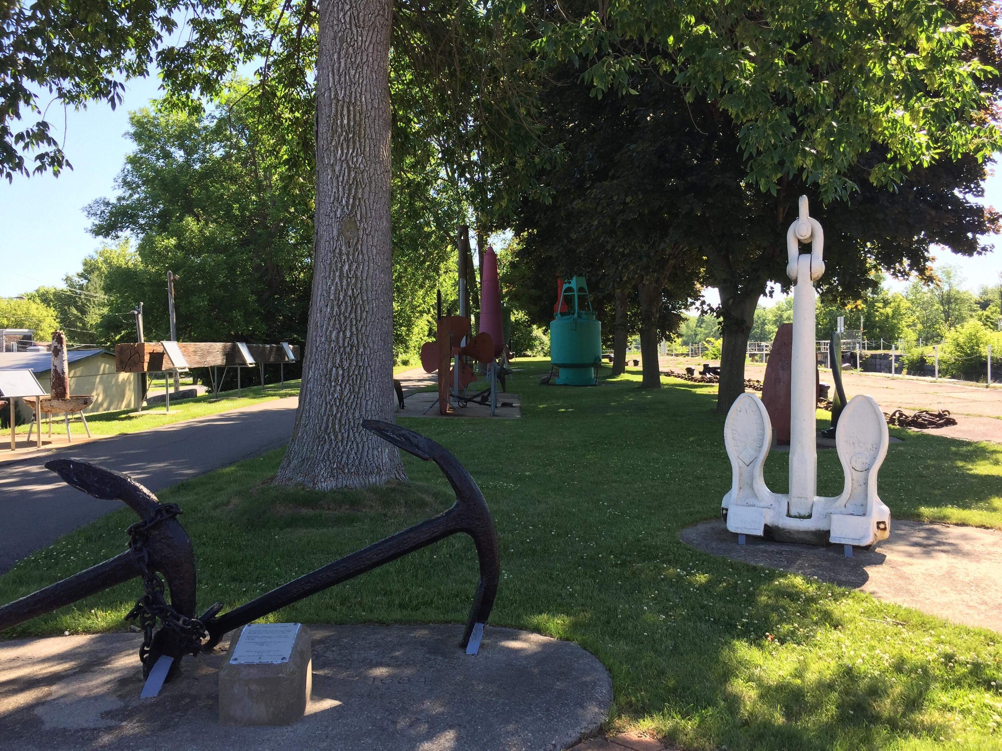
C’est au Parc des ancres que le point de départ a lieu. Apportez un lunch pour faire un pique-nique et visitez un musée à ciel ouvert. Le long du parcours, vous vous familiarisez avec l’ingénierie et l’architecture des écluses. Découvrez l’ancienne centrale hydroélectrique du canal de Soulanges communément appelé Petit Pouvoir.
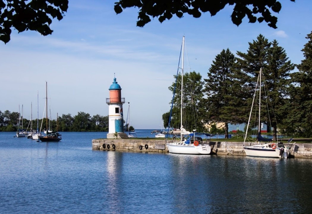
Besoin d’une pause? Arrêtez-vous au parc Thomas-Monro pour contempler l’embouchure Ouest du canal et admirez le paysage. Faites la pause et, si le cœur vous en dit, continuez en direction de Rivière-Beaudette sur la piste cyclable. La beauté du nautisme ne manquera pas!
Stretching over 35 km, the Soulanges bike path is known for its quality trails and varied landscapes. Completely paved along the length of the Soulanges Canal, one of the region’s heritage treasures, this multi-use trail crosses forests and fields, from Pointe-des-Cascades to Rivière-Beaudette, where it ends at the border with Ontario.
Just a few kilometres from the island of Montreal and easy to reach by two river shuttles (Les Cèdres and Les Coteaux), this trail is the perfect bike ride for a sunny summer day! Part of the Route verte No. 5, the Soulanges bike path is accessible from the island of Montreal as well as from Ontario via the Waterfront Trail. Ideal for both seasoned cyclists and families!
More experienced riders might want to try the Soulanges Canal cycling circuit, which includes 22 km of the 35 km long Soulanges bike path.
This trail begins at Parc des ancres. Bring a picnic lunch and visit an open-air museum. The beautiful architecture and engineering of the locks are a major scenic draw for visitors and cyclists. Among the points of interest along the Soulanges Canal are the old hydroelectric generating station, known as “Le Petit Pouvoir,” and, at the western entrance to the canal, Thomas-Monro Park, an ideal spot to take a break and admire the landscape. From there, you can continue along the bike path to Rivière-Beaudette. A scenic ride that offers a glimpse into the region’s maritime roots!
- -:--
- Czas
- 37,1 km
- Dystans
- 36 m
- Przewyższenia
- 24 m
- Spadek
- ---
- Śr. Prędkość
- ---
- Maks. wysokość
Jakość trasy
Typy dróg i nawierzchnie na trasie
Typy dróg
Droga rowerowa
26,4 km
(71 %)
Spokojna droga
2,2 km
(6 %)
Powierzchnie
Utwardzona
36,8 km
(99 %)
Asfalt
35,6 km
(96 %)
Nawierzchnia (nieokreślona)
1,1 km
(3 %)
Niezdefiniowany
0,4 km
(1 %)
Najważniejsze punkty trasy
Punkty zainteresowania na trasie
Interesujące miejsce po 0 km
Stationnement

Interesujące miejsce po 0,1 km
Parc des Ancres

Interesujące miejsce po 18,2 km
Kiosque de location de Kayak & SUP au canal

Interesujące miejsce po 18,7 km
Lieu historique national de Coteau-du-Lac

Interesujące miejsce po 18,8 km
Crème et Cie

Interesujące miejsce po 21,9 km
Parc Thomas-Monro

Interesujące miejsce po 32,2 km
Plage de Saint-Zotique

Interesujące miejsce po 34,6 km
Ferme La Belle et ses Bêtes
Kontynuuj z Bikemap
Użyj, edytuj lub pobierz tę trasę rowerową
Chcesz przejechać trasę Piste cyclable Soulanges lub dostosować ją do swojej wycieczki? Oto, co możesz zrobić z tą trasą na Bikemap:
Darmowe funkcje
- Zapisz tę trasę jako ulubioną lub w kolekcji
- Skopiuj i zaplanuj swoją wersję tej trasy
- Synchronizuj swoją trasę z Garminem lub Wahoo
Funkcje Premium
3 dni bezpłatnej wersji próbnej lub jednorazowa opłata. Dowiedz się więcej o Bikemap Premium.
- Nawiguj po tej trasie na iOS i Androidzie
- Eksportuj plik GPX / KML tej trasy
- Stwórz swój własny wydruk (wypróbuj za darmo)
- Pobierz tę trasę do nawigacji offline
Odkryj więcej funkcji Premium.
Uzyskaj Bikemap PremiumOtwórz ją w aplikacji


