

Monte Joanaz
Trasa rowerowa rozpoczynająca się w Pulfero, Friuli Venezia Giulia, Włochy.
Przegląd
O tej trasie
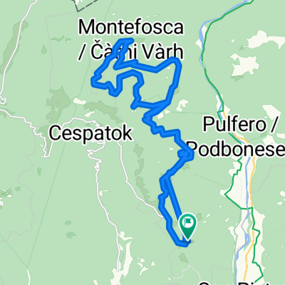
L’itinerario è dedicato agli escursionisti e parte dal pae- sino di Tamoris, ai piedi del monte Joanaz. Da Tamoris si prende la strada asfaltata in salita che porta verso Mon- tefosca. Giunti in prossimità del monumento Madonnina del Dom a 960 mt s.l.m. si imbocca la strada bianca che sale a destra e si percorre no in cima al monte. C’è la possibilità di arrivare in cima anche percorrendo il sen- tiero che costeggia la strada a destra. Arrivati in cima si imbocca il sentiero CAI che scende a sud verso valle e giunti alla strada bianca la si percorre verso destra in discesa no a tornare a Tamoris.
This itinerary is dedicated to excursionists and it starts from the village of Tamoris at the bottom of mount Joanaz. From Tamoris take the paved road that goes uphill to Montefosca. When arrived by the monument Madonnina del Dom at about 960 mt above sea level, take the white road that goes uphill on the right that lead you all the way to the top of the mountain. It is possible to reach the top also if you take the way that goes along road on the right. When arrived to the top, take the path CAI that leads you down to the South until you reach the white road. Con- tinue downhill on the right side of the white road in order to return to the village of Tamoris.
- -:--
- Czas
- 9,1 km
- Dystans
- 374 m
- Przewyższenia
- 372 m
- Spadek
- ---
- Śr. Prędkość
- ---
- Maks. wysokość

Kontynuuj z Bikemap
Użyj, edytuj lub pobierz tę trasę rowerową
Chcesz przejechać trasę Monte Joanaz lub dostosować ją do swojej wycieczki? Oto, co możesz zrobić z tą trasą na Bikemap:
Darmowe funkcje
- Zapisz tę trasę jako ulubioną lub w kolekcji
- Skopiuj i zaplanuj swoją wersję tej trasy
- Synchronizuj swoją trasę z Garminem lub Wahoo
Funkcje Premium
3 dni bezpłatnej wersji próbnej lub jednorazowa opłata. Dowiedz się więcej o Bikemap Premium.
- Nawiguj po tej trasie na iOS i Androidzie
- Eksportuj plik GPX / KML tej trasy
- Stwórz swój własny wydruk (wypróbuj za darmo)
- Pobierz tę trasę do nawigacji offline
Odkryj więcej funkcji Premium.
Uzyskaj Bikemap PremiumOd naszej społeczności
Pulfero: Inne popularne trasy rozpoczynające się tutaj
 Via Specognis 8, Pulfero a Via Specognis 8, Pulfero
- Dystans
- 44,7 km
- Przewyższenia
- 1883 m
- Spadek
- 1888 m
- Lokalizacja
- Pulfero, Friuli Venezia Giulia, Włochy
 Pulfero-Portogruaro
- Dystans
- 99 km
- Przewyższenia
- 349 m
- Spadek
- 531 m
- Lokalizacja
- Pulfero, Friuli Venezia Giulia, Włochy
 Faedis Canebola Madonnina Domm
- Dystans
- 60,5 km
- Przewyższenia
- 885 m
- Spadek
- 885 m
- Lokalizacja
- Pulfero, Friuli Venezia Giulia, Włochy
 Spignon
- Dystans
- 26 km
- Przewyższenia
- 656 m
- Spadek
- 656 m
- Lokalizacja
- Pulfero, Friuli Venezia Giulia, Włochy
 Cividale - Togliano - ZIracco - San Mauro - Orsaria - Ipplis
- Dystans
- 52,1 km
- Przewyższenia
- 162 m
- Spadek
- 159 m
- Lokalizacja
- Pulfero, Friuli Venezia Giulia, Włochy
 Route to Via Podvarschis 19, 33046 Pulfero
- Dystans
- 94,5 km
- Przewyższenia
- 5058 m
- Spadek
- 5016 m
- Lokalizacja
- Pulfero, Friuli Venezia Giulia, Włochy
 loch - matajiur mtg via cai 725 e cai 750 rientro per montemaggiore
- Dystans
- 28,1 km
- Przewyższenia
- 1315 m
- Spadek
- 1326 m
- Lokalizacja
- Pulfero, Friuli Venezia Giulia, Włochy
 valliinrosamtb3
- Dystans
- 11,9 km
- Przewyższenia
- 478 m
- Spadek
- 479 m
- Lokalizacja
- Pulfero, Friuli Venezia Giulia, Włochy
Otwórz ją w aplikacji