

Day 2: Lake Tinaroo Circuit
Trasa rowerowa rozpoczynająca się w Atherton, State of Queensland, Australia.
Przegląd
O tej trasie
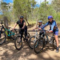
The Tinaroo loop is a mixture of sealed and dirt rd and circumnavigates the tropical paradise of lake Tinaroo. If you would like to do some extra kms and experience some elevated views you can spend an hours or so ascending up Lamb’s range. There is a turn off to the Lambs Range at the start of the lake circuit. Cathedral Figtree is also worth a look. It is located at the start of the circuit as well and it is well signposted. Stop at the Tinaroo village for food and the strawberry farm for ice cream. The road back to Yungaburra on the last part of the circuit has only a small cycling shoulder. You will need to ride this road for about 10km to get back to Yungaburra.
- -:--
- Czas
- 71,8 km
- Dystans
- 650 m
- Przewyższenia
- 649 m
- Spadek
- ---
- Śr. Prędkość
- ---
- Maks. wysokość
Kontynuuj z Bikemap
Użyj, edytuj lub pobierz tę trasę rowerową
Chcesz przejechać trasę Day 2: Lake Tinaroo Circuit lub dostosować ją do swojej wycieczki? Oto, co możesz zrobić z tą trasą na Bikemap:
Darmowe funkcje
- Zapisz tę trasę jako ulubioną lub w kolekcji
- Skopiuj i zaplanuj swoją wersję tej trasy
- Synchronizuj swoją trasę z Garminem lub Wahoo
Funkcje Premium
3 dni bezpłatnej wersji próbnej lub jednorazowa opłata. Dowiedz się więcej o Bikemap Premium.
- Nawiguj po tej trasie na iOS i Androidzie
- Eksportuj plik GPX / KML tej trasy
- Stwórz swój własny wydruk (wypróbuj za darmo)
- Pobierz tę trasę do nawigacji offline
Odkryj więcej funkcji Premium.
Uzyskaj Bikemap PremiumOd naszej społeczności
Atherton: Inne popularne trasy rozpoczynające się tutaj
 Day 3: Lake Eachem, Curtain Fig Tree and Malanda Falls Loop
- Dystans
- 44,8 km
- Przewyższenia
- 438 m
- Spadek
- 399 m
- Lokalizacja
- Atherton, State of Queensland, Australia
 Atherton - Herberton
- Dystans
- 19,6 km
- Przewyższenia
- 342 m
- Spadek
- 200 m
- Lokalizacja
- Atherton, State of Queensland, Australia
 Easy ride in Atherton
- Dystans
- 16,6 km
- Przewyższenia
- 142 m
- Spadek
- 139 m
- Lokalizacja
- Atherton, State of Queensland, Australia
 Day 3: Lake Eachem, Curtain Fig Tree and Malanda Falls Loop CLONED FROM ROUTE 437914
- Dystans
- 44,9 km
- Przewyższenia
- 475 m
- Spadek
- 475 m
- Lokalizacja
- Atherton, State of Queensland, Australia
 Atherton Herberton
- Dystans
- 20,1 km
- Przewyższenia
- 340 m
- Spadek
- 245 m
- Lokalizacja
- Atherton, State of Queensland, Australia
 22-02-22 Malanda loop
- Dystans
- 19,7 km
- Przewyższenia
- 231 m
- Spadek
- 233 m
- Lokalizacja
- Atherton, State of Queensland, Australia
 Rifle Range Road, Atherton to Rifle Range Road, Atherton
- Dystans
- 7,8 km
- Przewyższenia
- 221 m
- Spadek
- 223 m
- Lokalizacja
- Atherton, State of Queensland, Australia
 Day 4: Yungaburra to Millaa Millaa (The Falls Tea House)
- Dystans
- 73,8 km
- Przewyższenia
- 782 m
- Spadek
- 638 m
- Lokalizacja
- Atherton, State of Queensland, Australia
Otwórz ją w aplikacji