

Tour de Winooski
Trasa rowerowa rozpoczynająca się w Winooski, Vermont, USA.
Przegląd
O tej trasie
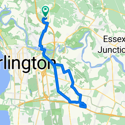
Tour de Winooski to proponowana wycieczka rowerowa z samodzielnym przewodnikiem, która zaczyna się w Intervale Center. To centrum rolnictwa społecznościowego jest zasobem dla lokalnie uprawianej i lokalnie prowadzonej produkcji żywności w okolicy Burlington i znajduje się w bliskiej odległości od znaków historii geologicznej na następnej przystani wycieczki, Salmon Hole. Ta naturalna przestrzeń nad rzeką Winooski jest ważnym siedliskiem dla ryb przybrzeżnych i pokazuje swoją historię geologiczną przez odkrywkowe dolomity, które zamieszkuje. Następnym miejscem na trasie rowerowej jest fabryka Ben & Jerry’s w Waterbury, VT. To lokalna fabryka produkcji żywności, którą wielu mieszkańców Vermontu i ludzi na całym świecie uwielbia. Zanim rowerzyści dotrą do Waterbury, przejadą obok Mt. Mansfield, który jest najwyższym szczytem górskim w Vermont. Następnym przystankiem na trasie jest Hubbard Tower w Montpelier. Rowerzyści mogą wspiąć się na wieżę widokową i obserwować geologię zlewni Winooski przez widoki na otaczające ich Green Mountains. Jeśli będą zmęczeni, rowerzyści mogą spędzić noc w jednym z wielu lokalnych pensjonatów w Montpelier. Rano rowerzyści podążą trasą do Barre. Mogą zrobić zakupy spożywcze i pomyśleć o geologii w Granite City Grocery, sklepie spożywczym w Barre. W tym momencie wycieczki rowerowej czas wrócić. Rowerzyści będą podążać trasą długim powrotem do Burlington, gdzie będą mogli delektować się lokalnymi potrawami w różnych restauracjach i odpocząć w Burlington Hostel.
- -:--
- Czas
- 165,6 km
- Dystans
- 549 m
- Przewyższenia
- 525 m
- Spadek
- ---
- Śr. Prędkość
- ---
- Maks. wysokość

Jakość trasy
Typy dróg i nawierzchnie na trasie
Typy dróg
Droga
69,5 km
(42 %)
Spokojna droga
28,2 km
(17 %)
Powierzchnie
Utwardzona
124,2 km
(75 %)
Nieutwardzona
36,4 km
(22 %)
Asfalt
120,9 km
(73 %)
Żwir
31,5 km
(19 %)
Kontynuuj z Bikemap
Użyj, edytuj lub pobierz tę trasę rowerową
Chcesz przejechać trasę Tour de Winooski lub dostosować ją do swojej wycieczki? Oto, co możesz zrobić z tą trasą na Bikemap:
Darmowe funkcje
- Zapisz tę trasę jako ulubioną lub w kolekcji
- Skopiuj i zaplanuj swoją wersję tej trasy
- Podziel trasę na etapy, aby utworzyć kilkudniową wycieczkę
- Synchronizuj swoją trasę z Garminem lub Wahoo
Funkcje Premium
3 dni bezpłatnej wersji próbnej lub jednorazowa opłata. Dowiedz się więcej o Bikemap Premium.
- Nawiguj po tej trasie na iOS i Androidzie
- Eksportuj plik GPX / KML tej trasy
- Stwórz swój własny wydruk (wypróbuj za darmo)
- Pobierz tę trasę do nawigacji offline
Odkryj więcej funkcji Premium.
Uzyskaj Bikemap PremiumOd naszej społeczności
Winooski: Inne popularne trasy rozpoczynające się tutaj
 BTV to Montreal
- Dystans
- 187,9 km
- Przewyższenia
- 253 m
- Spadek
- 264 m
- Lokalizacja
- Winooski, Vermont, USA
 around colchester short
- Dystans
- 26,7 km
- Przewyższenia
- 236 m
- Spadek
- 228 m
- Lokalizacja
- Winooski, Vermont, USA
 Sporty route in Essex Junction
- Dystans
- 13,9 km
- Przewyższenia
- 147 m
- Spadek
- 103 m
- Lokalizacja
- Winooski, Vermont, USA
 Ride to work :)
- Dystans
- 15,8 km
- Przewyższenia
- 125 m
- Spadek
- 178 m
- Lokalizacja
- Winooski, Vermont, USA
 Tour de Winooski
- Dystans
- 165,6 km
- Przewyższenia
- 549 m
- Spadek
- 525 m
- Lokalizacja
- Winooski, Vermont, USA
 Work
Work- Dystans
- 4,1 km
- Przewyższenia
- 56 m
- Spadek
- 5 m
- Lokalizacja
- Winooski, Vermont, USA
 commute home
- Dystans
- 16,7 km
- Przewyższenia
- 210 m
- Spadek
- 160 m
- Lokalizacja
- Winooski, Vermont, USA
 Whale Tails
- Dystans
- 31,9 km
- Przewyższenia
- 184 m
- Spadek
- 184 m
- Lokalizacja
- Winooski, Vermont, USA
Otwórz ją w aplikacji