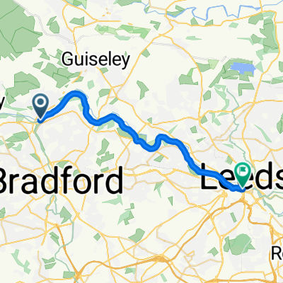
Get miles
Trasa rowerowa rozpoczynająca się w Shipley, Anglia, Zjednoczone Królestwo Wielkiej Brytanii.
Przegląd
O tej trasie
Gonna leave everything I know, gonna head out towards the sea. Ahem.
Greengates/Apperley Bridge (Bradford/Leeds) to Southport.
Following the more direct bits of the Leeds Liverpool Canal (and avoiding the bad quality towpath bits wherever possible - there are still a few rough-ish bits though, wouldn't recommend for a super delicate road bike). A few unavoidably busy routes through town centres (Burnley is the worst, because the canal goes through a tunnel there so you have to divert anyway. That said, the tunnel underneath the motorway there is well fun!).
Only one big hill - from Glusburn to the Lancashire border - but there is a nice cafe at the side of a small lake just before Colne if cake is needed to recover.
- -:--
- Czas
- 124,4 km
- Dystans
- 434 m
- Przewyższenia
- 514 m
- Spadek
- ---
- Śr. Prędkość
- ---
- Maks. wysokość
Jakość trasy
Typy dróg i nawierzchnie na trasie
Typy dróg
Droga rowerowa
39,1 km
(31 %)
Spokojna droga
27,7 km
(22 %)
Powierzchnie
Utwardzona
27,8 km
(22 %)
Nieutwardzona
13,8 km
(11 %)
Asfalt
22,2 km
(18 %)
Żwir
11,6 km
(9 %)
Najważniejsze punkty trasy
Punkty zainteresowania na trasie
Interesujące miejsce po 37,6 km
Cafe next to a small lake that does good cake!
Interesujące miejsce po 50,4 km
Unsure quite what happens here. Might have to go into the carpark to get through.
Interesujące miejsce po 106,7 km
Can divert at this point to go through the south of Southport (via Scarisbrick)
Kontynuuj z Bikemap
Użyj, edytuj lub pobierz tę trasę rowerową
Chcesz przejechać trasę Get miles lub dostosować ją do swojej wycieczki? Oto, co możesz zrobić z tą trasą na Bikemap:
Darmowe funkcje
- Zapisz tę trasę jako ulubioną lub w kolekcji
- Skopiuj i zaplanuj swoją wersję tej trasy
- Podziel trasę na etapy, aby utworzyć kilkudniową wycieczkę
- Synchronizuj swoją trasę z Garminem lub Wahoo
Funkcje Premium
3 dni bezpłatnej wersji próbnej lub jednorazowa opłata. Dowiedz się więcej o Bikemap Premium.
- Nawiguj po tej trasie na iOS i Androidzie
- Eksportuj plik GPX / KML tej trasy
- Stwórz swój własny wydruk (wypróbuj za darmo)
- Pobierz tę trasę do nawigacji offline
Odkryj więcej funkcji Premium.
Uzyskaj Bikemap PremiumOd naszej społeczności
Shipley: Inne popularne trasy rozpoczynające się tutaj
- Canal and moors
- Dystans
- 33,5 km
- Przewyższenia
- 329 m
- Spadek
- 329 m
- Lokalizacja
- Shipley, Anglia, Zjednoczone Królestwo Wielkiej Brytanii
- Get miles
- Dystans
- 124,4 km
- Przewyższenia
- 434 m
- Spadek
- 514 m
- Lokalizacja
- Shipley, Anglia, Zjednoczone Królestwo Wielkiej Brytanii
- Greengates to Manjit's loop
- Dystans
- 28,3 km
- Przewyższenia
- 404 m
- Spadek
- 398 m
- Lokalizacja
- Shipley, Anglia, Zjednoczone Królestwo Wielkiej Brytanii
- Bumpy Wharfedale route
- Dystans
- 54,3 km
- Przewyższenia
- 612 m
- Spadek
- 612 m
- Lokalizacja
- Shipley, Anglia, Zjednoczone Królestwo Wielkiej Brytanii
- Greengates to Selby loop, tarmac only
- Dystans
- 115,9 km
- Przewyższenia
- 399 m
- Spadek
- 397 m
- Lokalizacja
- Shipley, Anglia, Zjednoczone Królestwo Wielkiej Brytanii
- Apperley Bridge/Steeton loop
- Dystans
- 49,5 km
- Przewyższenia
- 353 m
- Spadek
- 385 m
- Lokalizacja
- Shipley, Anglia, Zjednoczone Królestwo Wielkiej Brytanii
- Loop around Bradford
- Dystans
- 48,3 km
- Przewyższenia
- 541 m
- Spadek
- 541 m
- Lokalizacja
- Shipley, Anglia, Zjednoczone Królestwo Wielkiej Brytanii
- Greengates/Skipton/Eccup loop
- Dystans
- 104,9 km
- Przewyższenia
- 718 m
- Spadek
- 720 m
- Lokalizacja
- Shipley, Anglia, Zjednoczone Królestwo Wielkiej Brytanii
Otwórz ją w aplikacji