

Tour de Mazovia
Trasa rowerowa rozpoczynająca się w Wieluń, Województwo łódzkie, Polska.
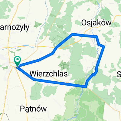
Przegląd
O tej trasie
- -:--
- Czas
- 203,3 km
- Dystans
- 193 m
- Przewyższenia
- 236 m
- Spadek
- ---
- Śr. Prędkość
- ---
- Maks. wysokość

Jakość trasy
Typy dróg i nawierzchnie na trasie
Typy dróg
Droga
107,8 km
(53 %)
Spokojna droga
42,7 km
(21 %)
Powierzchnie
Utwardzona
113,9 km
(56 %)
Asfalt
109,8 km
(54 %)
Nawierzchnia (nieokreślona)
4,1 km
(2 %)
Niezdefiniowany
89,5 km
(44 %)
Kontynuuj z Bikemap
Użyj, edytuj lub pobierz tę trasę rowerową
Chcesz przejechać trasę Tour de Mazovia lub dostosować ją do swojej wycieczki? Oto, co możesz zrobić z tą trasą na Bikemap:
Darmowe funkcje
- Zapisz tę trasę jako ulubioną lub w kolekcji
- Skopiuj i zaplanuj swoją wersję tej trasy
- Podziel trasę na etapy, aby utworzyć kilkudniową wycieczkę
- Synchronizuj swoją trasę z Garminem lub Wahoo
Funkcje Premium
3 dni bezpłatnej wersji próbnej lub jednorazowa opłata. Dowiedz się więcej o Bikemap Premium.
- Nawiguj po tej trasie na iOS i Androidzie
- Eksportuj plik GPX / KML tej trasy
- Stwórz swój własny wydruk (wypróbuj za darmo)
- Pobierz tę trasę do nawigacji offline
Odkryj więcej funkcji Premium.
Uzyskaj Bikemap PremiumOd naszej społeczności
Wieluń: Inne popularne trasy rozpoczynające się tutaj
 Wielun-Skomlin-Lyskornia-Lagiewniki-Wielun
- Dystans
- 52,5 km
- Przewyższenia
- 78 m
- Spadek
- 76 m
- Lokalizacja
- Wieluń, Województwo łódzkie, Polska
 Felinów
- Dystans
- 41,2 km
- Przewyższenia
- 132 m
- Spadek
- 132 m
- Lokalizacja
- Wieluń, Województwo łódzkie, Polska
 Komorniki,Królewska Grobla,Uszyce,Goła,Praszka,Ożarów,Kocilew,Rychłowice
- Dystans
- 65,6 km
- Przewyższenia
- 240 m
- Spadek
- 240 m
- Lokalizacja
- Wieluń, Województwo łódzkie, Polska
 2 x pętla Pątnów Kluski Bieniec (+ Wieluń)
- Dystans
- 69,5 km
- Przewyższenia
- 281 m
- Spadek
- 281 m
- Lokalizacja
- Wieluń, Województwo łódzkie, Polska
 Strugi
- Dystans
- 25,5 km
- Przewyższenia
- 199 m
- Spadek
- 212 m
- Lokalizacja
- Wieluń, Województwo łódzkie, Polska
 Leniwa ósemka z dzieckiem
- Dystans
- 18,6 km
- Przewyższenia
- 145 m
- Spadek
- 147 m
- Lokalizacja
- Wieluń, Województwo łódzkie, Polska
 Międzybórz i dach Wielkopolski
- Dystans
- 173,2 km
- Przewyższenia
- ---
- Spadek
- ---
- Lokalizacja
- Wieluń, Województwo łódzkie, Polska
 Graniczna 20A, Wieluń do Joanny Żubr 23, Wieluń
- Dystans
- 20,6 km
- Przewyższenia
- 62 m
- Spadek
- 78 m
- Lokalizacja
- Wieluń, Województwo łódzkie, Polska
Otwórz ją w aplikacji