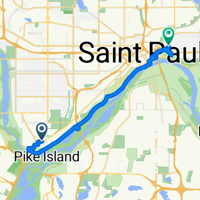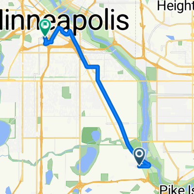
B2B00331 55417 > 55404 via Minnehaha
- 12,5 km
- 15 m
- 12 m
- Mendota Heights, Minnesota, USA
Trasa rowerowa rozpoczynająca się w Mendota Heights, Minnesota, USA.
Przegląd
utworzono 17 lat temu temu
Jakość trasy
Spokojna droga
4,2 km
34 %
Droga
3 km
24 %
Utwardzona
6,7 km
(54 %)
Asfalt
5,2 km
42 %
Nawierzchnia (nieokreślona)
0,9 km
7 %
Kontynuuj z Bikemap
Chcesz przejechać trasę B2B00331 55417 > 55404 via Minnehaha lub dostosować ją do swojej wycieczki? Oto, co możesz zrobić z tą trasą na Bikemap:
3 dni bezpłatnej wersji próbnej lub jednorazowa opłata. Dowiedz się więcej o Bikemap Premium.
Odkryj więcej funkcji Premium.
Uzyskaj Bikemap PremiumOd naszej społeczności
Otwórz ją w aplikacji