

Portland to Seattle - 2018
Trasa rowerowa rozpoczynająca się w Vancouver, Waszyngton, USA.
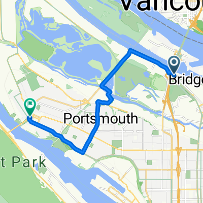
Przegląd
O tej trasie
Powrót do Seattle
Po naszym przejeździe z Seattle do Portland (Oregon) podczas STP organizowanego przez Cascade Bicycle Club w 2018 roku, wróciliśmy rowerami do Seattle po kilku dniach przerwy.
Wybraliśmy nieco inną trasę jadąc na północ przez Vancouver w stanie Waszyngton, która omijała długi odcinek autostrady 30, który był częścią trasy STP do Portland. Ogólnie była to lepsza droga. Użyliśmy również Inter-Urban Trail, gdy zbliżaliśmy się do Seattle.
Jedna wspinaczka, która prowadziła wzdłuż Green Mountain Road, była bardzo stroma i stanowiła prawdziwe wyzwanie, zwłaszcza z sakwami. Dzięki Bogu za bieg "babci" z przodu. Przygotuj się na to, że trzeba będzie pchać, jeśli zajdzie taka potrzeba. Zrobiłem bardzo przybliżony zużywając mapę ukształtowania terenu BikeMap i odkryłem, że nachylenie na odcinku kilkuset metrów podjazdu przekracza 20 %.
Przejechaliśmy ten odcinek w dwa dni, spędzając noc w Centralia w stanie Waszyngton.
Z wyjątkiem jednego bardzo krótkiego odcinka, cały przejazd odbył się po dość dobrze wyłożonych drogach. Zdecydowana większość dróg to drogi o małym ruchu lub drogi o większym ruchu z dwiema pobocznymi pasami.
- -:--
- Czas
- 304,5 km
- Dystans
- 896 m
- Przewyższenia
- 800 m
- Spadek
- ---
- Śr. Prędkość
- ---
- Maks. wysokość

Zdjęcia trasy

Jakość trasy
Typy dróg i nawierzchnie na trasie
Typy dróg
Droga
112,7 km
(37 %)
Droga rowerowa
45,7 km
(15 %)
Powierzchnie
Utwardzona
124,8 km
(41 %)
Asfalt
106,6 km
(35 %)
Nawierzchnia (nieokreślona)
15,2 km
(5 %)
Kontynuuj z Bikemap
Użyj, edytuj lub pobierz tę trasę rowerową
Chcesz przejechać trasę Portland to Seattle - 2018 lub dostosować ją do swojej wycieczki? Oto, co możesz zrobić z tą trasą na Bikemap:
Darmowe funkcje
- Zapisz tę trasę jako ulubioną lub w kolekcji
- Skopiuj i zaplanuj swoją wersję tej trasy
- Podziel trasę na etapy, aby utworzyć kilkudniową wycieczkę
- Synchronizuj swoją trasę z Garminem lub Wahoo
Funkcje Premium
3 dni bezpłatnej wersji próbnej lub jednorazowa opłata. Dowiedz się więcej o Bikemap Premium.
- Nawiguj po tej trasie na iOS i Androidzie
- Eksportuj plik GPX / KML tej trasy
- Stwórz swój własny wydruk (wypróbuj za darmo)
- Pobierz tę trasę do nawigacji offline
Odkryj więcej funkcji Premium.
Uzyskaj Bikemap PremiumOd naszej społeczności
Vancouver: Inne popularne trasy rozpoczynające się tutaj
 North Portland Trails
- Dystans
- 55 km
- Przewyższenia
- 368 m
- Spadek
- 394 m
- Lokalizacja
- Vancouver, Waszyngton, USA
 Slow ride in Portland
- Dystans
- 11 km
- Przewyższenia
- 4 m
- Spadek
- 8 m
- Lokalizacja
- Vancouver, Waszyngton, USA
 From work to home
- Dystans
- 10,9 km
- Przewyższenia
- 114 m
- Spadek
- 112 m
- Lokalizacja
- Vancouver, Waszyngton, USA
 Two Bridge Loop
- Dystans
- 29,5 km
- Przewyższenia
- 136 m
- Spadek
- 138 m
- Lokalizacja
- Vancouver, Waszyngton, USA
 W-B17_RooseveltHS-h1
- Dystans
- 4,9 km
- Przewyższenia
- 0 m
- Spadek
- 0 m
- Lokalizacja
- Vancouver, Waszyngton, USA
 Steady ride in Portland
- Dystans
- 16,9 km
- Przewyższenia
- 10 m
- Spadek
- 16 m
- Lokalizacja
- Vancouver, Waszyngton, USA
 Kelley Point
- Dystans
- 26,5 km
- Przewyższenia
- 83 m
- Spadek
- 87 m
- Lokalizacja
- Vancouver, Waszyngton, USA
 Two bridge loop
- Dystans
- 48,9 km
- Przewyższenia
- 123 m
- Spadek
- 124 m
- Lokalizacja
- Vancouver, Waszyngton, USA
Otwórz ją w aplikacji