

B2B00248 55125>55112 viaRadio/Inwood/Ideal/OlsonLk/Demontr/WarnerRd/Lake/BaldEag/H2/Centv/CtyJ
Trasa rowerowa rozpoczynająca się w Woodbury, Minnesota, USA.
Przegląd
O tej trasie
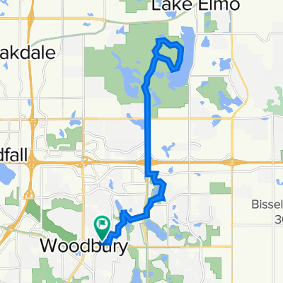
North on Radio Dr. It becomes Inwood Av. Follow Inwood to Stillwater Rd. Turn left and go to Ideal. Turn right and follow Ideal north. It becomes Olson Lake Rd. At 50th St. turn right to Demontreville Trail. Follow Demotreville to the left around the lake to Highlands Trail N. up the hill. At the top of the hill turn left at Hytrail Av. N. On your left will be the entrance to the Gateway Trail. Take the path down the hill and through a small forest. It curves around and suddenly you are at the entrance to the Gateway. Turn right and go through the tunnel under highway 36. Just past the end of the tunnel there is a hairpin turn to the left up to a parking lot and out to 60th St. N. At the end of this road is Hilton Trail. Turn right and go to the next corner and turn left at 62nd St. N. Go to Warner Rd. and turn right. Follow Warner Av. north past Stillwater Rd. until you reach Locust St. Turn left over to Mahtomedi Av./244. Turn right at Mahtomedi and follow around White Bear Lake past the Yacht Club until you reach Highway 96/LakeAv. Turn left and follow around until you reach Northwest Av. Angle off to the right on Northwest Av. until you reach Buffalo St. Turn left and cross highway 61. Just across the railroad tracks turn left on Hugo Rd. Follow Hugo Rd. until it curves to the right and becomes Park Av. Follow Park Av. to Bald Eagle Lake. Turn left at Bald Eagle Blvd and go around the lake until you reach Cty. Rd. H2. Turn left on H2 and go west until you reach Centerville Rd. Turn right at Centerville Rd. and go north until you reach Cty Rd. J. on the left. Turn left at Cty J and continue on J west past Hodgson Rd./ Lexington Av. and 35W. Continue on until you reach Coral Sea St. Turn left to your destination.
- -:--
- Czas
- 43,7 km
- Dystans
- 134 m
- Przewyższenia
- 164 m
- Spadek
- ---
- Śr. Prędkość
- 319 m
- Maks. wysokość
Jakość trasy
Typy dróg i nawierzchnie na trasie
Typy dróg
Droga
16,4 km
(38 %)
Droga rowerowa
12,1 km
(28 %)
Powierzchnie
Utwardzona
31,3 km
(71 %)
Nieutwardzona
0 km
(<1 %)
Asfalt
30,7 km
(70 %)
Nawierzchnia (nieokreślona)
0,6 km
(1 %)
Kontynuuj z Bikemap
Użyj, edytuj lub pobierz tę trasę rowerową
Chcesz przejechać trasę B2B00248 55125>55112 viaRadio/Inwood/Ideal/OlsonLk/Demontr/WarnerRd/Lake/BaldEag/H2/Centv/CtyJ lub dostosować ją do swojej wycieczki? Oto, co możesz zrobić z tą trasą na Bikemap:
Darmowe funkcje
- Zapisz tę trasę jako ulubioną lub w kolekcji
- Skopiuj i zaplanuj swoją wersję tej trasy
- Synchronizuj swoją trasę z Garminem lub Wahoo
Funkcje Premium
3 dni bezpłatnej wersji próbnej lub jednorazowa opłata. Dowiedz się więcej o Bikemap Premium.
- Nawiguj po tej trasie na iOS i Androidzie
- Eksportuj plik GPX / KML tej trasy
- Stwórz swój własny wydruk (wypróbuj za darmo)
- Pobierz tę trasę do nawigacji offline
Odkryj więcej funkcji Premium.
Uzyskaj Bikemap PremiumOd naszej społeczności
Woodbury: Inne popularne trasy rozpoczynające się tutaj
 Afton Ride
- Dystans
- 51,2 km
- Przewyższenia
- 290 m
- Spadek
- 304 m
- Lokalizacja
- Woodbury, Minnesota, USA
 Slow ride in Woodbury
- Dystans
- 7,8 km
- Przewyższenia
- 101 m
- Spadek
- 106 m
- Lokalizacja
- Woodbury, Minnesota, USA
 1208 St Johns Dr, Woodbury to 1208 St Johns Dr, Woodbury
- Dystans
- 8 km
- Przewyższenia
- 26 m
- Spadek
- 28 m
- Lokalizacja
- Woodbury, Minnesota, USA
 IronMAN Relay Route
- Dystans
- 36,2 km
- Przewyższenia
- 190 m
- Spadek
- 190 m
- Lokalizacja
- Woodbury, Minnesota, USA
 B2B00288 55125>55344 via Mndt Hght Rd, 494, 86th St
- Dystans
- 46,8 km
- Przewyższenia
- 248 m
- Spadek
- 283 m
- Lokalizacja
- Woodbury, Minnesota, USA
 B2B00915 55125>55115 viaLakeRd./CenturyAv/HudsonBlvd/Helmo/Ideal/Olson/Demontr/Hilton
- Dystans
- 20,8 km
- Przewyższenia
- 115 m
- Spadek
- 104 m
- Lokalizacja
- Woodbury, Minnesota, USA
 Lake Elmo Ride
- Dystans
- 24,1 km
- Przewyższenia
- 113 m
- Spadek
- 113 m
- Lokalizacja
- Woodbury, Minnesota, USA
 10870 Ashley Ln, Woodbury to 10869 Ashley Ln, Woodbury
- Dystans
- 28,9 km
- Przewyższenia
- 178 m
- Spadek
- 177 m
- Lokalizacja
- Woodbury, Minnesota, USA
Otwórz ją w aplikacji