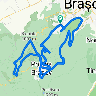
Romania-Brasov to Curtea de Arges
Trasa rowerowa rozpoczynająca się w Braszów, Okręg Braszów, Rumunia.
Przegląd
O tej trasie
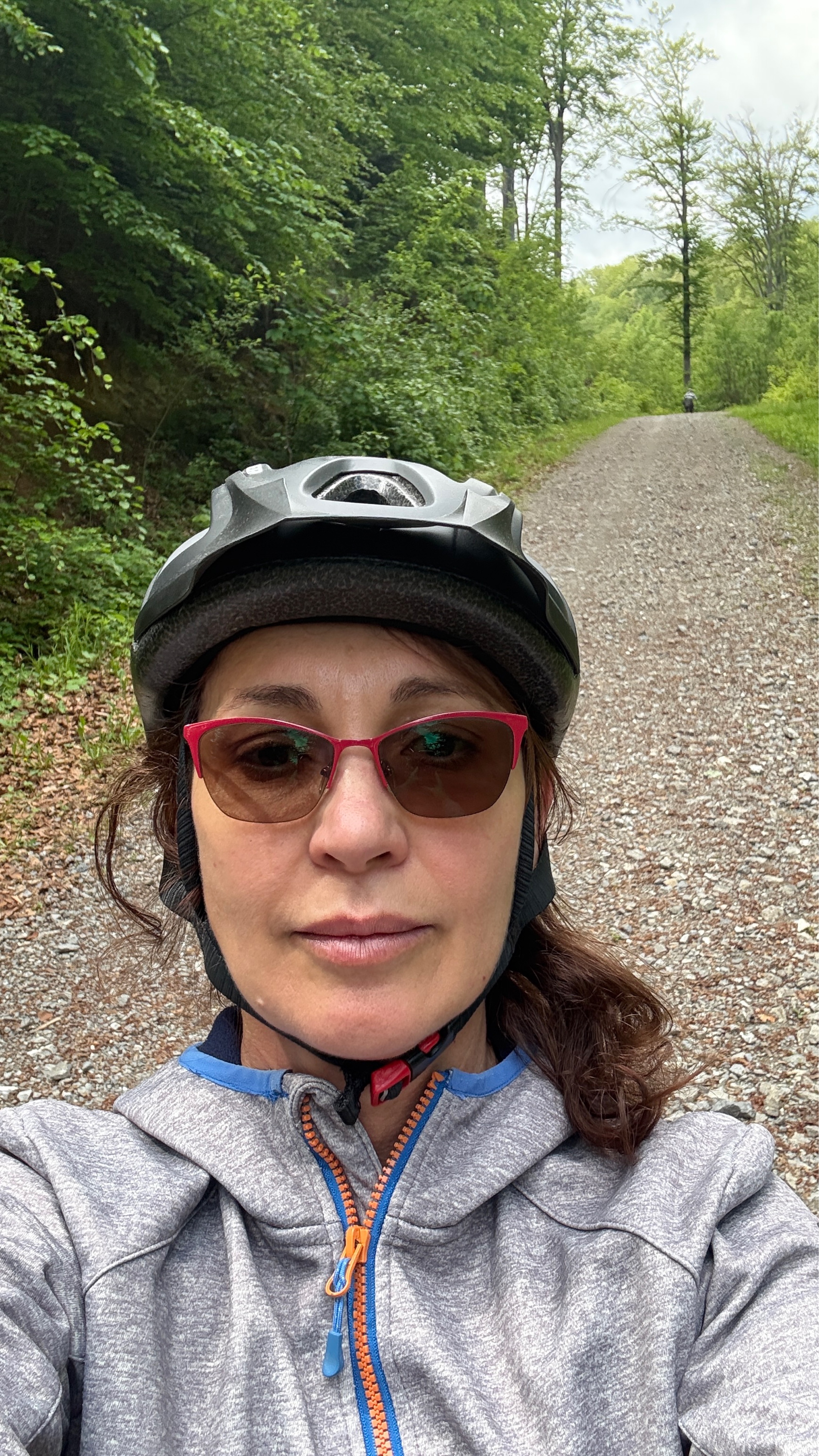
July-2018: The roads around Brasov are heavy with traffic and not pleasant to cycle. Hwy 73 to Bran was in bad condition and under construction in many parts. No shoulder. The more quiet and pleasant route, though some steep climbing, was over the mountain through Brasov ski area. After Bran, starts the most beautiful scenic mountain road all the way to Campulung. Excellent paving most of the route. No shoulder. Car traffic is moderate and some big trucks. Very winding and some steep grades. There is nice lodging in Rucar. Campulung has lodging but was not a pretty city. The route from Campulung to Curtea de Arges on 73C was very rough paving with many dangerous level changes in the road. Recommend extreme caution especially on the downhill stretches. No shoulder. Very curvy and steep grades. Moderate traffic and fewer trucks. Maybe staying on Hwy 73 and going the extra mileage would be safer and easier but we did not go that way. Too busy avoiding the sudden big bumps to get pictures! We actually did not enter Curtea but continued north on 7C and spent the night at Cetatea Poenari's pleasant lodge. Ran out of GPS battery to record that last bit. Slightly uphill ride.
- -:--
- Czas
- 139,7 km
- Dystans
- 1921 m
- Przewyższenia
- 2094 m
- Spadek
- ---
- Śr. Prędkość
- ---
- Maks. wysokość
Zdjęcia trasy
Kontynuuj z Bikemap
Użyj, edytuj lub pobierz tę trasę rowerową
Chcesz przejechać trasę Romania-Brasov to Curtea de Arges lub dostosować ją do swojej wycieczki? Oto, co możesz zrobić z tą trasą na Bikemap:
Darmowe funkcje
- Zapisz tę trasę jako ulubioną lub w kolekcji
- Skopiuj i zaplanuj swoją wersję tej trasy
- Podziel trasę na etapy, aby utworzyć kilkudniową wycieczkę
- Synchronizuj swoją trasę z Garminem lub Wahoo
Funkcje Premium
3 dni bezpłatnej wersji próbnej lub jednorazowa opłata. Dowiedz się więcej o Bikemap Premium.
- Nawiguj po tej trasie na iOS i Androidzie
- Eksportuj plik GPX / KML tej trasy
- Stwórz swój własny wydruk (wypróbuj za darmo)
- Pobierz tę trasę do nawigacji offline
Odkryj więcej funkcji Premium.
Uzyskaj Bikemap PremiumOd naszej społeczności
Braszów: Inne popularne trasy rozpoczynające się tutaj
- Blumana-Solomon-Valea cu apă-La Bancuță-Iepure-Sub Tâmpa-Blumăna
- Dystans
- 20 km
- Przewyższenia
- 943 m
- Spadek
- 882 m
- Lokalizacja
- Braszów, Okręg Braszów, Rumunia
- Deadly route for 3x9-Blumana Cabana Postavarul- Never again; push-bike de la Sulinar
- Dystans
- 16,4 km
- Przewyższenia
- 1106 m
- Spadek
- 131 m
- Lokalizacja
- Braszów, Okręg Braszów, Rumunia
- Brasov-Sibiu
- Dystans
- 193,8 km
- Przewyższenia
- 683 m
- Spadek
- 801 m
- Lokalizacja
- Braszów, Okręg Braszów, Rumunia
- Blumana-Noua-Forestier Crucur-Timisul de Jos și retur
- Dystans
- 31,2 km
- Przewyższenia
- 564 m
- Spadek
- 601 m
- Lokalizacja
- Braszów, Okręg Braszów, Rumunia
- Traseu MTB Hobby - Duatlon 2009
- Dystans
- 11,5 km
- Przewyższenia
- 696 m
- Spadek
- 687 m
- Lokalizacja
- Braszów, Okręg Braszów, Rumunia
- Brasov - Sf. Gheorghe - Baraolt - Brasov
- Dystans
- 127,4 km
- Przewyższenia
- 2118 m
- Spadek
- 1577 m
- Lokalizacja
- Braszów, Okręg Braszów, Rumunia
- Bike Race Brasov scurt
- Dystans
- 23,3 km
- Przewyższenia
- 759 m
- Spadek
- 761 m
- Lokalizacja
- Braszów, Okręg Braszów, Rumunia
- Strada Jepilor, nr. 34, Braşov to Strada Mestecăniș, nr. 1, Braşov
- Dystans
- 37 km
- Przewyższenia
- 2458 m
- Spadek
- 2458 m
- Lokalizacja
- Braszów, Okręg Braszów, Rumunia
Otwórz ją w aplikacji